







You are here
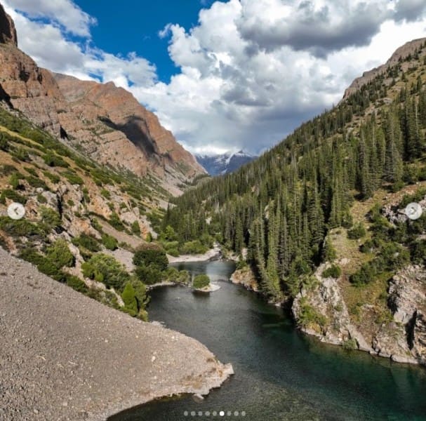
Lake Kara-Tokoy.
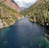
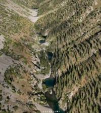
Hiking excursion to Lake Kara-Tokoy.
"The Chatkal Range at its highest points reaches an average elevation of 4,200-4,500 meters. Some of its peaks jut out significantly above the ridgeline, with the main peaks reaching at least 4,503 meters. The snow line lies above 4,000 meters, but due to the steepness of the slopes, even the highest peaks are virtually snowless. Snowfields and glaciers lie on high plateaus, a characteristic feature of the range. The predominant rock on the crest is dense limestone, with limestone conglomerates below. The peaks' unusually bizarre shapes make them challenging and interesting climbing sites. The slopes of the ridge are dissected by a series of deep gorges, so narrow that the glaciers that undoubtedly exist in their upper reaches are not visible."
Emmanuel Samuilovich Levin. "Routes in Western Tien-Shan."
Sights of Lake Kara-Tokoy.
High-mountain freshwater flowing lake Kara-Tokoy is located at an altitude of 2876.5 m. a. s. l., in the upper reaches of the river of the same name, on the western slopes of the Chatkal Range, in its northeastern part, in the Chatkal district of the Jalal-Abad region.
The lake is located 30.9 km east and slightly north of the village of Chakmak-Suu and 5.7 km north of Lake Kara-Tokoy Yuzhnoye, also known as Eshenkul. Various sources and maps list several variations of the lake's name: Kara-Tokoy, Kara-Toko, and Kok-Kol.
The sheer diversity of toponyms testifies to the complex history of the development of this remote mountainous region. Kara-Tokoy is located in an exceptionally inaccessible part of the Chatkal Range, where the mountainous terrain retains a nearly pristine character.
Deep gorges, steep slopes, scree, juniper thickets, coniferous forests, high-mountain meadows, and glacial cirques form a consistent system of natural complexes here, replacing one another as the altitude increases.
Origin of Lake Kara-Tokoy.
The nature of the Kara-Tokoy basin makes it a unique type of mountain dam lake, the origin of which is believed to be the collapse of large rock masses and the subsequent damming of the river valley. However, a definitive determination of the lake's age and formation mechanism requires specialized geomorphological and geological research.
According to a widespread theory, the lake's formation may have been linked to powerful seismic processes that occurred in the mountains at the turn of the XIXth and XXth centuries. The proposed formation process may have involved several successive stages.
Strong tremors caused the collapse of a significant rock mass from the slopes of the gorge. The rock mass moved downward and blocked the riverbed, forming a natural dam. Water gradually began to accumulate behind this barrier, flooding the lower part of the gorge and forming the modern lake basin.
If this hypothesis is confirmed by geological research, Kara-Tokoy is of particular interest as a relatively young mountain lake, formed as a result of a major natural catastrophic process.
Morphometric Features of Lake Kara-Tokoy.
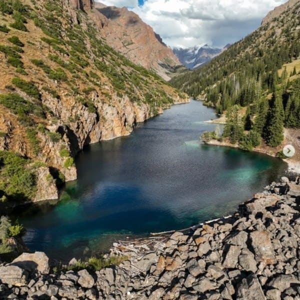
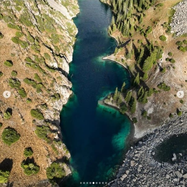
Lake Kara-Tokoy has a meridionally elongated shape. Its length reaches 2,238 m, the water surface area is approximately 1.01 sq. km., and the shoreline is approximately 5.6 kilometers long. The width of the lake varies significantly along its length: in the eastern part, it reaches 582 meters, while in the western part, it is approximately 477 meters.
Despite its relatively short length, the lake occupies a significant area, indicating a fairly wide and deep part of the flooded mountain valley. The uneven width of the lake, the steep sides of the southern slope, and the more gentle sections of the northern shore reflect the complex structure of the lake basin and the relief features of the valley in which the lake formed.
The coastline, approximately 5.6 km long, is characterized by significant indentation and a variety of shapes. In some areas, mountain slopes come directly to the water. While more gentle sections form at the inflow of streams. This combination of different shoreline types gives Kara-Tokoy the characteristic appearance of a high-mountain lake surrounded by the rugged slopes of the Chatkal Range.
With an area of approximately 1.01 square kilometers, Kara-Tokoy is one of the most notable high-mountain lakes in this part of the Chatkal Range. Its size is especially impressive given its remoteness and the almost complete absence of modern tourist infrastructure.
Mystery of Lake Kara-Tokoy's Flooded Forest.
One of the most unusual features of Kara-Tokoy is the presence of preserved tree trunks in its waters. According to visitors and local beliefs, the formation of a landslide dam submerged part of the ancient forest. In the clear, cold water, individual tree trunks and branches can be seen protruding from the depths, creating an unusual underwater landscape.
If these trees are indeed related to the formation of the modern basin, they could be of significant interest for determining the age of the lake. However, to reliably establish their age, specialized research is necessary - primarily dendrochronological analysis and radiocarbon dating of the wood.
It is this feature that has given rise to one of Kara-Tokoy's most striking characteristics: the lake is perceived as a unique flooded mountain forest, preserved beneath the cold water of a high-altitude basin. This imagery is also associated with one of the explanations for the name Kara-Tokoy.
In the Kyrgyz language, the combination "kara-tokoy" can be understood as "black forest" or "dark forest." This name may reflect the characteristics of the surrounding vegetation, or it may be connected to ancient beliefs about a wooded gorge.
It is currently difficult to definitively determine the origin of the toponym.
Landscape and Vegetation of Lake Kara-Tokoy.
The natural appearance of Kara-Tokoy is determined primarily by the sharply different conditions on the opposite slopes of the gorge. The southern shore is largely steep. The slope facing the lake is steep, dry, and exposed to intense sunlight.
Snow melts here relatively early. Spruce vegetation is virtually absent, and Turkestan juniper (Juniperus turkestanica) dominates. Juniper is locally known as archa. In the Western Tien Shan mountains, juniper communities occupy vast expanses, forming sparse forests, isolated clumps, and low, creeping thickets.
Above the forest floor, they gradually transition into high-altitude landscapes. The northern slope has a completely different character. It is gentler, wetter, and shaded. Moisture is retained significantly better here, and snow remains for longer, making conditions favorable for the development of coniferous vegetation.
The main forest-forming species is the Tien Shan spruce, or Schrenk's spruce (Picea schrenkiana). Its pyramidal crowns and bluish-green needles create the characteristic appearance of the northern slopes of the Chatkal Range. Along the Kara-Tokoy River, spruce occasionally grows alongside birch, willow, and sea buckthorn.
Particularly noteworthy is the Semenov fir (Abies semenovii), a rare representative of the coniferous flora of the Western Tien-Shan. Near the lake, it is found in localized groups in the most humid areas. Thus, the vegetation cover of Kara-Tokoy clearly demonstrates one of the most important patterns of mountain nature: the dependence of vegetation not only on absolute altitude but also on slope exposure, moisture, duration of snow cover, and the nature of the terrain. Lower down in the Kara-Tokoy Valley, at elevations ranging from approximately 1,500 to 3,000 meters, the importance of various juniper species increases, including Juniperus semiglobosa and Juniperus seravschanica.
Thus, a vertical landscape sequence gradually develops – from the juniper communities of the lower and middle mountains to spruce forests and further to alpine meadows and nival complexes.
Geographic coordinates of Kara-Tokoy lake system: N42°01'43 E71°49'39
Kara-Tokoy lake system.
Of particular value is not only the lake itself, but also the system of high-mountain reservoirs associated with it. Two significant watercourses flow into the eastern part of Kara-Tokoy - Kara-Tokoy East and Kara-Tokoy South. The Kara-Tokoy Yuzhny stream is about 4.7 km long and originates in the glacier of the same name.
Glacier Kara-Tokoy South.
The glacier is located in a vast cirque on the western slope of the Chatkal ridge and stretches along its main ridge for approximately 2.1 km from east to northwest. The glacier's area is about 840,013 sq. m., and the length of the glacier stream reaches 840 m.
According to its morphological type, it combines the features of a cirque and a hanging glacier and belongs to the Chatkal River basin. There is no pronounced glacial tongue. The lower surface of the glacier is covered with debris. The upper feeding area is located at an altitude of about 3971 m, while the lower open area reaches approximately 3486 m.
Nutrition is provided by the accumulation of snow, firn and solid precipitation. In the eastern part of the glacier there are cracks associated with the passage of the glacial mass through a rocky ledge.
Coordinates of Kara-Tokoy South glacier: N41°59'01 E71°51'40
Lake Verkhnee Kara-Tokoy.
In the eastern part of the glacial system there is a small periglacial flowing lake Verkhnee Kara-Tokoy, located at an altitude of 3516 m. a. s. l. Its length is about 325 m, its width reaches 110 m, and its area is 25,815 sq. m. m, the length of the coastline is about 757 m.
It is fed by small glaciers on the southern slope and underground runoff.
Coordinates of Lake Verkhnee Kara-Tokoy: N41°59'37 E71°51'52
From the glacier system, a watercourse is then formed and directed to the main valley.
Glacier Kara-Tokoy East.
Another important source of power for the system is the Kara-Tokoy East glacier. It is located in a cirque on the western slope of the Chatkal ridge and stretches along the main ridge for approximately 3.1 km from east to northwest. The glacier's area is about 1.74 sq. m. km, the length of the glacier stream is about 840 m.
The tongue is located at an altitude of about 3428 m, the upper feeding area reaches 4055 m. The glacier has a mixed cirque-hanging morphology. There are longitudinal and transverse cracks in its body, caused by the complex topography of the glacial bed and the passage of the glacial flow through areas with a pronounced difference in elevation.
Coordinates of Kara-Tokoy Vostochny glacier: N42°00'18 E71°53'55
Glacial lake Kara-Tokoy.
The northern part of the Kara-Tokoy Vostochny glacier ends at its end into the glacial flowing, freshwater lake Kara-Tokoy. The lake is located at an altitude of 3314 m above sea level. u. m., is located on the western slope of the Chatkal ridge in the upper reaches of the Kara-Tokoy Vostochnaya River.
This is a high-mountainous glacial reservoir. origin. The lake is located in the inaccessible alpine nival-glacial (nivalis - snowy, cold) zone, the uppermost landscape-climatic zone in the mountains, located above the snow line. This area has permanent snow and harsh temperatures; even in the summer months the average daily air temperature rarely rises above 0 °C.
Snow-free rocks are subject to severe destruction due to the constant freezing and thawing of water in cracks, forming sharp ridges and piles of rubble. The vegetation in the vicinity of the lake is extremely sparse and is represented mainly by crustose lichens, mosses and microscopic algae on stones.
Only a few species survive here (for example, edelweiss or saxifrage) on rocky ledges protected from the wind. There are no permanent inhabitants, but mountain goats, snow leopards, scavenger birds and some insects can come here. The lake was formed as a result of the melting of an ancient glacier, which left behind a natural ridge of stones, clay and debris (a moraine), which blocked the flow of meltwater.
The lake has an elongated shape. The mirror area of the cascade of lakes is about 0.06 sq. km. The lakes extend for 396 km, with the greatest width in the northern part being 233 m. The shoreline is 1.1 km long. The lake's water is blue.
The hue varies depending on the angle of the sun and the time of day, from a soft blue in the morning to gray at sunset.
Due to glacial feeding and the high altitude, the water remains extremely cold year-round. Even in the hottest summer months (July - August), the surface temperature does not exceed +5... +9 °C. From November to mid-May, the lake is completely frozen.
Geographic coordinates of Kara-Tokoy Glacial Lake: N42°00'42 E71°53'21
The Kara-Tokoy East River, approximately 5.3 km long, flows from the glacier.
Kara-Tokoy East Cascade of Lakes.
Approximately 1.7 km from its source, the stream reaches the first of the high-mountain moraine lakes, the Kara-Tokoy Eastern. This is a complex system of successive lakes formed by ancient glaciation. The retreat of the glacier left behind powerful moraine banks of boulders, clay, and debris, which act as natural reservoirs for meltwater.
The cascade is located at an altitude of approximately 2,976 m. a. s. l. The lakes extend for a total of 1.6 km, covering an area of approximately 140,697 sq. m., and have a shoreline of approximately 3,672 meters. The eastern part of the system is 236 meters wide, while the western part is significantly narrower, at approximately 76 meters.
The water is exceptionally clear and has a characteristic bluish-turquoise hue. Its intensity varies depending on the light, time of day, and atmospheric conditions. The high altitude and glacial feeding result in extremely low water temperatures.
Even in summer, the water remains very cold. The lakes are surrounded by a harsh high-mountain landscape. Forest vegetation is virtually nonexistent here. Rocky scree, moraine ridges, exposed cliffs, and alpine meadows form the characteristic landscape.
On the southern slopes, thickets of Turkestan juniper remain, while isolated islands of Tien-Shan spruce can be found in the southwestern part. Mountain goats, marmots, and various birds of prey can be found in these areas. However, the cold water of the high-mountain lakes themselves are relatively devoid of organic life.
Kara-Tokoy Cascade East Coordinates: N42°01'41 E71°52'15
Tourist Value of Lake Kara-Tokoy.
Kara-Tokoy is of significant interest to travelers seeking the little-known regions of the Western Tien Shan. The area's primary value lies not only in the lake itself. A trip here allows you to experience several high-altitude natural zones in sequence - from mountain forests and sparse juniper woodlands to alpine meadows, moraine complexes, and glaciers.
A particularly impressive route connects Lake Kara-Tokoy, the eastern glacier system, a cascade of high-mountain lakes, and proglacial reservoirs. This route effectively allows you to trace the entire path of mountain water - from the accumulation of snow and ice at altitudes above 4,000 meters to the formation of streams, lakes, and a river in the lower parts of the gorge.
The most favorable period for travel is the short high-altitude season - roughly from June to September, although the exact timing depends heavily on snow conditions and the condition of mountain trails. There are no roads directly to the lakes.
Travel is possible on foot or horseback across challenging mountain terrain. The route requires good physical fitness, experience in high-altitude travel, and the ability to navigate off-trail. Particular attention should be paid to sudden weather changes.
Even in summer, snowfalls, strong winds, night frosts, and sudden drops in temperature are possible in the highlands. In the area of high-mountain lakes, fuelwood is partially absent, so gas stoves and appropriate equipment are necessary for independent travel.
Kara-Tokoy is not a destination for mass tourism, but rather for expedition travel, where the value is determined primarily by the pristine nature, the lack of infrastructure, and the opportunity to see a little-explored corner of the Chatkal Range.
Geographical coordinates of Lake Kara-Tokoy: 42°01'34" N, 71°52'37" E.
Legend of Lake Kara-Tokoy.
Kara-Tokoy is associated with an old legend about a holy wandering dervish, duban. According to local tradition, the gorge in which the lake is located was considered sacred. A dervish once lived here, choosing a solitary life in the mountains.
He had no permanent home, wandering the mountains and staying in this gorge for long periods. People believed that the presence of the holy man sanctified the surrounding area. Therefore, the lake was treated with special reverence, and the lake itself became associated with the name duban.
This gave rise to another name for the body of water: Dubana, meaning "the lake of the holy dervish." Over time, the man to whom the legend was dedicated disappeared from historical memory, but his memory was preserved in the space itself – in the name of the gorge and the lake.
There is another layer of toponymic tradition. On Soviet-era maps, the lake was designated as Kara-Tokoy, while earlier maps of the Russian Empire use the name Toko. Thus, the modern toponym, the popular name Duban, and the old cartographic designation
Toko form a unique historical layer, intertwining geography, language, local memory, and spiritual understanding of the mountainous space. This is especially characteristic of such remote areas of the Tien Shan: a natural feature becomes not just a geographic point, but part of a cultural landscape.
There is another peculiarity to toponym – Kara-Tokoy.
On Soviet maps, the lake was designated as Kara-Tokoy, which is usually associated with the expression "black forest" or "dark forest." For a mountainous area, such a name is quite natural: the dense vegetation on the slopes and dark coniferous thickets could indeed appear almost black from a distance.
However, on maps of the Russian Empire, the lake was designated differently – Toko. It is this old name that is of particular interest. Perhaps the modern "Kara-Toko" arose later as a result of the gradual change and reinterpretation of the ancient toponym.
It's also possible that the name Toko is connected to ethnonyms or the economic history of the region. In this regard, the possible similarity with the name of shepherds - people traditionally associated with mountain pastures, transhumance, and grazing of livestock - is particularly interesting.
However, such interpretations should be viewed as toponymic theories, not as established facts.
Legend of Lake Kara-Tokoy also contains a deeper meaning.
In the traditional beliefs of nomadic peoples, not only graves and the places of holy men were sacred. An entire gorge - a source of water, a solitary mountain, a tree, a spring, or a lake - could also be sacred. Such places were perceived as spaces where the human world intersected with the world of nature and spiritual forces.
Therefore, the memory of the dervish could be preserved not as a separate monument, but directly in the name of the gorge and lake. According to legend, after the dervish's departure from these parts, people tried not to disturb the peace of the gorge for a long time.
They did not shout unnecessarily, did not disrespect the water, and did not take more from the lake than necessary. A traveler arriving here for the first time was expected to stop, collect water, and mentally thank the mountains for their shelter.
It was believed that a person who came here with good intentions could continue their journey peacefully, while anyone who treated the sacred place with disdain would inevitably encounter obstacles. Thus, gradually, the concept of Kara-Tokoy emerged as a lake that must not only be seen but also felt.
Today, it is difficult to separate the historical basis of the legend from later folk interpretations. The name of the dervish himself, his time of life, and the specific events associated with him are unknown. However, this is typical of such mountainous places: the memory of a person can fade, while the toponym associated with him continues to exist for centuries.
Perhaps this is why the legend of Kara-Tokoy resonates so naturally among the surrounding mountains. Here, water, forest, rocks, and an ancient human path form a unified space, where the natural landscape gradually transforms into a cultural one.
And today, when a traveler reaches the lake, they see first and foremost the calm mountain water and the rugged beauty of the gorge. But behind this landscape, according to an old legend, lies the memory of a nameless wanderer - a duban - who once chose these mountains as his refuge.
Perhaps this is why Kara-Tokoy has retained its reputation as a special, quiet, and slightly mysterious place - a place where nature itself has become the keeper of human memory.




Authority:
Alexander Petrov.
Photos by:
Alexey Ognev. Bishkek.