You are here
Gorge Kegety.


Walk to Kegety gorge in Kyrgyz Ala-Too ridge.
“Sweetness shudders through the land
as if, freed from the heat,
nature’d scooped spring waters in her hand
and splashed her burning feet”
Fyodor Ivanovich Tyutchev. “Summer evening”.
Trip from Bishkek to Kegety gorge.
Kegety gorge is located from 1143 to 2210 meters above sea level, located on the northern slopes of the Kyrgyz Ala-Too ridge, the territory of the subordinate administration of the city of Tokmok, 35 kilometers from the famous architectural and archaeological complex "Burana Tower" in the Chui region.
The length of the Kegety gorge is 28 kilometers, the gorge begins from the village of Kkegety and stretches southward to the confluence of two unnamed tributaries at an altitude of 2210 meters above sea level. The village of Kegety is located at the entrance to the gorge.
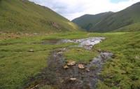
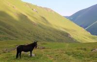
After we pass the Kegety village, the road goes deeper into the Kegety gorge along the left bank along the Kegety river. The gorge is really very picturesque, with steep overhanging slopes overgrown with deciduous and coniferous trees.
Basically, meadow-steppe and shrub plants predominate. A stormy river of the same name with crystal clear water flows along the Kegety gorge. At the beginning of the gorge, the slopes are covered with separate bushes of juniper, barberry, wild rose, honeysuckle, and mountain ash.
Before the cascade of the waterfall, they are replaced by a spruce forest with dense undergrowth. Further, the bottom of the gorge rises sharply up to 200 meters. Trees are hammered into it in a dense group and only the strongest, unusually tall and slender scatter along the slopes, rise to the beginning of the waterfall.
The clear forest moves to the left side of the gorge, and after it ends in the zone of alpine meadows, a viscous ascent begins along the moraine up to the cofferdam separating the moraine dammed lake Kel-Top ("lake place") from the gorge.
The lake is located at an altitude of 2725 meters above sea level, its mirror area is 0.2 square kilometers. The water from the lake goes underground. Moraines and large glaciers Kel-Tor and Anastasia are 3 kilometers higher.
At the beginning of the glacier, among the moraines, there are picturesquely small lakes with a milky-turquoise color of the water. The floodplain is dominated by thickets of bushes. There are a lot of medicinal herbs in the area. Among them are marshmallow, sage, St. John's wort, rhubarb, string, medicinal thyme.
Strawberries grow on grassy slopes, on the outskirts of forests, in clearings, among bushes and in spruce forests. Fragrant berries ripen in late June - early July. Strawberries are a very delicate berry, you need to collect them in dry dishes, preferably in the morning, when dew subsides, and at the end of the day before dew appears, then it lasts longer.
Natural and climatic conditions of the zone are favorable for organizing various types of tourism. One of the most striking sights is the moraine-glacial lake Kel-Top with turquoise water in the upper reaches of the tributary of the same name: the picturesque Barsa-Kelmes waterfall 30 m high in the gorge of the first tributary of the Kel-Top river; Kegetinsky waterfall 20 m high in the gorge of the left tributary of the Kegety river.
The last waterfall is especially beautiful in winter with the formation of ice, combined with the sparkling flow of water. Not far from the forestry there are caves and grottoes of Kara-Unkyur. From the upper gorge of Kel-Top through the pass 3400 meters above sea level, located near the granite peak of 4200 meters above sea level, you can get to the forest zone of Kegety, and through the passes of the starboard side to the zone "Shamsi".
Through depressions and branches of the left side of the Kegety gorge, the zone is connected with the wooded Tuyuk Issyk-Ata gorge. In Soviet times, there was a road from the Kegety gorge to the village of Kochkorka, gradually they stopped taking care of the road and it was blocked by landslides, even in the summer months it is rather difficult to ride here on a horse.
One of the largest tributaries, the At-Jailoo River, adjoins the gorge. In the upper part of the At-Jailoo gorge there is a beautiful tract with mines and a picturesque cascade waterfall. Within one day, you can take a walk from the Kegety gorge to the Kel-Tor gorge and further to the Kel-Tor lake with turquoise-colored water.
Also, from the Kegety gorge, you can take a walk to the Bel-Saz jailoo, to the Sharkyratma waterfall, to the Kushkonok and Kyzyl-Belez forests, to the Chaund Gorom and Kara-Unkur (Weeping Cave) tracts. One of the trips can be made to the Tuyuk gorge, located to the east of the Kegety gorge through the Belsaz pass.
Walk to the waterfall of the left tributary of the Kegety River. This waterfall is about 35 meters high. Water rushes down noisily from the lime terrace. The waterfall is located almost 100 meters from the road passing through the gorge.
In the upper part of the gorge there is a forestry located at an altitude of 2200 meters above sea level.
Geographic coordinates of the Kegety gorge: N42 ° 33'08.16 "E75 ° 06'44.43"
Authority:
Alexander Petrov and Anatoliy Khalepov
Photo by
Alexander Petrov.


