You are here
Modern Atyrau.
Trip to Atyrau.
“This was how it was with travel: one city gives you gifts, another robs you. One gives you the heart’s affections, the other destroys your soul. Cities and countries are as alive, as feeling, as fickle and uncertain as people. Their degrees of love and devotion are as varying as with any human relation. Just as one is good, another is bad”
Roman Payne.
Best New Atyrau Tours.
Is the port on Caspian Sea and the pier on the Ural river (former Guriev). Fishermen founded it as fishing settlement in the mouth of Ural in 1615. In 1992 it was renamed in Atyrau. At the beginning of XX century the fishing was the only branch of economy in the provincial yuezd town Guriev. Then the railway, which was situated not far from the place of Ural's flowing into Caspian Sea, had a big influence on development of the town.
The town is situated in two parts of the world Samarskaya side (the right bank of the Ural River) is in Europe, and Bukharskaya (the left bank) is in Asia. The employer Mikhail Guriev founded it in 1615 having asked the tsar Mikhail Fedorovich a decree for monopoly right to fish sturgeons in the mouth of Ural, but he was bound to build the town-fortification for defense from raids and to deliver red caviar to tsar. In 1668 Stepan Rasin owned Guriev.
The town was built on the Seashore, but now it recedes into the distance of 25 – 30 km. The first oil refineries and the plant of oil equipment were built here and the largest fish tinned plant in the Republic was also built here.
Kazakhstan's westernmost large city has two remarkable features. First, it straddles two continents: given the historic decision to count the Ural as the line that separates Europe from Asia in this region, the city districts located on the western bank of the Ural River are geographically in Europe, while crossing the bridge brings you into Asia.
Secondly, and far more significantly, Atyrau - formerly Guriyev - has become one of Kazakhstan's two oil capitals, a boomtown where construction is under way everywhere you turn. Local and foreign oil companies have set up their branches in this formerly very provincial town, and construct ghetto-like dormitory buildings for their staff, surrounded by walls and ugly fences.
The town's authorities have a hard time trying to impose constraint on the uncontrolled construction work and develop some sort of sophisticated city planning. On paper a master plan does exist, the first stage of which basically consists of tearing down the old town of Guriyev. Following that, both banks of the Ural will be turned into a modern metropolis with green parks between the skyscrapers.
The 160,000 inhabitants will get many more neighbours - a complex, urban centre of new residential buildings, shopping and leisure centres is to be built. But much needs to be done before this vision is realized.
In its present state, Atyrau is a large, somewhat chaotic settlement, but the first outlines of a city centre can now be seen. Merciless mosquitoes discourage those who usually like to explore towns on foot - defying them requires powerful repellent cream - while in order to enjoy the area's most popular sport, angling, mosquito nets as well as protective creams are essential.
Guriyev was the first Russian town built on Kazakh territory. After having conquered the khanates of Kazan and Astrakhan under Tsar Ivan IV (the Terrible) in the middle of the 16th Century, the Russians found themselves in the immediate neigh bourhood of the Kazakh tribes. In order to consolidate their position on the western bank of the Ural, a fortified post, constructed of tree trunks, was built and named Ust Yaitsk.
There had been a fishing settlement named Uyshik there previously, but the Russians developed the fishing industry further, and farmers, brought in from the Don Basin, settled down on the riverbank. Regiments of soldiers were also stationed there to provide security; this was much to the dislike of the indigenous Kazakh inhabitants, who tried to destroy the fortification more than once - only to attract a stronger Russian presence each time.
In 1645, having obtained property rights for the entire coastal area between the mouths of the Ural and the Emba, the Guriyev family one of Russia's wealthy trade clans, received the order to fortify the town in order to be able to resist further attacks from Kalmykas and Cossacks alike. Between 1647 and 1662, a better-equipped fortress was built, this time with stone walls and eight watchtowers equipped with 17 guns.
Relations with the neighbours out in the steppe improved, after the latter appeared to have decided to live with the situation. In 1734, the town was awarded city rights and was named after its founder Guriyev. Once more, the spark of revolt flared in the lower reaches of the Ural River after the Russian crown imposed tougher regulations on settlement, thereby depriving the Kazakh nomads of their grazing rights.
For 14 years, a peasant army led by Sarym Datov held out against the Russian troops until he surrendered in 1797, after discovering treachery being plotted within his own Kazakh ranks. Popular anger once more exploded in 1836 in an uprising led by the poet Makhambet Utemisuly and his comrade-in-arms Issatay Taymanov. As before, grazing rights were at stake in the area between the Volga and the Ural.
For two years, the area controlled by the Junior Horde was ravaged by insurgency, only to end with the defeat and the death of Taymanov. Utemisuly was murdered in 1846. But before the end of the century people discovered that in this particular area neither sturgeon nor grazing lands were the real wealth.
The first oil deposits were discovered as early as 1890, and in the beginning of the 20th Century their exploitation took off. It was only after World War II, however, that systematic exploration and development operations started.
Today, petroleum and fish are the main sources of income for the city. It has become a crossroads for transportation routes such as pipelines and railways between East and West, and shipping lines from Atyrau's seaport to Baku, Iran, Turkmenistan and along the Volga, the Volga-Don Canal and down the Don to the Black Sea, and on into Europe.
In 1992, Guriyev was renamed Atyrau by presidential decree. At this time the city began to transform itself. American presence is strong and will increase, since USAID and the local authorities have signed an agreement for the implementation of the overall development of Atyrau.
The city is relatively compact, and it does not take too long to walk from one end to the other (if you decide to brave the mosquitoes). A good starting and orientation point is the pedestrian bridge, built in 2002, between Pobedy (Victory) Park and the residential zone for the oil workers.
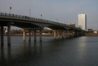
This suspension bridge between Europe and Asia has a span of 405 metres. Across the bridge, you can walk along the riverbank through the city towards the north, passing the river's horseshoe bend until you come to the road bridge. This is the city centre, divided into two by the river and stretching no more than two to four blocks away from the riverbank. Here and there, a few parks testify to attempts to conquer the saline soil and produce some greenery.
Two museums are located on the crossroads between Momysh Uly Street and Azattyk Avenue, the Local History Museum (1 Momysh Uly Street) and the Museum of Applied Arts (11 Azattyk Avenue). Both are well worth a visit, like all regional museums of their kind in Kazakhstan.
The Museum of Regional Traditions highlights the life and work of Makhambet Utemisuly (Utemisov), who lived in the area of Guriyev in the first half of the XIX-th Century and whose aphoristic and expressive poetry greatly contributed to the education of the common people.
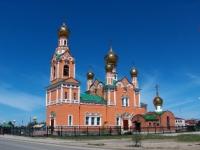
A mosque is located on Satpayev Street, just over a kilometre to the west of the road bridge. A second one, the Kuspan-Molla Mosque, is to the northwest on the street of the same name. The freshly restored Uspenskiy Cathedral adds cheer to the remains of the old town on Isataya Avenue, some way northwest of the city centre.
The cattle market of Tuma, on the western edge of town, is recommended to those who like "authentic" impressions of day-to-day life. The fishing port Atyraubalyk and the river port to its south, with the oil terminals in the background are also rather colourful. The best way to see them is from the western riverbank, since direct access to the sites is impossible.
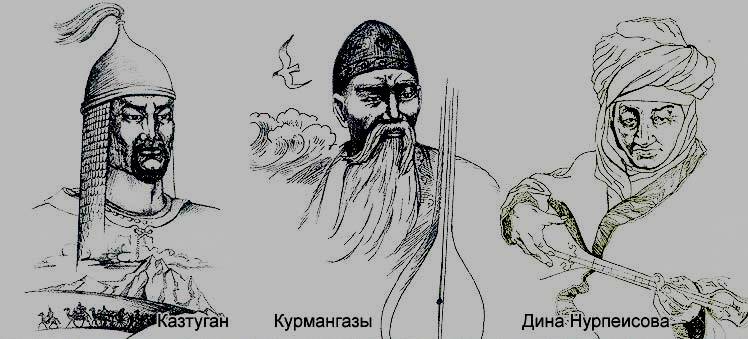
Today Atyrau became the center of the oil industry of Ural- Embensky region. The grave of the Kazakh people's composer Kurmangazy Sagyrbayev (1806 - 1879) is located in Atyrau; the town Saraidzhuk (XVI - XVII c.c.), not far from where the ways from Europe and Asia were crossed, is situated in 50 km north of the town.
Authority:
The guidebook across Kazakhstan . Authors Dagmar Schreiber and Jeremy Tredinnick. Publishing house "Odyssey".2010.
Photo’s
Alexander Petrov.


