


![]()
You are here
Kyzyl Kent ruins in Karkaraly.

Educational tourism in Karkaraly park.
"Now your uncle Tevkel... has placed his brother Shahmagmet, the prince, on the Kolmaks, and they are said to be wandering around the Bliss, all united..."
Kul-Muhammad. Moscow.
"In the palace ruins are found white clay objects in the shape of a cone with a widened base and a rounded top. Wheat grains are always found inside these objects."
N. Konshin. "From Pavlodar to Karkaraly." 1901.
Primary wellness tourism in Karkaraly park.
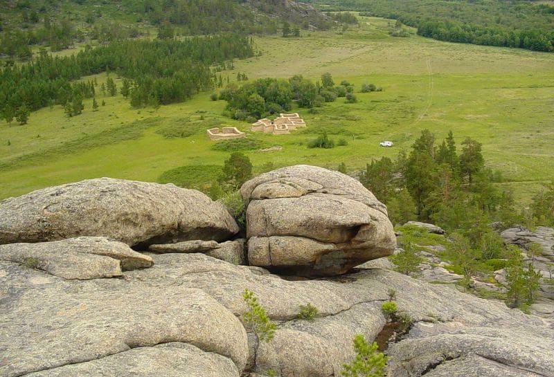
Kent Palace is located at an altitude of 895 meters above sea level, in northwestern part of Kent Mountains, 3.1 kilometers southeast of village of same name, 12.8 kilometers northeast of village of Taldy, 19.5 kilometers southeast of village of Karagayly, on territory of Karkaraly Nature Park, in district of same name, in east of Karaganda region.
The Kyzylkent Palace is located in the Kyzylkenysh (Red Treasury) gorge, on the right bank of the river of the same name. Although the monument has long been known locally as "Kyz-Auliye" (Holy Virgin), all researchers in their works have referred to it as the "Kyzyl-Kench Palace" or "Kyzylkent Palace."
History of archaeological excavations of Kyzylkent Palace.
In his article "From Pavlodar to Karkaraly," N. Konshin testified: "In the ruins of the palace are found white clay objects in the shape of a cone with a widened base and a rounded top. Wheat grains are always found inside these objects" (Konshin, 1901, p. 55).
According to I. Chekaninsky, one of these objects, found in the ruins of the Kyzylkent Palace, was formerly kept in the archaeological collection of the Semipalatinsk Museum. I. Chekaninsky considers it a "tsaritsa" and includes photographs of it in his work dedicated to the Kyzylkent Palace.
Archaeological excavations of the Kyzylkent Palace began in 1985 by an archaeological team from the KazProektrestavratsiya Institute. Further research on the site was continued by an archaeological expedition (the "Eureka" student team, created at the initiative of Professor A.K. Abilev) from Karaganda State University during the 1986-1987 field seasons.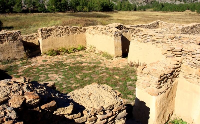
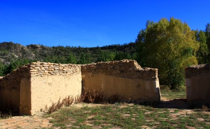
During the study, the main palace and three separate structures were completely excavated, and 10 burials were also examined from the burial ground located around the site. Before the excavations, the palace ruins consisted of a mound of earth and stone up to 25 meters in diameter and up to 2.7 meters high, densely overgrown with grass and rose bushes.
The ruins of three separate structures and a burial ground, also overgrown with grass and shrubs, were found around the palace. On the southeastern side of the palace, in front of the entrance, are two oval-shaped pits up to 2 meters deep. After excavations, the main palace consisted of a cruciform building with four rooms and a vestibule.
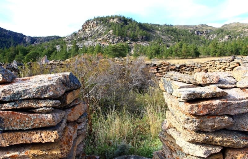
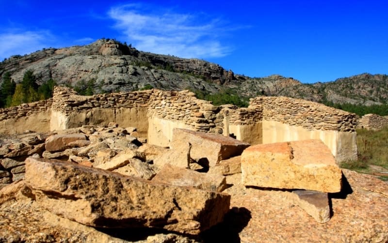
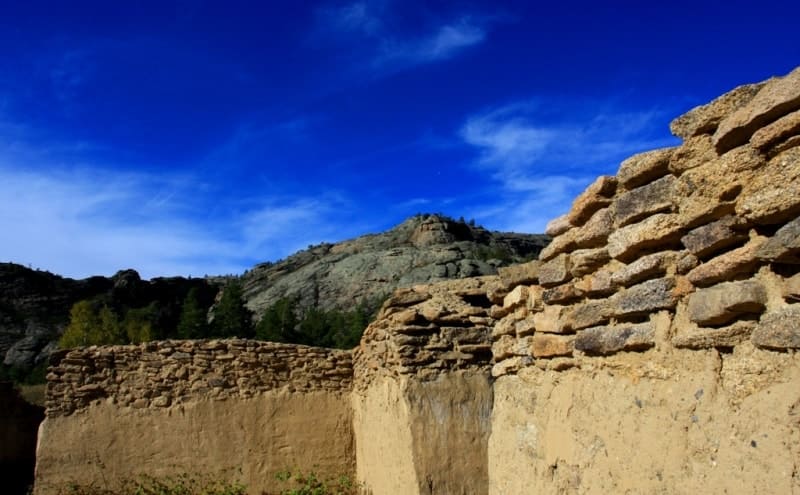
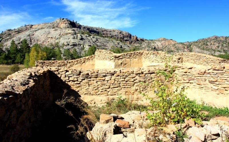
The palace walls were constructed of undressed flagstone. The slabs were 0.10 - 0.20 meters thick. Larger slabs, sometimes 0.6 - 0.7 meters long and 0.4 - 0.5 meters wide, were laid at the corners of the structure during construction. The stone and earth ramparts on the exterior of the structure reached a height of up to 2.2 meters, descending 3 - 5 meters from the walls to the present-day surface.
Inside the structure, the rubble along the walls reached up to 2 meters, gradually decreasing to 1 meter toward the center of the main room. During the clearing of rubble inside the structure, a large number of half-decayed planks, poles, and logs were discovered. It was not possible to determine any order in the arrangement of these logs and planks.
The southeast side of the main chamber is 11.6 meters long, the northeast side is 12 meters long, the northwest side is 11.8 meters long, and the southwest side is 12.2 meters long. Small rooms attached to three sides of the main chamber have entrances 1.1 to 1.3 meters wide.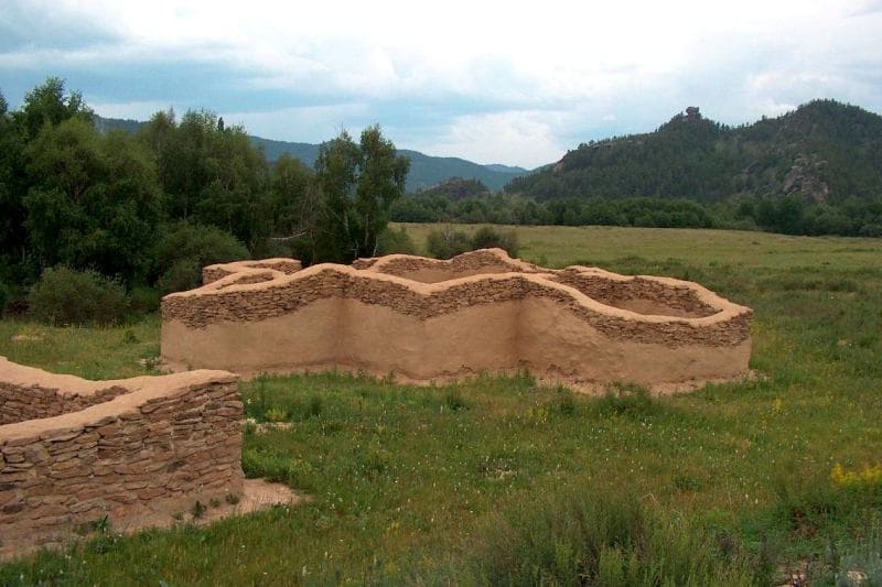
These rooms have no entrances from the outside of the structure. The room on the northeast side of the main chamber measures 2.8 x 2.5 meters, the room on the northwest side is 4 x 3.5 meters, and the room on the southwest side is 4.6 x 3.5 meters.
In the center of the room on the southwest side of the main chamber, there is a fire hole in the floor. The walls of the small rooms adjoin the walls of the main room without connecting the masonry. In its architectural style (two stories, a balcony, columns), as well as the finds uncovered during archaeological excavations, the Kyzylkent Palace is not typical of Kazakh buildings.
A three-year study of the palace has shown that the monument is a religious structure and was likely built as a Lamaist monastery (temple) in the XVIIth century by the Oirats. The research results also convincingly demonstrate that the monument was inhabited for a very short period.
The absence of traces of long-term human habitation - a small ash pit, a very small number of animal bones, etc. - as well as the paucity of finds, suggest that it was never inhabited. The carved wooden decorations found during archaeological excavations of the palace are similar to those found in Lamaist temples in Mongolia, where such ornaments were widely used "to decorate facades and interiors through carving, especially in wood."
Information about clay artifacts found in the palace ruins is interesting. Thus, the Kyzylkent Palace was built in the 17th century as a Lamaist monastery. It is hypothesized that it could have been built in the 1640s by Khoshout Khundulen-Ubashi or in the first half of the 1670s by Ochirtu-Tsetsen Khan.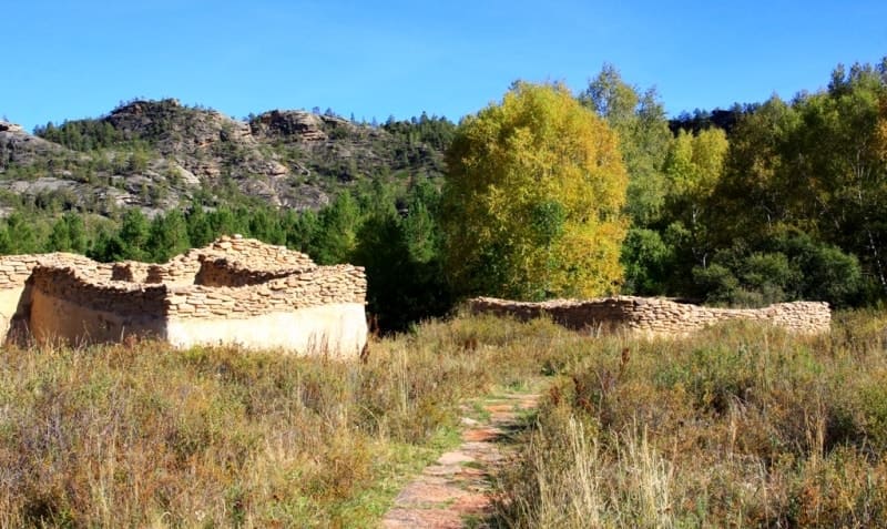
Archaeological excavations have proven that the Kyzylkent Palace was inhabited for a very short time; for one reason or another, it was apparently abandoned early in its existence. Most of the burials examined in the burial ground were empty; the very construction of the burials indicates that they were constructed according to Muslim rites.
The characteristic stone mound, a stable western orientation, the northwest orientation of the buried bodies, their position, and the absence of finds indicate a Muslim burial rite. This indicates that Kazakhs buried their dead here. It should be noted that those buried in these empty graves may have been reburied.
The custom of reburial among the Kazakhs in the pre-revolutionary period was widespread. Today, it is clear that this was a large city, at least 30 hectares in area, and home to several thousand people. It was divided into streets and neighborhoods.
A clearly visible neighborhood for metallurgists smelting copper and bronze is evident. Craftsmen made weapons, horse harnesses, and jewelry. Apparently, the inhabitants of Kent were skilled metallurgists, attempting to extract iron. Excavations revealed ceramics that were clearly not of local origin, but were typical of southern Western Siberia and Central Asia.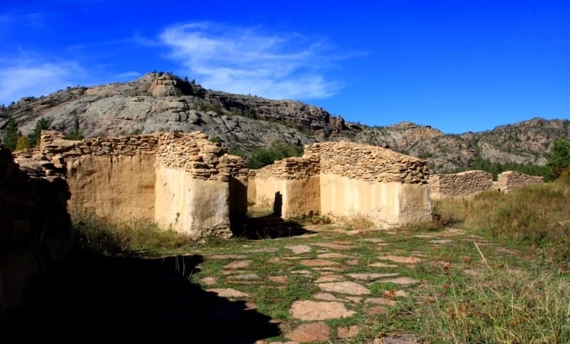
At that time, the Begazy-Dandybai culture began to stratify society into rich and poor, into nobility and ordinary settlers. A subculture of the nobility, an elite, was developing alongside the general popular culture. Kent's excavations are striking in their abundance of bronze artifacts and unusual antler bone objects, the purpose of which remains a mystery to scientists to this day.
There are only conjectures and theories. But a truly priceless find was a graphite rod with clear signs of use and sharpening. "It was a rich and prosperous city," Viktor Varfolomeev shares his theories. "All the crafts conceivable for that period flourished here.
Judging by the thickness of the cultural layer and the diversity of finds, it stood for at least 200 - 300 years. What happened to Kent? Why did its inhabitants abandon it? One can only speculate. At the end of the Bronze Age, climate conditions changed, population density increased, food demand increased, and herds grew in numbers.
To feed the growing herds, people had to move in search of pasture. And the descendants of the Begazy-Dandybay people left the city at the very beginning of the Saka era and began to wander... The Andronovo and Begazy-Dandybay people left no written records. But the burial mounds of Tegiszhol and the ancient city of Kent can tell us about their lives.
Geographical coordinates of Kent Palace are: N49°13'09 E75°53'56
Authority:
www.shuak.kz
“From Pavlodar to Karkaralinsk” N. Konshin. Tatiana Ten.
Photos by:
Alexander Petrov.