You are here
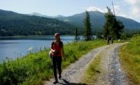
Nature of Kazakh Altay.


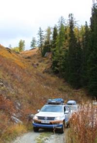
Jeep tours on Kazakh Altai.
“Nature magically suits a man to his fortunes by making them the fruit of his character”
By cars from Kazakh Altai to Russia.
Altai is mountain system located at the junction of Central Asia and Siberia. Mountains are located in the territory of four countries: Russia, Mongolia, Kazakhstan and small part of China. It is accepted to distinguisl Russian, Mongolian and Kazakh (Kazakhstan) Altai. Russian and Kazakh Altai is located between 800 and 900 of east longitude and 52 and 48 of northern latitude.
Mongolian Altai is stretched to the southeast for nearly 1200 kilometers, from 49 to 45 northern latitude and from 88 to 98 east longitude. Having linear spreading, it is limited by Gobiysky Altai.
In Russian and Kazakh Altai, the ranges fan-likely stretch from Russian-Mongolian border to the west and the northwest. In the extreme east Altai is limited by Shapshalsky range, in the west by the Irtysh River valley.
At the border of Russia, Mongolia and China there is the largest frozen mountain junction of Altai which links Russian, Kazakh and Mongolian Altai together. Mongols call it Tavan-Bogdo-Uul (Five sacred mountains).
There is the second by height top of whole Altai and the highest in Mongolian Altai. It has two names. One is national name - Kuyten- Uul (Cold mountain), and another literally name is Nairamdal (Friendship). According to available data, absolute altitude of this top is 4374 meters.
Long since Altai drew attention of many researchers. From the middle of XVIII century in the west of highland people are engaged in exploration of minerals, especially gold and silver. Well-known Russian scientist-naturalist P.S. Pallas visited northwest regions of Altai in 1771.
Then in 1826 K.F. Ledebura's expedition studied vegetation of Altai in details. In 1829 outstanding German geographer A. Humboldt walked from Omsk upwards across Irtysh to the confluence of the Narym River.
In the next few years of XIX and XX centuries the nature of Altai was studied by such well- known Russian scientists as F.A. Gebler, P.A. Chihachev, G.E. Shchurovsky, G.N. Potanin, M.S.Pevtsov, V.A.Obruchev, V.V. Sapozhnikov, M.V. Tronov and others. Also these places were visited by Alfred Bram - well-known German zoologist, the author of multivolume encyclopedia "Animals' life”.
In Russian and Kazakh Altai the total area of all glaciers is 864 square kilometers, and their quantity is nearby 1280. The largest by the area is Big Taldurinsky glacier (28 sq. km) and is located in South Chuysky range, in the territory of Russiall Altai.
The longest of them is Sapozhnikov glacier which stretches along Beluha massif for 10,5 kilometers. In Mongolian Altai the total area glaciers is about 833 square kilometers. In Tavan-Bogdo-Uul there is Potanin glacier, the biggest glacier of Altai. Its area is 56 square kilometers and length of 12 kilometers. On the average, glaciers go down to high-altitude point of 2400-2500 meters.
Rough mountain Rivers of Altai are rich in fish. The Rivers related to Irtysh and Ob basins are the deepest ones. Among the Lakes of Russian Altai the most remarkable is Teletsky Lake located in the Chulyshman River valley. Its length is 73 kilometers, the greatest width - 5,2 kilometers, the area - about 231 square kilometers, the maximum depth reaches 325 meters. It is very beautiful and attracts many tourists.
Very large tectonic Lakes are located at northeast foot of Mongolian Altai. Among them the biggest Lake is Khara-Us-Nur which area is about 1500 square kilometers. Other picturesque Lakes of Southern Altai are Yazevoe and group of small Lakes located around Rahmanovsky springs (in White Berel River basin - right tributary of Buhtarma). From physic-geographical point of view Russian and Kazakh Altai can be divided into Eastern, Central, Southern, Western and Northwestern.
The woodiest of them are two latter regions. These regions are characterized by woods consisting of firs, cedar, silver fir and larch. Southern Altai is presented by wood-meadow consisting particular of larch which gives the place to cedar (cedar pine). In the Central Altai large forests on slopes of mountains alternate with steppe landscapes of intra-mountain Chuysky, Kuraysky and other hollows.
In Eastern Altai woods are spread on northern slopes and steppes prevail on the southern slopes of the mountains. Same situation can be seen in the northwest of Mongolian Altai, mountain steppes and deserts at their foot prevail in the southeast of these mountains. Permafrost in the extreme north of Altai is extended over 1200 meters, in the south, in Mongolian Altai it extended over 2200 meters.
Kazakh Altai can be divided into Western and Southern Altai for convenience. Western Altai includes Rudny Altai (Ubinsky, Ivanovsky and Ulbinsky ranges) famous for numerous polymetallic deposits.
Western Altai is stretched from lower and middle course of the Buhtarma River (right tributary of Irtysh) to the northwest to Russia border. Mountains there are rather low: they rise up to 2500-2700 meters.
The highest top is Vysheivanovsky Belok (2778 meters) which is located approximately 30 kilometers to the east from Ridder (Leninogorsk). The largest ranges in Western Altai are Tigiretsky, Kholzun, Listvyaga (its western part), Ubinsky, Ivanovsky and Ulbinsky.
Basically these ridges have diagonal spread in relation to geographical widths. Highest of them is Ivanovsky range. It is the only massif exposed to present icing. These glaciers are rather small-less than 1 kilometer in length, but they are characterized by quantity (36), though total icing area is about 3 square kilometers. Glaciers go down to high-altitude point of 2100-2300 meters.
Ivanov range is the most humidified not only within Kazakh Altai but also in all Central Asia. On the average about 1500 millimeters of precipitation fall here annually. In other years this quantity can reach 2200 millimeters and more.
This is the most snowy place in Kazakh Altai. Mountain region - a part of Kazakh Altai and one of the ranges of this district is called as Southern Altai. Southern Altai is considerably higher than Western: there are more than ten Peaks with altitude over 3000 meters, the highest top of region and whole Altai is two-headed Beluha (Muztau) which on border of Kazakhstan and Russia rises up to 4499 meters.
Western and eastern tops of Beluha are linked by a saddle. Permafrost in Kazakh Altai is spread for up to 2000 meters. In Western Altai it mainly carries island character: mountains are low and very snowy.
In Southern Altai permafrost has both island and interrupted and solid character - conditions for permafrost are more favorable here rather than in Western Altai: mountains are higher and less snow-covered.
Traces of grandiose ancient icing - moraines – can be met everywhere in Buhtarma River basin. Moraine near Uryl settlement formed by glacier about 200 thousand years ago, amazes by its sizes. Moraine blocks ancient valley of Buhtarma River reaching the height of 350 meters.
Among the most typical cryogenic forms of relief are rock streams (rock placers consisting of large blocks) and high terraces which cannot be found anywhere else in the mountains of Central Asia.
Rock streams and high terraces are typical cryogenic forms of mountains relief of Siberia, but not of Central Asia. Other cryogenic phenomena of Altai are solifluction, frost mounds, thermokarst and other formations, which are rather typical for Central Asia Mountains too.
The fauna of Altai is similar to Siberian fauna: it is a habitat of wild boars, lynxes, brown bears, elks and roe. Rocky Mountains is the habitat of mountain goats and flat slopes of wild rams.
Objects of fur craft are sables, wolverines, Siberian weasels, ermines and least weasels. Otters and American minks inhabit Rivers banks. Marals which are bred within fenced wood spaces are widespread there.
Extract from cut off marals' horns is used for preparation of valuable pantocrine drug, widely used in medicine. Avifauna of Altai is very rich. Wood-grouses, black grouses, hazel grouses, wood-peckers, ouzels, bullfinches, lentils, siskins, buntings and black storks are found in mountain taiga.
Higher than 2000 meters above sea level there are ruby throats, redpolls, brown chiffchaffs, partridges, Altai snow cocks, mountain finches and martins. Golden eagles and saker falcons soar over mountain tops.
Valuable kinds of fishes are found in the Rivers and Lakes, they are grayling, lenok and taimen. Kalba is the region of small but very beautiful Sibinsky Lakes are limited by granite slablike rocks. Water in these Lakes is fresh and is the habitat for roach, pike, gudgeons and European carp.
Altai subsurface resources are rich in minerals, especially in complex ores containing lead, zinc, copper, gold, silver and such rare metals as cadmium, molybdenum, bismuth, indium, thallium, cobalt and selenium.
There are large deposits of antimony, mercury, brown coal, slate and limestone, marble and refractory clay. The greatest number of deposits containing nonferrous metals is in Rudny Altai. Southern Altai ranges - Southern and Northern Chuysky - are the most attractive for tourists and climbers.
Ascent at the top of Beluha for the first time was made by known researcher of Siberia and Central Asia mountains V.V. Sapozhnikov in 1898, but he reached only the saddle of the mountain.
Glaciologists, the brothers B. and M. Tronovs in 1914 have conquered eastern top of Beluha. The first ascension of the western top, the highest elevation of Altai, has been made in 1936.
Foot and horse routes along mountain Rivers valleys and picturesque vicinities of Markakol and Rahmanovsky springs are very popular among tourists. Thrill-seekers can try their strength in caves or rafting downstream Buhtarma, Bereli, Uba, Ulba and Kurchuma Rivers.
Authority:
“Central Asia Mountains”. 2009, Almaty,Publishing house “Mektep”. Authos Aldar Gorbunov, Anna Ivachenko, Sharipa Bisarieva.
Photos
Alexander Petrov.


