


![]()
Вы здесь
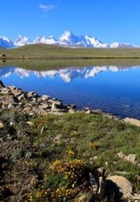
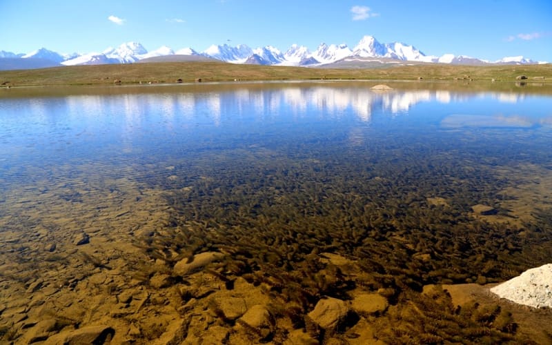
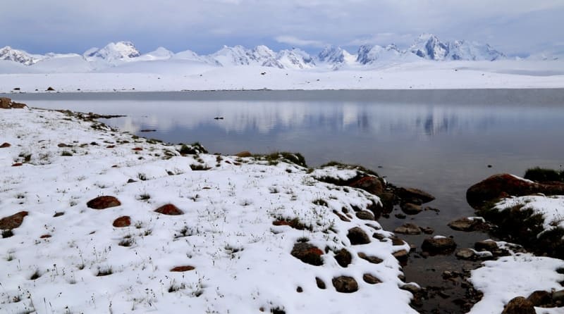
Lake Kagalachap.
Backpacking in Kyrgyzstan.
"Then a narrow valley. In it, among ancient moraines, a small lake stretches out in an elegant oval. Another pebble bed with river bends in the middle; smooth slopes of the banks, covered with placers, and downstream a huge mountain with a table-shaped, as if cut off, peak, completely covered with an even layer of snow. And even further - darkness - and enticing mystery. We looked at this picture for a long time, enchanted by the diversity of beauty, and greedily absorbed its irresistible grandeur and charm."
Palgov N.N. "Along Central Tien-Shan". News of State Russian Geographical Society. 1930. Volume LXII, issue 2.
Central Asia Hiking and Backpacking.
Fresh, flowing lake Kagalyachap is located at an altitude of 3789 meters above sea level, is located on watershed plateau Kagalyachap, 4.5 kilometers southeast of Kubyurgenty pass located at an altitude of 3907.2 meters above sea level, between northern slopes of Western Kokshaal-Too ridge and southern slopes of western part of Borkoldoy ridge and eastern part of Naryn-Tau ridge in At-Bashinsky district of Naryn region.
The lake is 554 meters long from west to east, the largest width in the central part is 500 meters from north to south, the lake area is 0.22 square kilometers, the perimeter reaches 1.82 kilometers. The lake lies 1.4 kilometers southeast of the highway between the Kendy and Karakoz border posts.
The lake is located near the so-called Aksai glaciation node, on a 129-kilometer stretch between the outbursts of the Western and Eastern Ak-Sai (Kokshaala) and Uzengegush rivers. The watershed of these rivers from the north of the Kokshaal-Too ridge is the Kagalyachap watershed plateau, located in the southern part at an altitude of 4323.4 meters above sea level and in the northern part at an altitude of 3097.2 meters above sea level (Kubyurgenty pass), located south of the peak Kyzyl-Asker, between the northern slopes of the western part Kokshaal-Too ridge and the southern slopes of the western part of the Borkoldoy ridge and the eastern part of the Naryn Too ridge in the Naryn region and only a small part of the northeastern part lies in the Issyk-Kul region.
10.4 kilometers southwest of the lake is the tongue of the Kotur glacier, located at an altitude of 3989 meters above sea level. 10.7 kilometers to the south and a little to the east is the tongue of the Kyzylunet Vostochny glacier, located at an altitude of 4043 meters above sea level.
1.1 kilometers to the northeast is Lake Kagalyachap North, located at an altitude of 3758 meters above sea level. In winter, the lake freezes, and there are a lot of algae in the lake.
Geographical coordinates of Lake Kagalachap: N41°10'57.34" E77°23'21.49"


Authority and photos by:
Alexander Petrov.