


![]()
You are here
Ridge Naryn Too.
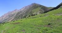
Photo tours in mountains of Kyrgyzstan.
"An expedition is a school in which the process of learning about nature, folk experience, and people's wisdom is endless. Travels expand the motley range of human knowledge"
Eduard Makarovitch Murzaev.
Tours to Naryn region in Kyrgyzstan.
Latitudinal ridge of Naryn-Too is located in Inner Tien-Shan in Atbashi district of Naryn region. The length of the ridge from east to west is 120 kilometers, the greatest width in the central part reaches 39 kilometers. The Naryn-Too ridge borders on the west with the small Almashyk ridge with a dominant height of 3378.9 meters above sea level.
In the southwest, it adjoins the eastern part of the At-Bashi ridge. In the north, along its entire length, Naryn-Too is bordered by the Naryn River valley and the latitudinal ridge of Jetim. In the east, the Borkoldoy ridge closely approaches the ridge, the border with it runs along the valley of the Karakol River, the left tributary of the Naryn.
From it, the ridge stretches to the west, to the longitude of town of Naryn and the road to the Torugart pass. In the south-eastern part, the ridge borders on the highest part of the western part of the Kokshaal Too ridge, where the massifs of the Kyzyl-Asker peaks with a height of 5842 meters above sea level and Dankov with a height of 5982.3 meters above sea level are located.
The southern border of the ridge runs along the valley of the Eastern Aksai River. In the southwest, Naryn-Too borders on the small mountain range of Kodjete with a dominant peak with a height of 3995 meters above sea level. In the north, the ridge forms the left side of the Bolshoy Naryn River valley.
The Naryn-Too ridge can also include a complex unnamed branched spur located in the interfluve of the Dzhaldzhir and Ulan Zapadny rivers - the sources of the At-Bashi River. This spur adjoins the main ridge through a simple Ulan Pass. South of the Dzhaldzhir River, through the pass of the same name, the Naryn-Too ridge connects with the Dzhanydzher ridge.
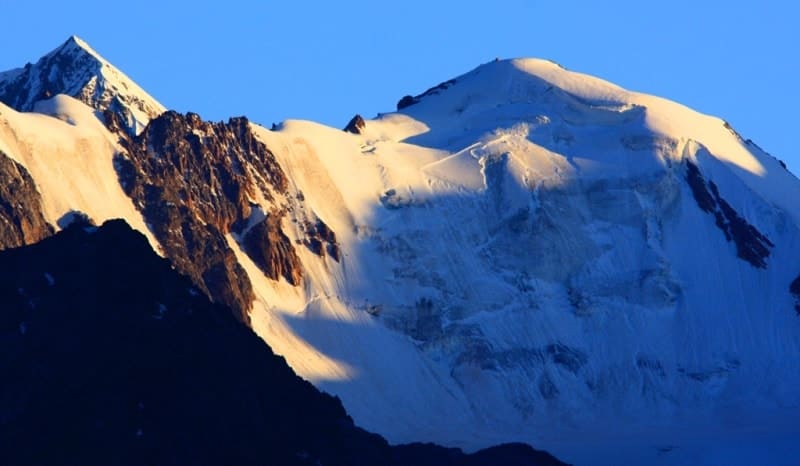
In the Naryn-Too Mountains (average heights of 3800 - 4300 meters above sea level. The highest point of the ridge is Chontor Peak, 4690 meters above sea level, located in the southeastern part at the headwaters of the Dzhaljir River. The second highest peak is Chontor West Peak, 4662 meters above sea level, located 3.1 kilometers to the east of Chontor Peak.
The third highest peak is Susarlytor Peak, 4522.6 meters above sea level, located in the eastern part of the ridge in the upper reaches of the Ulan West River. In the western part of Naryn-Too, the highest peak is Ichke-Kamandy Peak, 4499.8 meters above sea level, located in the upper reaches of the Ichke-Kamandy and Chong-Acha-Kamandy Rivers, which are left tributaries of the At-Bashi River.
The average height of the ridge reaches 4200 meters above sea level, the highest - 4499 meters above sea level - Mount Orto-Acha. The crest of the Naryn Too ridge has a sharply dissected glacial relief. In the eastern part of the ridge, on the northern slope, at an altitude of 3600 - 3800 meters above sea level, there is a denudation surface.
In the central part of the ridge, both slopes are strongly dissected by deep gorges. In the western - denudation surfaces appear again on both slopes. Foothills are developed along the southern slope. The middle and eastern parts of the Naryn Too ridge are composed of various terrigenous rocks, shales, quartzites, limestones and granodiorites, limestones, granites, metamorphic shales.
The western part of the Naryn Too ridge is composed of rocks of the middle and late Paleozoic. The northern slope is steep with rocky gorges, the southern slope is more gentle, with clay-sand hills at the foot. Mountain-meadow and meadow-steppe landscapes, rocky highlands with rocks and scree on steep slopes dominate.
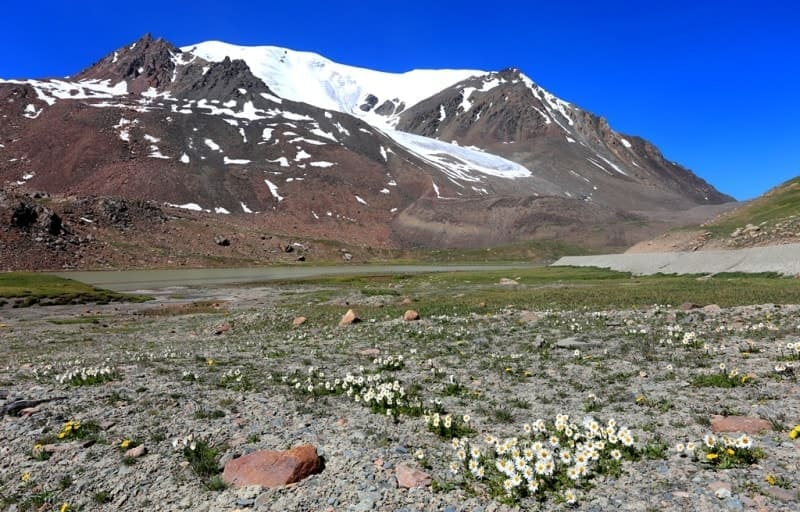
In the gorges, areas of spruce forests have been preserved. In the Naryn-Too ridge there are 239 glaciers, with a total area of 69.4 square kilometers. On the northern slope, 2/3 of the glaciation area of the Naryn-Too Mountains is concentrated.
The glaciers are small, nly one glacier is larger than 2 square kilometers. The height of the ends of the glaciers is 3800 - 3900 meters above sea level. On the northern slopes there are spruce forests at an altitude of 2600 to 3000 meters above sea level, subalpine meadows and meadow-steppes at an altitude of 3000 to 3200 meters above sea level, alpine meadows are located at an altitude of 3200 to 3500 meters above sea level, on the southern slopes - high-mountain feather-grass steppes are located at an altitude of 2600 to 3000 meters above sea level, spruce forests are located at an altitude of 2800 to 3000 meters above sea level, subalpine meadows, meadow-steppes, juniper forests spread at an altitude of 3000 to 3200 meters above sea level, kobresia meadows lie at an altitude of 3200 to 3500 meters above sea level, higher, at an altitude of 3600 meters above sea level lies the glacial-nival belt.
Geographical coordinates of Naryn-Too ridge: N41°21'28 E76°31'48

Authority and photos by:
Alexander Petrov.