







Вы здесь
Glaciers in Big Almaty River basin.
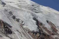
Glacier morphology in Big Almaty Valley.
"The capital of the Kazakh SSR - the city of Alma-Ata - relies exclusively on the water resources of two glacial rivers: the Bolshaya Almatinka and the Malaya Almatinka. Stretching for 70–100 km along the mountain foothills on either side of Alma-Ata are tens of thousands of hectares of collective farm fields; their flourishing appearance is owed to the melting of high-mountain snows and glaciers. A mere ten glacial rivers flowing toward the northern foothills of the Trans-Ili Alatau are capable of irrigating up to 20% of all irrigated land in Kazakhstan. Glaciers are the product of eternal snows."
N.N. Palgov. “Nature of Kazakhstan in Sketches and Pictures”. 1950.
Ecotours in Big Almaty Gorge.
The Big Almaty River consists of two branches. The left (western) branch is known as the "Prokhodnaya." The right (eastern) branch bears the name " Big Almaty." The Prokhodnaya River valley is flanked by the Kargalinsky Spur to the west and the Big Almaty Spur to the east.
To the south and southeast, it is enclosed by the main ridge of the mountain range, which runs northeastward in this area. The total area of all glaciers in the Prokhodnaya River basin - including firn fields and buried sections - is 7.2 square kilometers.
The basin of the right branch of the Big Almaty extends deep into the main mountain range. The extent of glaciation there is significantly greater than in the headwaters of the left branch. Four more or less distinct glacier groups can be identified here.
The first is situated on the slope of the main ridge, between the western lateral spur and the river's main headstream. This section of the main ridge does not exceed 4,000 meters in elevation. The ridge's northern slope drops steeply into a broad valley filled with ancient moraine deposits.
This valley originates at the saddle of the lateral spur that separates the basin of the river's left branch from that of its right branch. At one time, this saddle was occupied by a transfluent glacier; today, only moraine deposits remain in its place.
On the northern slope of the ridge - which has a highest peak of 4,243 meters but averages under 4,000 meters - six glaciers, ranging from 0.5 to 1.5 km in length, lie within short, steep ravines.
Morenny Glacier in headwaters of Ozernaya River.
With the exception of one, their termini do not reach the valley floor. The single glacier that does descend into the valley is notably longer (up to 2 km). It is located near the point where the ridge turns southward. Throughout its middle and lower reaches, it is completely covered by moraine deposits, beneath which it slowly advances.
It forms a large, high ridge amidst the valley's old, vegetation-covered hills. Due to this distinctive appearance, the glacier has been named "Morenny" (Moraine Glacier). From southwest to northeast, these glaciers are arranged in the following order:
Perevalny Glacier in headwaters of Ozernaya River.
The Perevalny Glacier lies at the headwaters of the Yuzhny Potok stream, within an expanded cirque consisting of two chambers where the surrounding walls reach an average elevation of over 4,000 meters. From this cirque, the glacier extends into the main valley; its exposed section, which is partially covered by moraine, reaches the saddle of the main ridge.
The area of the Perevalny Glacier is distributed as follows: firn fields - 0.82 sq km.; exposed tongue section - 0.65 sq. km.; buried tongue section - 0.72 sq. km.; for a total area of 2.19 sq. km.
Cherny Glacier, located in headwaters of Ozernaya River.
Cherny Glacier was named for the dark color of its moraine deposits by its discoverer, V. D. Gorodetsky, in 1916. The glacier covers a total area of 3.59 sq. km., comprising 1.93 sq. km. of firn fields, 0.61 sq. km. of exposed tongue, and 1.05 sq. km. of buried tongue.
Skalisty Glacier, located in headwaters of Ozernaya River.
The Skalisty Glacier is situated north of the Cherny Glacier, beyond a short, rocky spur. It was first explored in 1938 by an expedition led by N. N. Palgov. The Skalisty Glacier It belongs to a mixed cirque-hanging glacier type and can therefore be classified as a hanging cirque glacier.
The glacier is 1.95 km long in total, comprising 1.16 km of firn field and 0.79 km of exposed tongue. The average width is 730 m for the firn field and 500 m for the tongue. The glacier's total area is 1.92 sq. km.; specifically, the firn fields cover 0.85 sq. km., the exposed tongue 0.58 sq. km., and the buried tongue 0.49 sq. km.
The positive vertical range of glaciation is 328 m, and the negative range is 362 m. The glacier coefficient is 1.5. The upper part of the glacier occupies a niche containing its entire cirque and part of the tongue. A rock outcrop divides the tongue into two halves: the left half terminates in a steep front within the niche, while the right half descends the mountain slope as an icefall, forming the hanging section of the glacier.
Below the icefall, the right tongue is split by a medial moraine ridge into two lobes. At an elevation of 3,425–3,450 m, the ends of these lobes approach the buried tongue of the neighboring Glavny (Main) Glacier; there, covered by moraine debris, they terminate in steep faces.
Small oval lakes, 30-50 m in length, are nestled in two locations between the ends of the lobes and the buried section of the Glavny Glacier. In the past, the Skalisty Glacier was a tributary of the Glavny Glacier. It has not lost this connection, as it remains joined to the Glavny Glacier beneath the moraine deposits.
The Glavny Glacier was named in 1916 by V. D. Gorodetsky.
Glavny Glacier (also known as A. P. Gorodetsky Glacier) is located in headwaters of Ozernaya River.
The Glavny Glacier is a valley glacier. It consists of two branches: a left branch and a right branch. The left branch originates in a deep, narrow cirque, snow-covered on all sides - though most heavily on the northern and rear western slopes. The snow-capped peaks enclosing the cirque have an average elevation of 4,000 meters.
The left branch begins at a steep, entirely snow-covered cirque wall and extends westward. Near the firn line, it turns north; as it approaches the right branch, it veers left toward the northwest, and upon merging with the right branch, it resumes a westward direction.
The firn field of the left branch contains partially concealed crevasses. In the middle section of the glacier tongue, there is a depression approximately 7-8 meters deep with a radius of 30-40 meters; this appears to have once held a small lake that has since disappeared.
Below this depression, crevasses appear on the left side of the tongue - initially small, but becoming increasingly significant. They soon give way to an icefall with a steep gradient. This marks the end of the exposed section of the branch. The right side of the left branch's tongue is more solid and unbroken by crevasses.
Here, fragments of moraine material appear with increasing frequency on the surface, gradually covering it completely. The right branch of the Glavny Glacier originates from the ridge of a spur separating the Bolshaya Almatinka basin from the Levyi Talgar basin.
There is a narrow, snow-covered saddle on the ridge. The total area of the Glavny (Main) Glacier, including its debris-covered section, is 5.23 sq. km.
Northeastern glaciers of Big Almaty Gorge.
The third group of the Big Almaty glaciers - mapped by R. G. Timofeyev - is situated in a basin located north of the Glavny Glacier. This basin was once the cirque of an ancient glacier that left moraine deposits behind. To the north, the basin is bounded by the southeastern slopes of Sovetov Peak (4,317 m) and the southern slopes of Pogrebetsky Peak (4,231 m) and Lokomotiv Peak (4209,4 m).
The southeastern slope of Sovetov Peak, facing the basin, features more than a dozen distinct snow patches, drifts, and strips. Piles of moraine deposits extend downwards in front of them.
Zmeyevidny Glacier in Big Almaty Gorge.
On the southern slope of Pogrebetsky Peak lie a small, unnamed cirque glacier and the Zmeyevidny Glacier, which is notable for its distinctive appearance. It is situated in a deep cirque. The glacier has a total length of 1.89 km, comprising a 0.31 km firn field, a 0.88 km exposed tongue section, and a 0.70 km debris-covered section.
The back wall of the Zmeyevidny Glacier's cirque is steep and rocky. Snow accumulates primarily in the hollows of the cirque's side slopes, between rocky ridges and crags. And one of these depressions holds a small glacier. The firn field of the circus is flat and calm, with a slope of 8-90. But when approaching the tongue, it falls steeply (up to 200).
Here the main glacier meets a small glacier. Having merged with it, it takes the direction of the latter, to the southeast, and, wriggling like a snake and gradually reducing its width, enters a narrow ravine between moraines. The tip of the glacier is also unique.
Most of all, it resembles an asymmetrical triangular wedge. The lower edge of this wedge is adjacent to the stock, the right one spreads wide to the side, forming something like a thin blade, the left one remains steep. The upper edge of the faces represents the sharp ridge of the tip of the glacier.
In the development of such a form, a significant role is obviously played by the glacier being surrounded by moraines, which approach it so close that the heat reflected from them increases the intensity of ablation.
Mutny glacier in Big Almaty Gorge.
On the western slope of the Turistov spur lies the Mutny glacier with a small isolated snowfield. The Mutny glacier is the head glacier of the basin. It does not occupy the entire bed of the gorge, but only the northern half of its transverse profile.
The Mutny glacier can be classified as a type of slope trail glaciers. The area of the glacier is 0.74 square meters. km. Its firn field is 0.23 square meters. km., open part of the glacier 0.40 sq. km., and buried 0.11 sq. km. The northern slope of the Molodaya Gvardiya spur carries a small flat hanging glacier at its western end, and to the east of it are the Timofeev and Gryazny glaciers.
Timofeev Glacier in Big Almaty Gorge.
The Timofeev Glacier is the largest in the entire basin. The glacier belongs to the slope glaciers, but more precisely it can be classified as a slope glacier. It has a double drop:
from the firn fields along the slope and
downstream along the slope.
The glacier's area is 3.07 square meters. km. Firn field - 1.14 sq. km., open part of the tongue - 0.83 sq. km., and the buried part is 1.10 sq. km., Positive glaciation difference - 326 m, negative - 234 m. Glacier coefficient 1.4.
Gryazny glacier in Big Almaty Gorge.
Next to the Timofeev glacier, separated from it by a ravine passing through moraine deposits, is the Gryazny glacier. It occupies the southeastern corner of the basin. The glacier area is 1.44 sq. km. The mouth of the basin is closed by an ancient, well-compacted moraine.
In addition to the listed glaciers, there are two more in the basin. The first of them, the Plosky glacier, is a hanging glacier, lying on the same slope of the side spur where the Timofeev glacier is located. The second glacier is located on the southern slope of the basin to the west of the Serpentine glacier.
It is named after “Karevyi” and is a typical cirque and hanging glaciers lying at the bottom of a short niche.
References:
Gvozdetsky N. A., Nikolaev V. A. *Kazakhstan*. Moscow: Mysl, 1971.
Gvozdetsky N. A., Mikhailov N. I. *Physical Geography of the USSR*. Moscow: Mysl, 1978.
Zhivago N. V., Piotrovsky V. V. Geomorphology with Fundamentals of Geology. Moscow: Nedra, 1971.
Catalogue of Glaciers of the USSR. Leningrad, 1967, Vol. 13, Issue 2, Part 1.
Catalogue of Glaciers of the USSR. Leningrad, 1967, Vol. 13, Issue 2, Part 2.
Tuyuksu Glaciers (Northern Tien Shan). Leningrad: Gidrometeoizdat, 1984.
Glaciation of the Tien Shan. Ed. N. B. Dyurgerov. Moscow, 1995.
"Glaciation of the Zailiysky Alatau." Moscow: Nauka, 1969.
Palgov N. N. The Bolshaya Almatinka Glaciation Cluster in the Zailiysky Alatau Range. *Izvestiya Vsesoyuznogo geograficheskogo obshchestva* [Proceedings of the All-Union Geographical Society], 1948, Vol. 80, Issue 1.
Palgov N. N. Shokalsky Glacier in the Zailiysky Alatau Range. *Izvestiya Vsesoyuznogo geograficheskogo obshchestva* [Proceedings of the All-Union Geographical Society], 1948, Vol. 80, Issue 1.
Palgov N. N. Trip to the Tuyuksu Glacier in the Summer of 1922 (Offprint from *Izvestiya GRGO*, Vol. LVIII), 1926.
Tokmagambetov G. A. Glaciers of the Zailiysky Alatau. Alma-Ata, 1976.
Tokmagambetov G. A. Secrets of Kazakhstan's Natural Ice. Alma-Ata: Nauka, 1978.
Svarichevskaya Z. A. *Geomorphology of Kazakhstan and Central Asia*. 1965.
Chedaya O. K. *Morphostructures and Recent Tectogenesis of the Tien-Shan*. Frunze: Ilim, 1986.
Material prepared using data from:
Glaciological studies and works by scientists: S. E. Dmitrieva, N. N. Palgova, G. A. Tokmagambetova (*Glaciers of the Zailiysky Alatau*, 1976), K. G. Makarevich, and E. N. Vilesov.
Article: "Glacial Structures of the Northern Tien Shan – Zailiysky Alatau."
http://www.bigmir.net
https://elib.rgo.ru/safe-view/123456789/226999/1/0LPQtdC+0LsuMjRfVGFsZ2FyLCBnbGF2bmF5YSB2ZXJzaGluYSBaYWlsaWlza29nbyBBbGF0YXUsIGJsaXoucGRm
Photos by:
Alexander Petrov.