


You are here
Enilchek village.
Traveling through villages of Issyk-Kul region.
"Hide your gold, your faith and the purpose of your journey"
Ernst Heine.
Settlements of Issyk-Kul region.
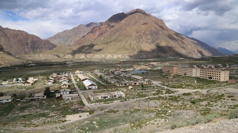
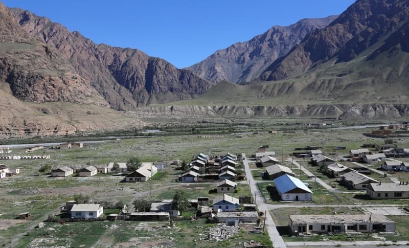
Village of Enilchek is located at an altitude of 2495 meters above sea level, located at mouth of Inylchek River in Saryjaz, in south of junction of Kuylyu and Saryjaz ridges, in eastern part of Inylchek Too ridge, in Ak-Suu district, in southeast of Issyk-Kul region, is administrative center of Enilchek district.
In 1962, at the confluence of large and deep rivers Inylchek and Saaryjaz, in the eastern part of the Central Tien Shan mountains, a rich deposit of tin and tungsten was discovered, which was named “Trudovoye”. The Trudovoye deposit consists of 4 adjacent areas: Central, Lesisty, Tashkoro and Ryzhy, the explored reserves of which amount to 23.1 million tons of ore, 126.1 thousand tons of tin, 87.7 thousand tons of tungsten trioxide and 572.3 thousand tons fluorspar.
The average content of tin in the ore is 0.55%, tungsten trioxide – 0.38%, fluorspar – 12.29%.
The main ore areas of the deposit are Central and Tashkoro. The first of them is confined to the Kurgak, and the second - to the Inylchek anticline and is located 2 - 3 km east and northeast of the first. Almost all industrial ore bodies occur in the apical endocontact zone of granitoid intrusions.
According to the Ministry of Natural Resources of Kyrgyzstan, tin reserves and resources are estimated at 318.8 thousand tons, including 214.7 thousand tons prepared for exploitation.
History of village of Enilchek.
From 1963 to 1968 of the last century, prospecting and geological exploration work was carried out at the field. In the mid-1980s, a decision was made to build the Saryjaz mining and processing plant for the extraction and processing of minerals. For the operation of the plant, a settlement was needed to house workers and miners.
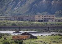
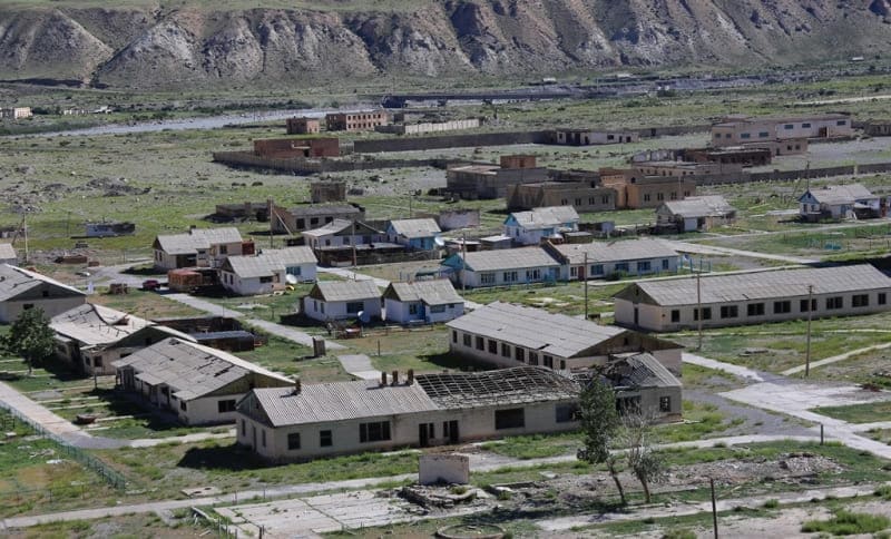
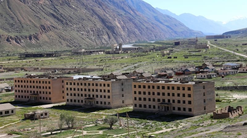
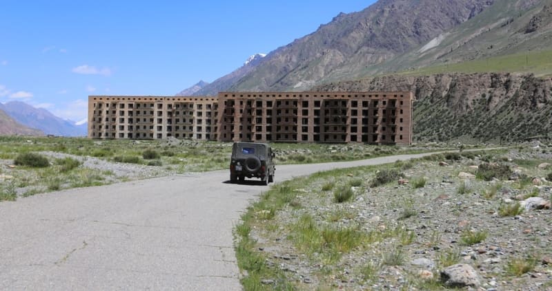
The village was built in 1989, it was planned that more than 20,000 people would live in the village. To ensure the livelihoods of workers and miners, multi-storey buildings (4 and 5 floors), schools, a hospital, and sports grounds were built. An airport with the necessary infrastructure capable of receiving Yak-40 aircraft was built in the eastern part of the town.
After the construction of the village was completed, a competition was announced in the country to recruit workers for the functioning of the plant. Young people with working professions from different parts of the Union began to come to the village.
After the collapse of the Soviet Union, internal economic ties that had been observed since 1988 were interrupted. Funding for the plant and the village began to decline sharply, there was no work, people began to leave new apartments and houses that were not fully inhabited.
Now (2024) there are about 30 families living in the village who are engaged in livestock farming. In 1996, the rights to exploit and develop the Trudovoye deposit were transferred to the Mining Artel Enylchek LLC. Unfortunately for the new owners, the mines located high in the mountains were too inaccessible to begin their full-scale development.
The search for partners has begun. As a result, in October 1999, a new Tien Shan Tin LLC appeared in the city of Karakol with an authorized capital of 16,000,000 soms. Half of the enterprise belonged to the Novosibirsk Tin Plant. 30% went to “Amart” and another 10% in the new enterprise was received by two prospecting artels “Dzhengart” and “Inylchek”, which owned mining equipment and the equipment necessary for high-mountain mining.
The Inylchek mining artel remained in the village. Tien-Shan Tin LLC was also located there. The distance from the village of Inylchek to the mining village, located at an altitude of 3100 meters above sea level, is 27 kilometers, the road to it goes along the mountainside.
Geographic coordinates of village of Enilchek: N42°01'50 E79°04'55
Authority and photos by:
Alexander Petrov.