


![]()
You are here
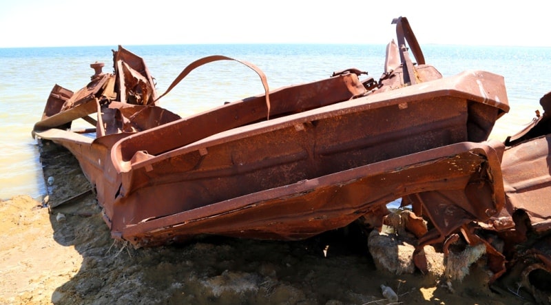
Third ship is on Aral Sea.


Day trip from Almaty to Astana.
To travel is to live”
Hans Christian Andersen.
Wine-tasting cruise in Almaty.
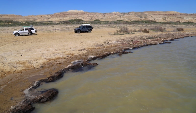
From 70th years of last century when still some ships of the Aral flotilla went to the sea to get fish and at return could not pass back to that place from where they sailed away still yesterday. The ships are based upon the coast of the left sea, expecting the fate.
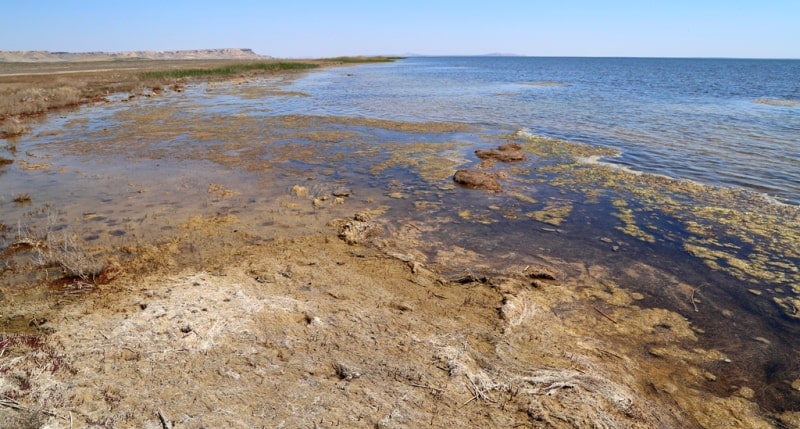
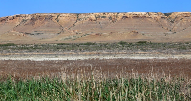
Locals call their "scrap metal", and they can be understood too - when with work difficult and not everyone can be a fisherman, it is necessary to feed a family, becomes not to a slop. Since the 1960s sea level (and water volume in it) began to decrease quickly including owing to withdrawal of water from the main feeding Amu Darya Rivers and the Syr-Darya for the purpose of irrigation, in 1989 the sea broke up to two isolated reservoirs - the North (Small) and Southern (Big) Aral Sea.
At the end of XVI and the beginning of the XVIIth century because of lowering of the level of the sea were formed the island Barsakelmes, Kaskakulan, Kozzhetpes, Uyala, Biyiktau, Vozrozhdeniya. The Syr-Darya River - Zhanadarya and Kuandarya - ceased to flow into the Aral Sea according to 1819 and since 1823.
To the 1970th years 34 species of fishes lived in the Aral Sea, from them more than twenty had trade value. In 1946 in the Aral Sea 23 thousand tons of fish are caught, in the early eighties this indicator reached 60 thousand tons. On the Kazakhstan part of the Aral Sea there were five fish factories, one fish-canning plant, forty five fish works points, in the Uzbek part (Karakalpakstan) - five fish factories, one fish-canning plant, more than twenty fish works points.
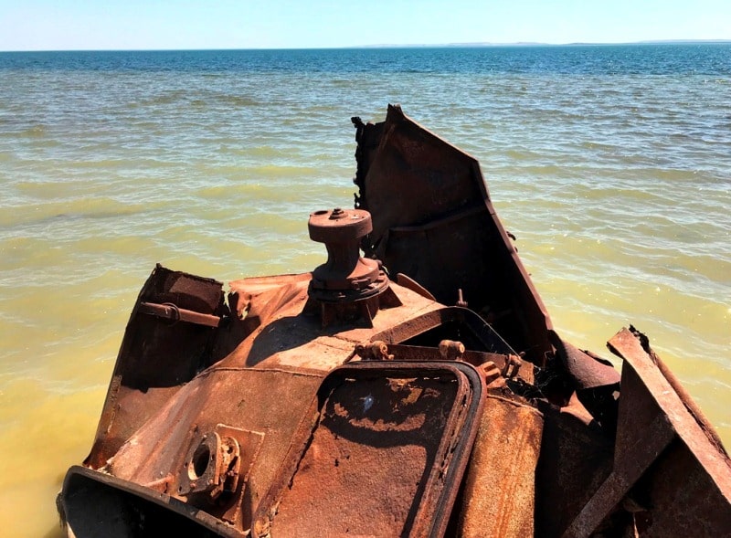
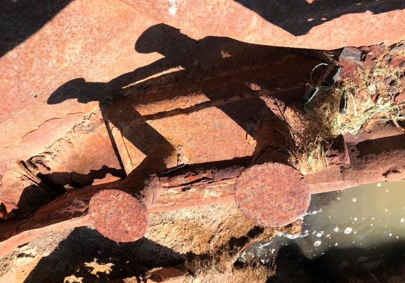
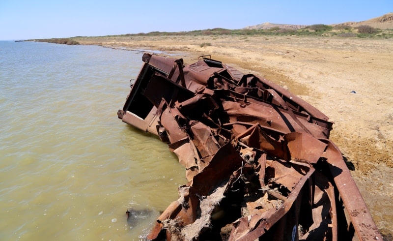
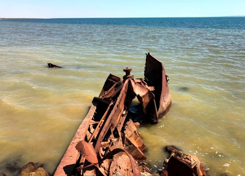
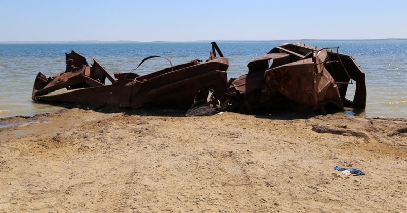
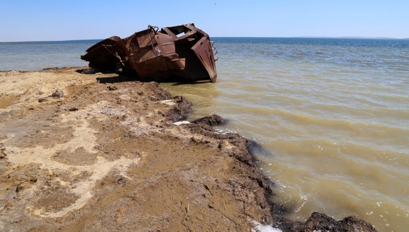
The third ship is in the Aral district of the Kyzylorda region, in 129 kilometers from Aralsk. Approximately in 120 meters to the west from the Second ship there is the Third ship. This, too the shapeless heap of rusty scrap metal which was the ship also is partially in water and on the land.
It was the tow, judging by the remained cabin of the boat. From here, on the East in 3 kilometers, practically in a coastal zone the Aral Sea is the deepest place in the gulf Butakova - 45 meters.
Geographical coordinates of Third ship: N46°45'19 E60°42'26

Authority and photos
Alexander Petrov.