


![]()
You are here
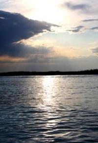
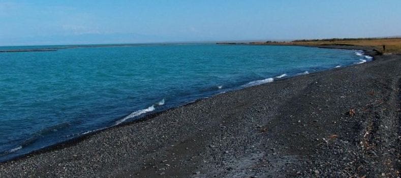
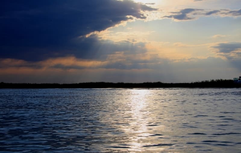
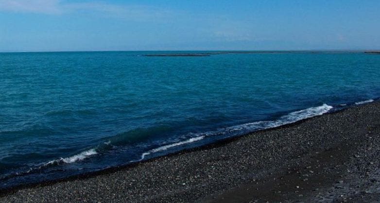
Alakol lake in Kazakhstan.
Ornithological tours on lake Alakol.
«Every creature lives in a state of war by nature»
Jonathan Swift.
Trip in Kazahstan.
Drainless, salty lake Alakol is located at an altitude of 347.7 meters above sea level, stretched from northwest to southeast, located in the east of Zhetysu and southwest of East Kazakhstan regions. The water area of the lake varies from 2076 kilometers during the minimum water level drop to 2650 kilometers (with islands - 2696 kilometers) during the period of its maximum filling.
The length of the lake from southeast to northwest is 95 kilometers, the maximum width in the central part is 56.2 kilometers (average 25.5 km), the length of the coastline is 247 kilometers. The maximum depth of the lake reaches - 54 meters (average 21 meters).
The area of the lake is 3070.95 square kilometers (01/18/2023). The volume of the water mass is 58.56 billion cubic meters, the average amplitude of water level fluctuations is 82 cm. The catchment area is 47,859 kilometers.
The transparency of the water varies from 0.6 - 0.8 meters in the shallow and up to 6 meters in the central part of the reservoir. Alakol is a salt lake. Mineralization of water from 1.2 to 11.6 g/kg. The salinity of the water is almost twice the salinity of Lake Balkhash.
Mineralization increases in the central, i.e. deep-water part of the lake, however, near the mouths of the rivers, the water is desalinated. The water is brackish or bitter-salty, very hard (19 - 32 mg-eq / l) has a chloride-sulfate-calcium-sodium composition.
The pH value during the year varies from 7.2 to 9.2. (Beremzhanov, Snegireva, 1963; Kurdin, Shilnikovskaya, 1965). In the 70s - 80s, an increase in the content of heavy metal compounds and pesticides in the aquatic environment, zoobenthos and fish was noted as a result of the intensive use of nitrogen fertilizers and pesticides since the late 60s. until 1995 on agricultural land adjacent to the lake.
In the central part of the lake there are 3 rocky islands: Ulken Araltobe with an area of 25.25 square kilometers, Sredny with an area of 170852.14 square meters, the perimeter of the island reaches 1614.58 meters and the island of Kishkene Araltobe with an area of 1.7 kilometers square, the perimeter of the island is 6221.53 meters .
In the western part there is a group of sand and pebble islands Chubar-Tubek. In the northern part there is a significant island of Piski, the length of which from west to east reaches 4.2 kilometers, the maximum width in the eastern part is 600 meters (01/18/2023).
On the western coast of Alakol, 2 collector drainage canals flow into the lake: Maisky, 50 kilometers long, and Mai-Biryuk, 25 kilometers long. Channel width up to 15 meters, depth up to 2 meters. Canals were laid from the Tentek River in the mid-70s during a period of intensive development of irrigated agriculture and the cultivation of beets, corn and vegetables on the southwestern coast of the lake.
In addition to collecting return water from cultivated fields, they are also replenished with drainage water, the outlet of which is typical for a vast meadow zone to the north and northeast of the village of Maisky. The flow rate of water with optimal accumulation of the channel at the confluence with Lake Alakol is up to 20 cubic meters per second.
From 1994 to 2002 in wetlands in the bays of the western coast of the lake between the villages of Rybachy and Gorky Klyuch, in autumn, death from an infectious disease of waders, terns, gulls, river and diving ducks, coots, individual individuals of mute swan and pelicans is observed (Berezovikov et al., 2002) .
The number of dying birds, especially waders and terns, is estimated in tens, and in some years in total hundreds and thousands. 15 streams flow into the lake, of which five have a constant flow. In the northern and northeastern parts, from the southern slopes of Tarbagatai, the rivers flow into the lake: Urdzhar, Katynsu, Emel, which account for 86% of the total surface runoff into the lake.
In the southern and southeastern parts, small rivers Zhamanutkol, Rgayty and Zhamaty flow down from the northern slopes of the Dzungarian Alatau, but they do not carry their waters to the lake, since they do not have glacial feeding, their runoff is characterized by a short-term spring flood.
Only the river Rgayty, together with the waters of Lake Zhalanashkol, partially reach Alakol through the marshy lowland between these lakes. In addition, Lake Alakol receives flow from Lake Sasykkol through the channels of Zhenishkesu, Yesinkin and the Urdzhar River, and from Lake Koshkarkol via the Uyaly River.
The colonies of the Alakol coast are composed of loose clay or sandy loam rocks. The southern, eastern and northern shores have coastal cliffs up to 2 - 9 meters high. Bays deeply protruding into the land, bordered by a strip of reeds and sand and pebble spits, are the most important nesting sites.
Along the western, eastern and southeastern shores, in depressions where there are groundwater outlets, swamping and the formation of extensive reed massifs are characteristic. Alakol is characterized by a cyclic rise and fall of the water level.
Reed thickets are developed along the banks of the Alakol, forming significant massifs in the mouths of rivers and in bays, but in the southern and southeastern parts of the lake they are fragmentary and confined mainly to lagoons.
The higher aquatic vegetation of Lake Alakol is represented by 35 species. Near-water associations are formed by southern reed (Pragmites australus), lake bulrush (Scirpus lacustris), narrow-leaved cattail (Typha angustirostris), umbrella susak (Butomus umbellatus), similar tubers (Bolboschoenus affinus), silver-scaly bog (Heleocharis argirolepis), sedges.
Aquatic vegetation is most developed in shallow bays dominated by pondweeds, arrowheads, hornwort duckweed, urut, etc. Chara algae are represented by 11 species, including Nitella hyalina, Nitellopsis obtusa, Chara fragilis, Ch.intermedia, Ch. aspera, and others. Chara algae are especially developed in Chubar-Tubek, Gorky Klyuch, and Hare Bay bays.
Geographic coordinates of Lake Alakol: N46°09'40.77" E81°41'04.69"
Authorship:
Berezovikov Nikolay Nikolaevich, Cand.Biol.Sci.
Photos by
Alexander Petrov