


![]()
You are here
Arkaim settlement in Kazakhstan.
Cultural tours across Kazakhstan.
“I've known rivers:
I've known rivers ancient as the world and older than the flow of human blood in human veins. My soul has grown deep like the rivers”
Langston Hughes.
Kostanay and Silk Road Tours.
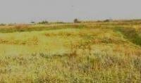
The Arkaim settlement is located at an altitude of 297.3 meters above sea level, located in the interfluve: 4.8 kilometers from the drying channel of the Dry River beam and 5.6 kilometers from the Kamyshlyayat River, 7 kilometers to the north and a little east of the village of Komarovka, 6.4 kilometers northwest of the village of Pervomayskoye, 18 kilometers west of the village of Arshaly, on the territory of the Komarovsky rural district, Denisovsky district, in the northwest of the Kostanay region.
he Arakaim settlement is located 88.2 kilometers east and slightly north of the Arkaim fortification located at an altitude of 312 meters above sea level, located 2.4 kilometers east and slightly south of the village of Aleksandrovsky, 16.1 kilometers southwest of the village of Polotskoye, 18.1 kilometers east and slightly south of the village of Izmailovsky, in the Kizilsky district in the southeastern part of the Chelyabinsk region of the Russian Federation.
The only monument of the proto-urban culture of the ancient Indo-European tribes known today in Kazakhstan, dating from the border of the 3rd - beginning of the 2nd millennium BC, according to other sources of the XVIIIth - XVIIth centuries. BC e.
The first to suggest that this was a large ancient settlement was Valery Vasilyevich Myltsev, a history teacher at the Komarovskaya secondary school, a local historian, and a permanent guide. Victor Nikolaevich Logvin in 1990, who was the first to describe this unique monument, gave it the name KazArk - Kazakhstan Arkaim.
The early stages of the Bronze Age are characterized by settlements with defensive walls and the most ancient in the steppe zone of the city-fortress, which were localized on the territory of the modern Ural-Kazakhstan steppes and are known so far only in the Southern Trans-Urals and near the village of Pervomayskoye.
This is a unique city-fortress, city-temple, city-workshop, city-observatory, the study of which is still ahead and who knows what secrets this mysterious city will reveal to us. A more common name is "Arkaim-2". The monument is part of the most ancient civilization of the Ural-Kazakhstan steppes - the "Country of Cities", which unites more than 20 fortress cities founded by Indo-Iranian tribes.
The Denisov Local History Museum has a permanent exhibition on archeology, which exhibits random finds from the surface of the ancient Kazakh Arkaim - fragments of ceramics, tools made of stone and bone, as well as rare finds made of bronze, transferred to the museum of V.V. Myltsev - a puncture, a fragment of a razor and an arrowhead.
Geographical coordinates of Arkaim settlement: N52°42'57.48" E60°52'28.14"
Authority and photos:
N. Taran, director of the Denisov Museum of History and Local Lore.
http://www.museum.denisovka.kz/index.php/ru/2017-09-17-03-32-31/347-2017-10-13-06-23-21