


![]()
You are here
Atameken ethno-memorial соmрlех.

Excursion on sights of Astana.
“...it seemed a part of her life, to step from the ancient to the modern, back and forth. She felt rather sorry for those who knew only one and not the other. It was better, she thought, to be able to select from the whole menu of human achievements than to be bound within one narrow range”
Orson Scott Card.
Мар of Kazakhstan.
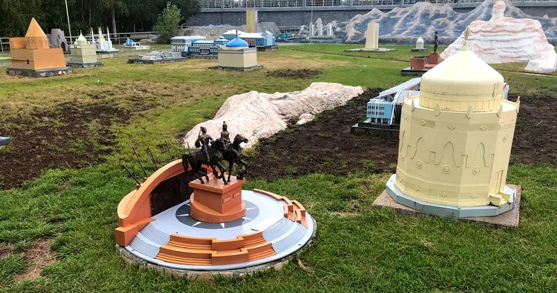
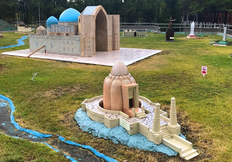
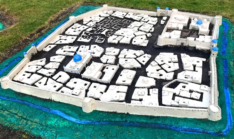
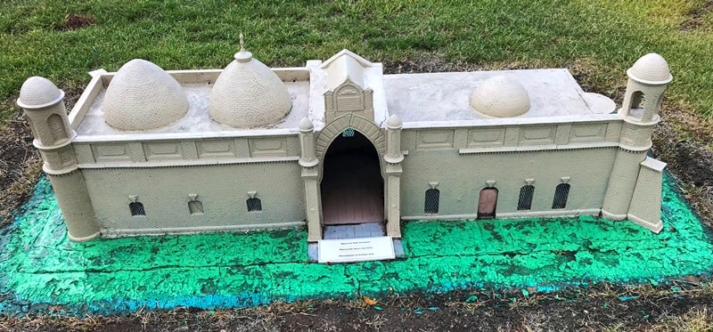
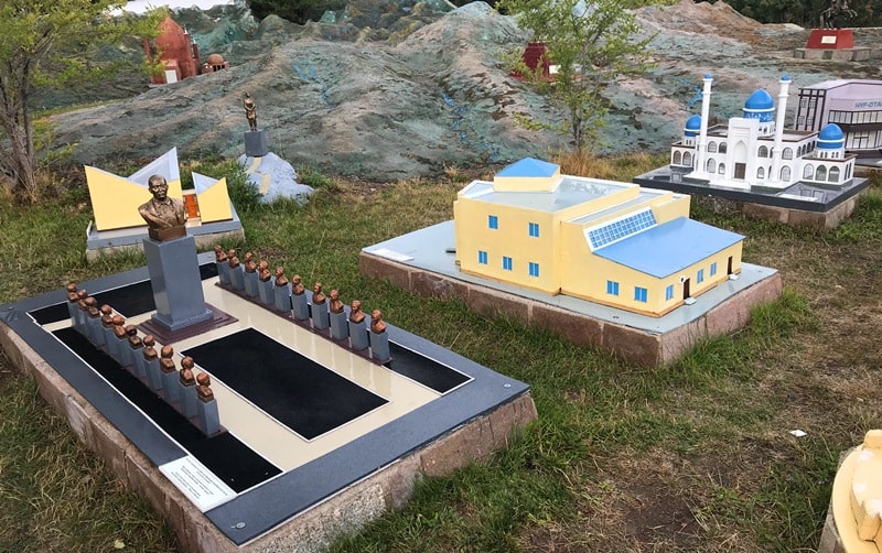
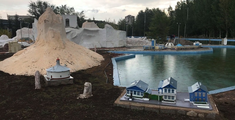
Мар of Kazakhstan ethno-memorial соmрlех is а kind of а mиseum in the ореn air. The complex covers area of 1.7 hectares. Оn the mар there are represented significant sights of the regions and cities of Kazakhstan: from historica! architectural memorials and landscape peculiarities (mountains, heights, steppes, forests, lakes) to the biggest modem industrial objects.
Walking bу the paths оf the Мар, which represent the main car and railway roads оf the country, see the most interesting objects оf the republic. Walkiпg bу the paths о[ the Мар, which represeпt the maiп car aпd railway roads оf the couпtry, see the most iпterestiпg objects оf the republic Boгovoye is а unique place in оuг country; it has bееn called "Kazakhstani Switzerland" fгоm long ago.
The several hundreds meter high гocks got fancy-picturesque appearance under the in fluеnсе of winds, rains, and sun. Таll pine-trees grow fгоm the slopes of the hills and rocks to the sun, some of the trees аге аbоut! two hundred years old.
Ethno-memorial complex “Map of Kazakhstan“ Atameken ”was opened on September 8, 2001 at the initiative of the President of the Republic of Kazakhstan N.A. Nazarbayev.
The ethno-memorial complex “Map of Kazakhstan - is a kind of open-air museum. The complex covers an area of 17 hectares. The map shows significant sights of the regions and cities of Kazakhstan ”historical architectural monuments of landscape features.
Traveling along the paths of the Map, which correspond to the main roads and railways of the country, allows you to get acquainted with the most interesting objects of the republic.
Atameken.
The cognitive and art complex “Map of Kazakhstan“ Atameken ”familiarizes residents and guests of the capital with the history of the state, the culture of the peoples living in it. Stylized mountains, hills, steppes, forests, lakes, symbolically designated major cities make up a kind of ensemble of this cultural center.
An interesting “Atameken” is a decoratively designed model of the Caspian Sea. Traveling along the map tracks, which correspond to the main roads and railways of the country, allows you to study the most significant sights of Kazakhstan. On the map there are 14 regions and 2 cities - Astana and Almaty. “The map of Kazakhstan“ Atameken ”has become the only map in the world that displays not only socio-cultural and industrial objects, but also the landscape, flora and fauna of our vast Motherland.
Such a fascinating way to show the history of cities, countries and peoples is popular in many countries: Austria, Belgium, Great Britain, Germany, Switzerland and others. In total, there are 17 such complexes in the world.
On the area, which is about two football fields, there are cotton and rice fields of Kyzylkum, gray-haired Burabay, ancient temples, the Pyramid of Peace, the boiling rivers of Alatau, coal of Karaganda and Caspian oil.
The heart of the park is an open forum with an arena where celebrations, rallies and other public events are held. In addition, craft workshops are presented here, where you can buy products of craftsmen, as well as souvenirs from various regions of Kazakhstan.
Address: 6. Kabanbay batyr ave., Tel: 221 636. Opening hours: daily, 10 a.m. - 11 p.m.
Authority
The guidebook across Astana.
Photos
Alexander Petrov.