







You are here
Chatyr-Kol lake.
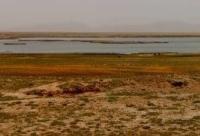
High-mountain lakes Kyrgyz Tien-Shan.
"On the 18th, we reached the rather extensive valley of the mountain lake Chadyrkul, surrounded on all sides by mountains and covered in a deep blanket of snow. It was so cold here that Kashgar had never experienced January. The caravan made its way through the snowdrifts with great difficulty and, having crossed the ice of the lake, spent the night in the Tashrabat Mountains, which surround the valley on the north side. Lake Chadyrkul is about 10 miles wide and about 20 long; it must be located high, at least 7,000 feet in absolute altitude. The next day, we crossed the Tashrabat Mountains and set up camp in the wide and level valley of the Atbash River. The Tashrabat pass has one extremely difficult passage for a caravan on camels; on the descent, the path runs along the edge of a high cliff, but the climb is insignificant. Since the river along which the road runs was frozen, we avoided the dangerous spot and walked on the ice.
Chokan Valikhanov. "Description of the Route to Kashgar and Back to the Alatau District. March 18, 1859."
Trip to Chatyr-Kol lake from Tahs-Rabat caravanserai.
High-mountain, saltwater lake Chatyr-Kol is located at an altitude of 3,530.2 m. a. s. l., between the southwestern part of the Atbashi Range and the northeastern part of the Torugart-Too Range in the Atbashi District of the Naryn Region.
The lake extends 22.5 kilometers from southwest to northeast, with its greatest width in the central part being 10.8 kilometers. Its surface area is 160.1 square kilometers, its perimeter reaches 57.37 kilometers, and its average volume is 8.5 cubic kilometers.
Lake Chatyr-Kol is located in the intermontane Chatyr-Kol Lowland southwest of the sublatitudinal At-Bashi Range and northeast of the Torugart-Too Range. The Torugart-Too Range is 74 kilometers long and 14 kilometers wide, including its southern end, located in the Republic of China.
It is the highest-altitude endorheic lake in the Inner Tien-Shan (in Kyrgyz, Chatyr-Kol means "heavenly lake"). The basin is 48 kilometers long, 18 kilometers wide at its widest point, and 12-13 meters deep, reaching 19 meters in the western part and 8 meters in the eastern part.
The Chatyr-Kul Basin has a sharply continental climate. Winters are snowless, but temperatures drop to -50°C. The lake's depth generally ranges from 12-13 meters, reaching 18-19 meters in the western part and 8 meters in the eastern part.
The lake bottom is hilly and pitted throughout. Twenty-four large and small rivers flow into the lake.
The largest of these are the Kekaigyr River (45 kilometers long), which flows into the lake from the east; the Torugart-Sy River (13 kilometers long), which flows into the lake from the southeast; the Kara-Su River (17 kilometers long), which flows into the lake from the south; the Kara-Tai River (12 kilometers long); and the Tepshi River (12.5 kilometers long), which flows into the lake from the west.
Only the Kekaigyr River, flowing down the slopes of the Atbashi Range, has a permanent watercourse. In winter, the riverbeds freeze to the bottom. The basin's drainage area is approximately 1,050 sq. km. However, due to the arid climate and limited development of modern glaciation in the mountains, the river network is poorly developed.
Lake Chatyr-Kol's salinity reaches 2%. The water is clean and clear. The water temperature in summer is 10°C, reaching 4.4°C at a depth of 0.6 meters. It freezes in October and breaks up in late April. The ice thickness is 0.25-1.5 meters. Numerous mineral springs are found in the southeastern part of the lake.
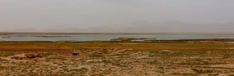
The relative elevation of the surrounding mountains ranges from 300 to 900 meters above sea level. The lake's surroundings are dominated by steppe landscapes. The lake basin is characterized by the topography of a gently dissected lake-river aggradational plain.
The shores are generally low, predominantly marshy in the south and east, and consist of six terraces. Only in the north, where the Middle Paleozoic limestone cliffs reach almost to the water's edge, are the shores high, resembling abrasive ledges.
Ornithological fauna of Lake Chatyr-Kol.
Phoenicurus erythrogastra, Corvus corax tibetanus, Fulica atra.
History of Lake Chatyr-Kul.
On March 18, 1859, while returning from Kashgar, Kazakh traveler and Central Asian explorer Shokan Valikhanov visited Lake Chatyr-Kul. While at the lake, the scholar heard many tales and legends. Valikhanov's estimates of the lake's dimensions are approximately 10 miles wide and 20 miles long, with an absolute altitude of at least 7,000 feet (2,100 meters).
Before him, the lake was depicted as Sengerkul on the left bank of the Karadarya River. The current name and the lake's actual location became known thanks to Valikhanov's descriptions. Valikhanov's estimates of the lake's size differ little from reality.
"Valikhanov also points out the lake's elevated position," writes Kyrgyz geographer S. Umurzakov. Chokan was the first foreign traveler to visit this beautiful lake. From there, through the Atbash and Uzgen river valleys, Valikhanov's caravan reached the Kokand fortification of Kurtka, located on the right bank of the Naryn River.
It then proceeded northeast, up the Naryn, and on April 6, in the Dzhetymcheku region, crossed the main caravan road leading through the Zaukinsky Pass into the Issyk-Kul Valley.
On September 11, 1888, Nikolai Lvovich Zeland's expedition passed by lake while traveling from city of Verny to Kashgar. From 1881 to 1888, N.L. Zeland worked as a regional physician in the Semirechye region, in the city of Verny. From 1888 to 1896, he was an assistant military medical officer.
Inspector of the Turkestan Military District, Tashkent. Member of the Turkestan Medical Society. Member of the Turkestan Circle of Archaeology Enthusiasts.
N.L. Zeland wrote a brief description of Lake Chatyr-Kul:
“Ahead and far below, a panorama of the Chatyr-Kul valley opened up, and in its center, the lake itself shone silver. On the bank of the river flowing into the lake, yurts were set up for us, which the Kyrgyz had already discovered from the pass.
The horizon was bordered by mountains completely covered in snow. The lake’s elevation is 11,570 feet. It is freshwater, about 2 miles long, less wide. It is home to marinka (Diptychus) and osman (Oreinus), which generally predominate in the waters of the Tien-Shan system.
It is remarkable that existing descriptions of Chatyr-Kul describe it as a lake devoid of fish - based on a review by a Kyrgyz - which Incidentally, this news also found its way into foreign works (see E. Reclus, L'Asie Russe, 1881). Meanwhile, the Kirghiz who were with me not only claimed the existence of fish, but also had no trouble naming its species.
On the other hand, there are many aquatic birds in the area, which feed, of course, on fish, as G. Kaulbars also noted. The soil along the lake's shores is clayey and belongs to post-Tertiary deposits. The area is deserted. At present, all the Kirghiz have disappeared, but some wander here in the summer."
Here's how botanist Vladimir Ippolitovich Lipsky describes his journey to Lake Chatyr-Kul during his travels through mountainous regions of Turkestan in 1903.
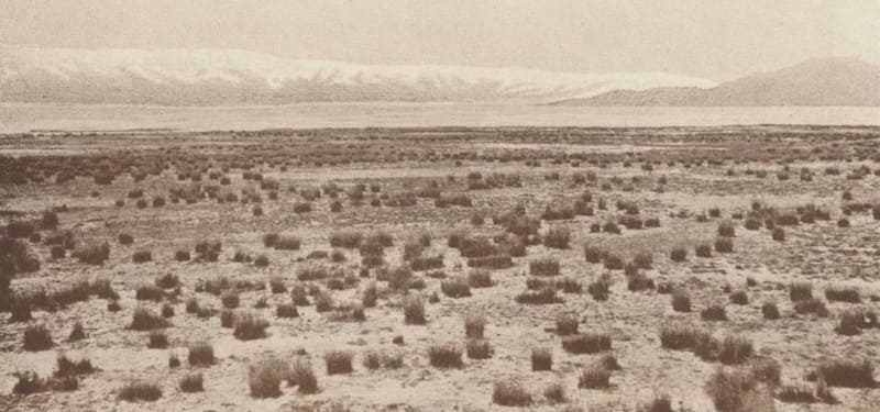
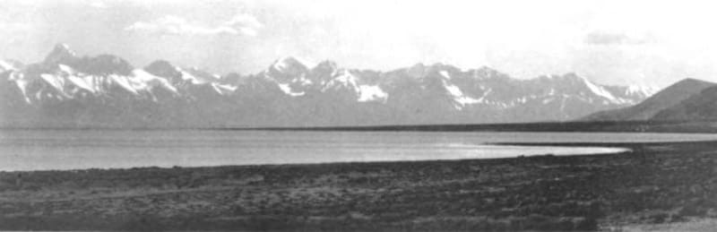
"Lake Chatyr-Kul, which opened up only gradually, initially had a muddy appearance and jutted out in tongues to the east. A dark blue wedge then juts out into this muddy water, and further west, the water becomes a beautiful deep blue. The view toward the southwestern end of the lake, where the snow-capped ridge extends, is very beautiful.
At first, our road led away from the lake, and only in the second half did it almost entirely follow the lakeshore. I, however, turned toward the lake much earlier in order to measure its elevation and make various observations. The lake's elevation turned out to be quite significant: 12,458 feet.
The water of this enormous lake is a beautiful deep blue, and to my surprise, it tastes fresh, at least from the shore. This was strange because, in fact, Salts lie along the shore of the lake (I collected samples of them). And then on the shore lies a whole bank of the seaweed Zostera marina.
This plant was so thick that it was always difficult to approach the water: your foot sank as if into soft manure and only then into the water. This bank of Zostera continued throughout our journey along Chatyr-Kul. I find the fact that this seaweed is found at such a great height in a mountain lake quite interesting.
A festuca of ovina stretches along the entire shore of Chatyr-Kul. Then, when the mountains approached the lake again, nomadic herbivores appeared in significant numbers. The western end of Chatyr-Kul offers excellent sites for herbivores; the slopes are covered with beautiful grass.
It's worth mentioning that on the opposite southern side of the lake, no herbivores are present at all. It was already evening when we reached the westernmost end of the lake. After passing the lake, we drove along the valley for a while, and then I climbed one of the hills to take a photo of the lake.
From here, at the western end, the view of the lake was particularly beautiful; to the left (north), the view was bounded by the At-Bashi Mountains, and to the right (south), by a snow-capped ridge - an extension of the Tien Shan. In the distance, to the east, a barely visible strip of the southern shore stretched.
Photographing the entire lake, of course, was impossible."
Geographic coordinates of Chatyr-Kol lake: N40°36'50 E75°17'42
Authority:
Alexader Petrov.
Book «The Soviet encyclopedia», «Soviet Union Kirghizia», publishing house "Idea", Moscow, 1970.