You are here
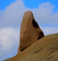
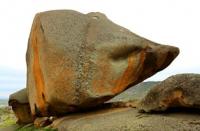
Dongaly mountains on Altai.


Sights of mountains of Dongaly.
“In July, I saw a magnificent reflection of paradise:
Burned myself sunset color madness
And hugging in a continuous rainbow,
Merged into a scarlet ray over a blue forest"
Vladimir Vladimirovich Nabokov.
Trip from Ust-Kamenogorsk to mountains of Dongaly.
Dongaly mountains are located in the Uspensky district of the East Kazakhstan region, 70 kilometers west of Ust-Kamenogorsk and 12 kilometers south of the Semey-Ust-Kamenogorsk highway. From north to south, the mountains stretch for 12.5 kilometers, from west to east 9.5 kilometers.
The highest elevation is Mount Dongaly, 750 meters above sea level, which is located south of Lake Dubygaly. South of the Dongaly mountain, 1 kilometer in the drainless cavity is Lake Dubygalinskoye. The length of Dubygaly Lake is 2 kilometers 300 meters, width 1 kilometer 700 meters.
The Dongaly mountains are composed of weathered granite outliers and are located on the northern side of the Kalba Upland along the left bank of the Irtysh River. In the north-east of the mountains, 14 kilometers away, is the village of Gagarino.
From the south and the eastern side of the mountain, the drying Kuryk stream encircles in places, which belongs to the Irtysh River basin in high water.
Geographic coordinates of Dongaly mountain range: N50 ° 02'29.37 "E81 ° 47'02.10"
Authority and photos:
Alexander Petrov.


