







You are here
Fourth Beloubinskoye Lake.
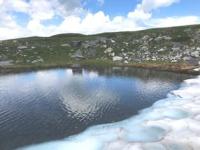
Sights of Beloubinskoye Lakes in Western Altai.
"Mountains determine not only the landscape but also the climate, serving as barriers to winds and reservoirs of fresh water in their glaciers."
Photographs of Beloubinskoye Lakes in West Altai Nature Reserve.
Fourth Beloubinskoye Lake is a freshwater high-altitude body of moraine-glacial origin, located at an altitude of 1,958 m. a. s. l. within the West Altai State Nature Reserve. The lake is located within the Ridder City Administration in the East Kazakhstan Region, between the eastern spurs of the Ivanovo Range and the western slopes of the Koksu Range – in one of the most picturesque and inaccessible areas of Kazakhstan's Altai.
Fourth Lake completes the chain of Beloubinsky Lakes, which stretch along the northern slope of the eastern Ivanovsky Range. It is located 362 meters northeast of the Third Beloubinsky Lake, approximately 1.9 kilometers east and slightly north of the First Beloubinsky Lake, 1.2 kilometers southeast of Kedrovoe Lake, and 2.3 kilometers southeast of Lake Shcherbakova.
Thus, the Fourth Beloubinsky Lake forms the eastern end of a single high-mountain lake complex stretching for almost two kilometers along the northern slopes of the Ivanovsky Range.
Origin of Beloubinsky Lake Basin.
The modern basin of the Fourth Beloubinsky Lake was formed as a result of ancient mountain glaciation, which determined the development of the relief of this part of the Altai for millennia. During the Ice Ages, powerful glaciers slowly descended from the high-altitude sections of the Ivanovsky Range.
As they moved down the slopes, they eroded rock, deepened natural depressions, and transported enormous masses of debris. Following gradual climate warming, the glaciers began to retreat, leaving behind moraine ridges, boulders, and cirques.
Most likely, the basin of the Fourth Belooubinskoye Lake is a glacial depression, partially bounded by moraine deposits. After the glacier disappeared, the resulting basin gradually filled with water from snowfields, precipitation, and temporary streams.
Despite its relatively small size, the lake retains all the characteristic features of a high-mountain moraine-glacial reservoir, forming an important part of the integrated glacial complex of the Beloubinsky Lakes.
Morphometric Features of Fourth Beloubinsky Lake.
Fourth Beloubinsky Lake is elongated from southwest to northeast. It is 214 meters long, with a maximum width in the central part of 166 meters. Its water surface area is 27,704 square meters, and its shoreline is 612.15 meters long. Compared to the other Beloubinsky lakes, it has a more compact basin.
However, this is precisely what gives the lake its distinctive character - it seems to be enclosed in a natural stone bowl amidst the rugged high-mountain slopes. One of the northern tributaries of the Belaya Uba River flows from the northeastern part of the lake.
Thus, Lake Fourth Belooubinskoe also plays a role in the formation of the headwaters of this large mountain river, whose waters then flow through numerous valleys of the Western Altai.
Features of Surrounding Landscape of Lake Fourth Belooubinskoe.
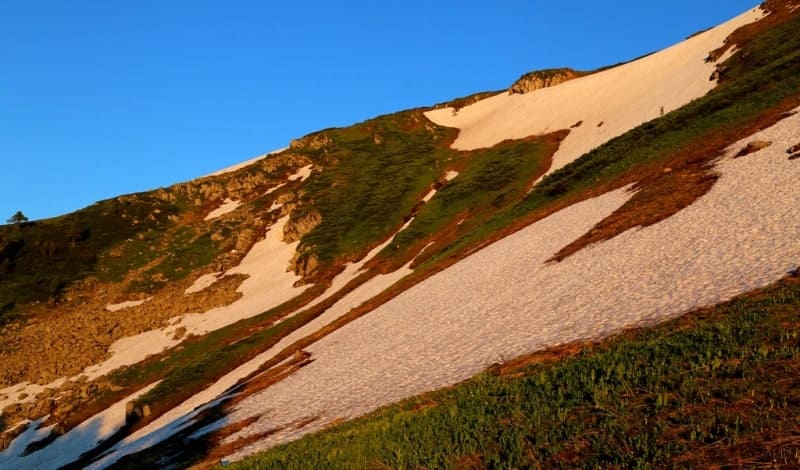
Unlike the previous Belooubinskoe lakes, Lake Fourth is distinguished by its particularly harsh natural appearance. The lake is located in a deep intermountain basin. The southern slope is steep and, in places, almost vertical, starting directly from the main ridge of the eastern Ivanovsky Range.
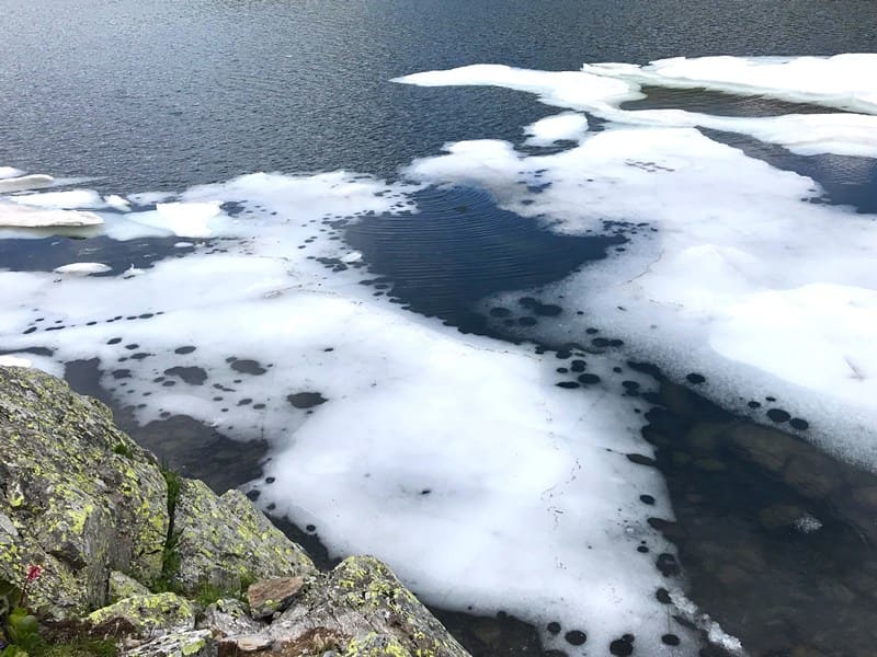
Rock slides, steep bedrock outcrops, and significant slopes emphasize the youth of the glacial relief. A notable feature is the almost complete absence of vegetation around the lake. The harsh climatic conditions, the deep lake basin preventing sunlight penetration, the high altitude, the short summer, and the rocky substrate hinder the development of stable vegetation.
This gives the surrounding landscape the impression of a virtually untouched high-mountain desert, where rocks, water, and the atmosphere play a dominant role. It is precisely this austerity of nature that gives the Fourth Beloubinskoye Lake its special beauty.
Here, the power of ancient natural processes that shaped the modern topography of Altai is particularly acutely felt.
History of Exploration of Beloubinskoye Lakes.
The history of the exploration of the Beloubinskoye Lakes remains understudied. To date, reliable information about the discoverers of this group of high-mountain lakes is lacking. It can be assumed that individual lakes were known to local hunters, guides, and foresters long before scientific expeditions.
However, documentary evidence of the first explorations has not yet been found. Therefore, each modern field survey of such sites is particularly valuable, adding to our knowledge of the little-studied regions of Western Altai.
Natural Significance of Fourth Beloubinskoye Lake.
The Fourth Beloubinskoye Lake completes the sequence of Beloubinskoye Lakes, stretching along the northern slope of the Ivanovsky Range. Together with the First, Second, and Third Lakes, it forms a unique high-mountain lake complex, allowing us to trace the formation of glacial basins and the modern hydrographic network.
All four lakes share common features: their moraine-glacial origin, their feeding by precipitation and snowfields, their participation in the formation of the Belaya Uba River basin, and their location within a single mountain range. At the same time, each lake has its own unique appearance and individual characteristics, reflecting the diversity of the high-mountain landscapes of Western Altai.
The Fourth Beloubinskoye Lake is a unique culmination of this natural complex. Its rugged, treeless shores, deep glacial basin, and immediate proximity to the main ridge of the Ivanovsky Range provide a particularly vivid glimpse into the processes that shaped the modern appearance of the high-mountain Altai.
Hike to Fourth Beloubinskoye Lake.
In July 2019, the author and friends took a radial horseback ride to the Fourth Beloubinskoye Lake after visiting the Third Beloubinskoye Lake. The route ran along the northern slope of the eastern part of the Ivanovsky Ridge. As they progressed, the landscape's change became increasingly apparent.
Vegetation gradually disappeared, giving way to rocky scree and rugged high-altitude terrain. Arriving at the lake, the travelers encountered one of the most unique corners of the Beloubinsky group. A deep intermontane basin, a steep southern slope, and an almost complete lack of vegetation create the impression of a harsh world shaped by an ancient glacier.
It is here that one becomes especially clear that the Beloubinsky lakes are not a random collection of bodies of water, but a unified natural system formed by the ancient glaciation of the Altai.
Geographic coordinates of Fourth Beloubinskoye Lake: N50°17'30 E84°09'47





Authority and photos by:
Alexander Petrov.