You are here
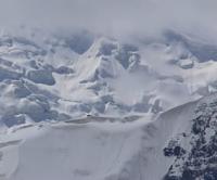
Glacier 503 (Kyzylkul).

Nature of Tajikabad region of Tajikistan.
“It is impossible to value in hard currency the feeling of freedom and timelessness that the mountains give you when you stand on a high spur under a flawless blue April sky and look around you.”
Jonathan Coe.
Glaciers of Surkhob River basin.
Glacier 503 (Kyzylkul) is located at an altitude: upper limit is 4280 (peak Jagryk) meters above sea level (peak Kavdal. Kaudal), end of glacier is 2623 meters above sea level, is located on northern slope of Peter the Great ridge, in upper reaches of Dara River, in Tajikabad region of Republic of Tajikistan.
The glacier is located in the basin of the Shurak Kapali Vostochny River, 16.2 kilometers long and is a left tributary of the Surkhob River. The length of the glacier is 2.5 kilometers, the glacier area reaches 0.9 square kilometers.
History of study of glacier 503 (Kyzylkul).
From 1975 to 1990, the glacier retreated 80 meters at an average rate of 5.6 meters per year, losing 2.4% of its area.
Geographic coordinates of glacier 503 (Kyzylkul): N38°58'13 E70°50'53
Authority:
"Glaciers of Tajikistan". Ministry of Nature Protection of the Republic of Tajikistan. Main Directorate for Hydrometeorology and Natural Environment Observations. Dushanbe. 2003.
Photos by:
Alexander Petrov.


