You are here
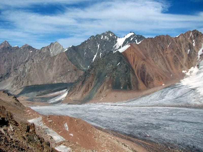
Glacier of Tuyk-Su.

Group inclusive tour in Almaty.
“It is untrue that equality is a law of nature. Nature has no equality; its sovereign law is subordination and dependence”
Luc de Clapiers de Vauvenargues.
Package tourists in Almaty.
Tuyuk-Su glacier is located: upper boundary of glacier is at an altitude of 4,218 meters above sea level, end of glacier is at an altitude of 3,537 meters above sea level, is located in central part of eastern spur of Maloalmatinsky gorge, on northern slope of Zailiysky Alatau, in system of vast Northern Tien Shan ridge, in Medeu district of Almaty and in Talgar district of Almaty region.
The Tuyuk-Su glacier cirque is located in the upper reaches of the Maloalmatinsky gorge, here are also the sources of the Malaya Almatinka River, which originates from several glaciers, the main ones of which are the Tuk-Su glacier and the Molodezhny glacier.
The Tuyuk-Su glacier cirque is framed by peaks, the most northwestern peak is Mount Kumbel, 3,618.8 meters above sea level in the Kumbel ridge. Further south is the next unnamed peak in the ridge that separates the Maloalmatinskoye Gorge from the Kumbel-Su River valley, 3,867.4 meters above sea level.
The cirque of the Tuyuk-Su glacier closes in the southwest with the Molodezhnaya peak, 4,103 meters above sea level. Pogrebetsky Peak, from which the central part of the Tuyuk-Su glacier descends to the north, 4,231 meters high, is the southernmost peak.
Further northeast is the Tuk-Su Pass, from which, just over 3 kilometers in a straight line, is the Patriotic War peak, 4,208.5 meters above sea level. Further north between the Molodezhny glaciers and the tongue of the Tuyuk-Su glacier is the glaciological station of the Institute of Geography of Kazakhstan, founded in 1956, whose staff monitors the movement and melting of glaciers.
Currently, the station is the only one in Central Asia where glacier observations continue. At the Tuyuk-Su meteorological station at an altitude of 3,750 meters above sea level, the average annual temperature is minus 6.4', in January - minus 15.5', in July - plus 2.8.
The sum of positive average monthly temperatures in the summer is 6.5'. Frosts reach 40'.The average ice movement speed is 22.3 m/year. For the period from 1964 to 1974, the average annual accumulation on the Tuyuksu glacier was 104.6 g/cm2, ablation - 118 g/cm2, balance - 13 g/cm2.
Out of 10 years of observations, 5 years were with a negative balance and 5 years with a positive one.Over the same period, the mass balance of the remaining glaciers in the Tuyuksu basin was negative (from - 11 to - 28 g/cm2 per year).In general, the average mass balance for the basin over 10 years was - 14.3 g/cm2.
Over 25 years (1937 - 1962) the area of the Tuyuksu glacier decreased by 0.084 square kilometers (Tuyuksu Glaciers. 1984).The glaciers of the southern slope of the Zailiyskiy Alatau and the northern slope of the Kyungoy-Ala-Too provide runoff into the basins of the Chilik and Chon-Kemin rivers.
Tyuuk-Su, the central valley glacier, is located from south to north, in the center of a group of glaciers consisting of ten glaciers that form a horseshoe-shaped cirque. The length of the open part of the glacier is 2.7 kilometers, the width in the cirque area reaches 880 meters, in the lower part (the tongue of the glacier) 440 meters, the area of open ice is 3.1 square kilometers.
The average height of the snow line over the past 10 years is 3040 meters above sea level. The open end of the glacier descends to an altitude of 3400 meters above sea level. The ice thickness on the Tuyuk-Su glacier is on average 50 meters, with a maximum of 100 meters.
The volume of ice is about 150,000,000 cubic meters. The lateral moraines, joining with the terminal moraine, created a giant ridge about 300 meters high, which blocks the valley of the Malaya Almatinka River, making access to the glacier difficult.
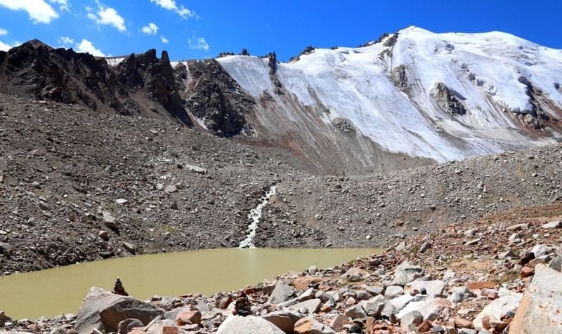
A significant part of the glacier (1.4 kilometers) is located under this moraine. The glacier shrinks (retreats) on average by 10 meters per year, as a result of which a large lake is formed from meltwater between the terminal moraine and the tongue of the glacier in the summer.
The breakthrough of the terminal moraine by these glacial waters is the cause of the mud and rock flows. Only the waters of the glaciers seeping through the terminal moraine run down into the Mynzhylka valley, and merging together at an altitude of 3040 meters above sea level give rise to the Malaya Almatinka River, in the valley of which a complex of hydraulic structures has been created to ensure the safety of Almaty.
Geographical coordinates of Tuyuk-Su glacier: N43°02'38 E77°04'40


Authority and photos
Alexander Petrov.
Catalog of glaciers of the USSR. - Leningrad, 1967, v. 13, c. 2. Part 2. Tuyuksu Glaciers (Northern Tien Shan). L.: Gidrometeoizdat, 1984. Icing of the Tien Shan. Ed. N. B. Dyurgerova. - M., 1995. Icing of the Trans-Ili Alatau. - M .: Nauka, 1969. Palgov N. N. Bolshealmatinsky glaciation site in the ridge of Zailiysky Alatau. Brief Encyclopedia Kazakh SSR, Volume 2, Nature, Alma-Ata, 1990.
Photos by:
Alexsander Petrov, Roman Stesenko, Sergey Mikhalkov.


