







You are here
Glaciers in Issyk River basin.
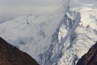
Tributaries of Issyk River.
"Summer days are mostly cloudy, and often overcast. The glaciers of the Zailiskiy Alatau move at a slow pace - much slower than Alpine glaciers. The highest speed observed at any point on the Konstitutsiya Glacier was 17 cm per day. At the snouts of many glaciers, however, speeds drop to one centimeter per day or less. Sharp annual fluctuations in precipitation and summer air temperatures significantly alter the position of the firn line - the boundary between the glacier surface exposed from snow and the area that remains snow-covered year-round."
N.N. Palgov. «Nature of Kazakhstan in Sketches and Pictures». 1950.
Walks in Issyk River valley.
The Issyk River is formed by two branches: the left is named Zharsai, and the right is Teskensu. Glaciation in the Issyk basin is most extensive in the headwaters of the Kokbulak-Teskensu river system. It is less developed at the sources of the Zharsai River and is quite insignificant in the main river's side tributaries.
The Teskeno-Kokbulak group consists of 13 glaciers arranged in a semi-circle formed by a section of the main ridge and two lateral spurs: a western spur on the Zharsai River side and an eastern spur on the Turgen River side. The Teskeno-Kokbulak group forms a semi-circle enclosing the following glaciers, listed from west to east: the three Bozkul glaciers, Avsyuk, two unnamed glaciers, Lobastyy, Kokbulak, Dvukhlopastnyy, Mezhduumestnyy, Grigoryeva, Palgova, and Kassina.
Bozkul Glaciers in upper reaches of Issyk Gorge.
These are located in a branching gorge of the Zharsay spur. One belongs to the hanging-valley glacier type, while the other two are standard hanging glaciers. The main glacier is distinguished by the fact that its tongue is covered by a moraine mantle for a considerable distance; in this respect, it can be classified as an "armored" glacier.
Its lower section extends eastward along the mountain slope and rests against the moraine dam of Lake Bozkul. Here, its steep, high front approaches very close to thickets of Turkestan juniper and the upper limit of the spruce forest. The entire glacier is approximately 2-3 km long and 200-500 m wide.
Avsyuk Glacier in upper reaches of Issyk Gorge.
It is about 3 km long, extending to approximately 4 km if the buried section is included. Its width is roughly 200-300 m. Two unnamed glaciers lie on the western slope of the spur situated between the Avsyuk Glacier and Lake Akkul. Both are located in small cirques carved into the slope of a flat-topped mountain.
The mountain's flat summit itself is entirely covered by a flat-summit type firn glacier. The combined area of the cirque glaciers and the flat-summit glacier - with which they are connected - is approximately 2 sq. km.
Kokbulak Glacier in upper reaches of Issyk Gorge.
Glaciation on the northern slope of the main ridge begins in the west with the Lobastyy and Kokbulak glaciers, situated on opposite sides of the same glacial hollow. These two glaciers lie in the southwestern corner of the head basin of the Kokbulak River.
Here, the main ridge features two snow-capped peaks separated by a wide saddle. The southeastern peak - a slightly rounded rise on the otherwise level ridge crest - has been named "Belaya Shapka" (White Cap) by mountaineers; its elevation is 4,200 m.
The northwestern peak is a broad cone 4,300 m high (Kokbulak Peak). The saddle between these peaks resembles a smoothed, damp, scree-covered expanse with small patches of snow along its edges; it is known as the Kokbulak Pass. It lacks a distinct glacier tongue.
The lower surface of the glacier is covered with rock debris. The glacier's upper accumulation zone lies at an elevation of 3,971 m above sea level. The terminus of the exposed part of the glacier is located at an elevation of 3,486 m a.s.l. The glacier is nourished by accumulation of snow, firn, and solid precipitation.
Transverse crevasses appear in two locations in the eastern section, where the glacier flows over a rocky outcrop. A proglacial lake - 325 meters long and 110 meters wide - is situated in the eastern part of the glacier. The Kokbulak Glacier is primarily associated with the Belaya Shapka summit and, to a lesser extent, with Kokbulak Peak; these rise on either side of the saddle.
Its firn fields cover half the slope of Belaya Shapka and part of the slope of Kokbulak Peak. The Kokbulak Glacier can be classified as a slope-apron glacier. It is approximately 2 km long; its width is nearly the same at the firn fields and about 1 km at the terminus, with a total area of roughly 2 sq. km.
Lobastyy Glacier, located in upper reaches of Issyk Gorge.
It lies to the left of the Kokbulak Glacier and is formed exclusively by snows from Kokbulak Peak. The glacier spreads across the summit's slope like a smooth white sheet, set at an angle of 20-30 degrees. A small portion of it extends from the slope down into the valley.
The entire glacier reaches a length of up to 2 km. Its width, which is 2 km or more at the top, narrows to 200 m at the bottom. The glacier's area does not exceed 3 square kilometers. Its surface is uniform, resembling a smooth winter field; only a single ice exposure breaks the expanse, appearing as a ledge.
The glacier's right flank, facing southeast, drops off in a steep wall that overhangs the rocks below. This wall, ranging from 10 to 40 meters in height, consists of white firn ice with numerous garlands of icicles hanging from its edges. The glacier, covered by an even layer of snow, abuts the wall with a high, convex, smoothly contoured front.
This distinctive and striking terminal shape prompted N. N. Palgov to name it "Lobastyy" (meaning "Bulbous-fronted" or "Big-browed").
Dvukhlopastnyy Glacier in upper reaches of Issyk Gorge.
This glacier is situated partly on the slope of the main ridge and partly (on the east) on the slope of a short lateral spur. It lies adjacent to the Kokbulak Glacier, sharing a common firn field with it in the upper section of the mountain slope. Further down, they are separated by a rocky outcrop that drops toward the Dvukhlopastnyy Glacier as a snow-free precipice, while sloping toward the Kokbulak Glacier as a moderately steep, snow-covered incline.
Below this outcrop, the buried sections of the glaciers converge, forming a continuous surface complex of moraine deposits. The Dvukhlopastnyy Glacier is classified as a slope apron glacier. The section of the main ridge supporting its firn fields forms a smooth, entirely snow-covered crest, with the peak known as Belaya Shapka ("White Cap") rising at its western end.
A medial moraine divides the glacier into two northward-trending lobes; the left lobe is both longer and wider. It extends at least 2 km (measured from the ridge crest), or up to 2.5 km or more when including the buried section. The average width of the glacier across both lobes exceeds 1 km. Its area is 3.8 sq. km.
Mezhduumestny Glacier, located in upper reaches of Issyk Gorge.
It is a slope-apron glacier situated primarily on the slope of the main ridge; the ridge crest above and flanking the glacier features a nearly level surface at an elevation of 4,100 m or higher. After descending the slope, the glacier tongue terminates in a broad lobe within a short basin.
The basin is flanked by a snow-free spur slope to the west (which supports the Dvukhlopastny Glacier on its opposite side) and a low, rocky ridge with sharp crags to the east. The basin is over 200 m wide. The lower section of the glacier is buried beneath moraine deposits; these descend in hummocky terraces toward the Kokbulak River valley at the point where the river bends, shifting from an easterly to a northerly course.
The total area of the glacier, including its frontal moraines, is approximately 2.5 sq. km.
Grigoryev Glacier, located in upper reaches of Issyk Gorge.
Grigoryev Glacier is the largest in the entire Issyk River basin. It extends up to 5 km in length, with a width of up to 2 km at the tongue and up to 3 km at the firn field. It can be classified as a basin glacier. In terms of configuration, it bears a strong resemblance to Dmitriev Glacier.
The total area of the glacier, including its buried terminus, is slightly over 8 sq. km.
Palgov Glacier, located in upper reaches of Issyk Gorge.
It is located in the southeastern corner of the Kokbulak Basin, near the Grigoryev Glacier. A short spur separates the two, yet the moraine deposits of both extend right up to the Kokbulak River and partially touch one another. The Palgov Glacier is a valley glacier. Its width ranges from 1,600 m in the cirque to 600 m in the upper and middle sections of the tongue, narrowing to 200 m at the exposed terminus.
The total area of the glacier, including its buried section, is estimated at approximately 5 sq. km.
Kassin Glacier, in upper reaches of Issyk Gorge.
The glacier lies on the western slope of the Issyk Spur and the northern slope of the Kassin Spur, which separates it from the Palgov Glacier. The Kassin Glacier is the northernmost in the Kokbulak group and is classified as a valley glacier.
Avsyuk Glacier, in upper reaches of Issyk Gorge.
The valley containing it opens into the main river valley in the stretch between Lakes Akkul and Bozkul, almost opposite the hanging valley occupied by the Avsyuk Glacier. The length of the exposed part of the glacier exceeds 3.5 km; including the moraines deposited in front - beneath which ice may be present - the total length is about 6 km.
The area of the glacier, including its frontal moraines, is approximately 4 sq. km. With no tributaries, the glacier forms a compact river of ice, fed by the rear wall of the cirque and a left-hand lateral mountain spur.
Glaciers of Zharsay Group in Zailiskiy Alatau.
According to V. G. Gorbunov, the Zharsai group consists of seven glaciers. It is situated at the headwaters of the two source streams of the Zharsai River. The group's largest glacier - the Zharsai Glacier - lies within the left source stream. Its left section originates at Metallurg Peak, its central section at Zharsai Peak, and its right section at Kokbulak Peak.
It is a valley glacier formed by three branches: the left is the longest, the right has the largest surface area, and the middle one is the smallest. All three branches merge 1.5-2 km from the cirque's headwalls. The glacier is approximately 4 km long, with a total area (including the buried section) of about 7 sq. km.
In the right source stream of the Zharsai River - beyond a short spur east of the Zharsai Glacier - lies a second glacier, which appears to be of the gorge glacier type. It is 1.5 km long and covers an area of approximately 1.2 sq. km. This glacier is named the Medoev Glacier.
The remaining five glaciers are classified as cirque and hanging glaciers. The total glaciated area at the headwaters of the Zharsai River reaches approximately 12 sq. km, according to small-scale surveys (K. G. Makarevich estimated it at 8.5 sq. km in 1954).
References:
Gvozdetsky N. A., Nikolaev V. A. "Kazakhstan". Moscow: Mysl, 1971.
Gvozdetsky N. A., Mikhailov N. I. *Physical Geography of the USSR*. Moscow: Mysl, 1978.
Zhivago N. V., Piotrovsky V. V. Geomorphology with Fundamentals of Geology. Moscow: Nedra, 1971.
Catalogue of Glaciers of the USSR. Leningrad, 1967, Vol. 13, Issue 2, Part 1.
Catalogue of Glaciers of the USSR. Leningrad, 1967, Vol. 13, Issue 2, Part 2.
Tuyuksu Glaciers (Northern Tien Shan). Leningrad: Gidrometeoizdat, 1984.
Glaciation of the Tien Shan. Ed. N. B. Dyurgerov. Moscow, 1995.
"Glaciation of the Zailiysky Alatau." Moscow: Nauka, 1969.
Palgov N. N. The Bolshaya Almatinka Glaciation Cluster in the Zailiysky Alatau Range. "Izvestiya Vsesoyuznogo geograficheskogo obshchestva" Proceedings of the All-Union Geographical Society, 1948, Vol. 80, Issue 1.
Palgov N. N. Shokalsky Glacier in the Zailiysky Alatau Range. "Izvestiya Vsesoyuznogo geograficheskogo obshchestva" [Proceedings of the All-Union Geographical Society], 1948, Vol. 80, Issue 1.
Palgov N. N. Trip to the Tuyuksu Glacier in the Summer of 1922 (Offprint from *Izvestiya GRGO*, Vol. LVIII), 1926.
Tokmagambetov G. A. Glaciers of the Zailiysky Alatau. Alma-Ata, 1976.
Tokmagambetov G. A. Secrets of Kazakhstan's Natural Ice. Alma-Ata: Nauka, 1978.
Svarichevskaya Z. A. "Geomorphology of Kazakhstan and Central Asia'" 1965.
Chedaya O. K. "Morphostructures and Recent Tectogenesis of the Tien-Shan". Frunze: Ilim, 1986.
Material prepared using data from:
Glaciological studies and works by scientists: S. E. Dmitrieva, N. N. Palgova, G. A. Tokmagambetova (*Glaciers of the Zailiysky Alatau*, 1976), K. G. Makarevich, and E. N. Vilesov.
Article: "Glacial Structures of the Northern Tien Shan – Zailiysky Alatau."
http://www.bigmir.net
https://elib.rgo.ru/safe-view/123456789/226999/1/0LPQtdC+0LsuMjRfVGFsZ2FyLCBnbGF2bmF5YSB2ZXJzaGluYSBaYWlsaWlza29nbyBBbGF0YXUsIGJsaXoucGRm
Photos by:
Alexander Petrov.