


![]()
You are here
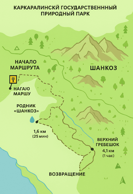
Hiking Route "Across Shankoz Mountains."

"Romanticism is essential in human life. It is this that gives a person divine strength to travel beyond the mundane. It is a powerful spring in the human soul, pushing them to great achievements."
Fridtjof Nansen.
Exploring Mountain Lakes in Shankoz Mountains.
Location: Northwestern Karkaraly Mountains, Karkaraly State Nature Park, Karaganda Region.
Route Length: Approximately 8.2 kilometers (roundtrip).
Duration: 3.5 – 4 hours with stops.
Difficulty: Easy to Moderate.
Maximum Altitude: Approximately 1,120 meters above sea level.
Hiking Route.
1. Starting point: an ecological post at the western entrance to the nature park.
0 kilometers, elevation: 880 meters above sea level.
The route begins on the road leading from the village of Karkaralinsk to the Koyandy valley (approximately 10 kilometers from Karkaralinsk).
There is an information board and a parking area here. It's convenient to leave your car or bike.
2. Shankoz Spring - 1.6 kilometers, 25 minutes.
Coordinates: approximately N49°27.6', E75°20.4'
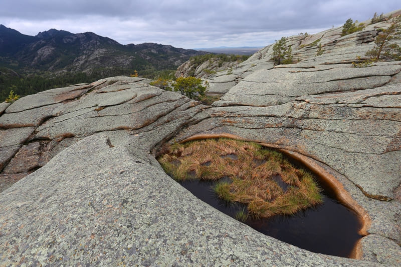
The trail passes through a pine forest, gradually gaining altitude. The soil is sandy, with granite outcrops in places.
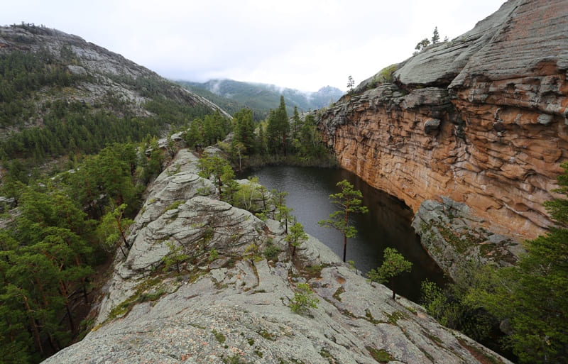
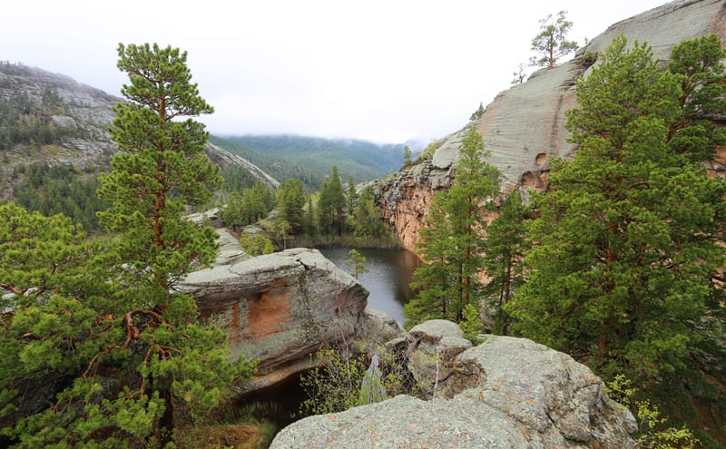
At the bend in the valley, you can hear the babbling of a stream – this is where the first Shankoz Spring, which gave the mountains their name, is located.
Nearby, wooden benches and a shelter are an ideal place to rest. In spring and after rains, the water is especially clear and cold.
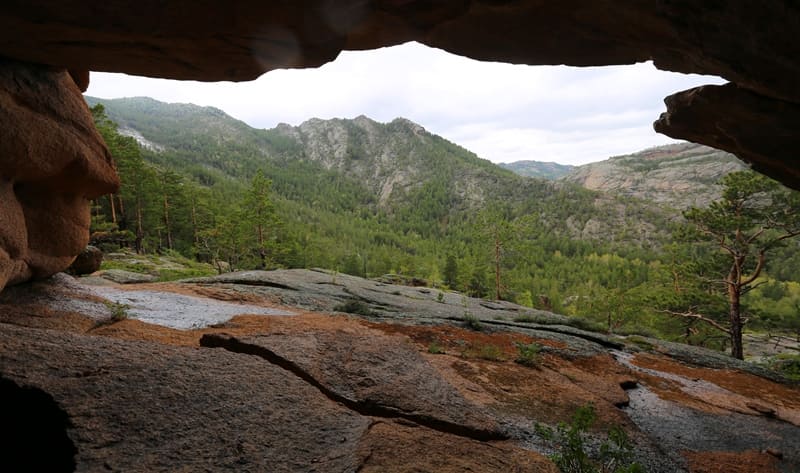
3. "Stone Gate" observation deck - 3.1 km, 40 minutes.
From the spring, the trail climbs up the western slope. After about a kilometer, the first granite outcrops appear.
Between two vertical cliffs, a narrow passage about 2 meters wide opens – it's called the "Stone Gate."
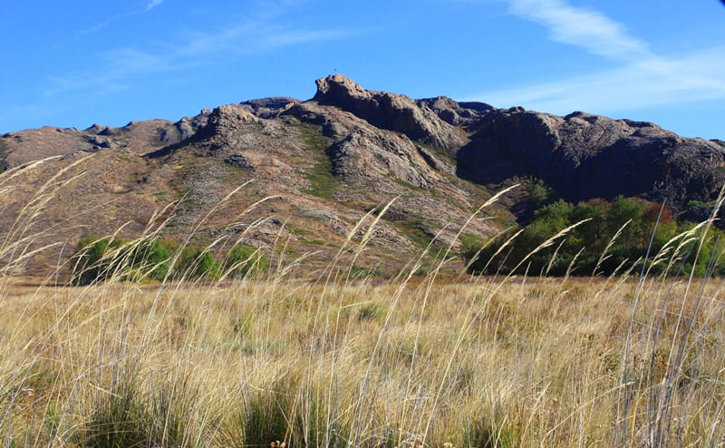
From here, the first wide view to the north opens up – the steppes stretching toward the village of Taldy.
The observation deck is a convenient place to take photos and a snack.
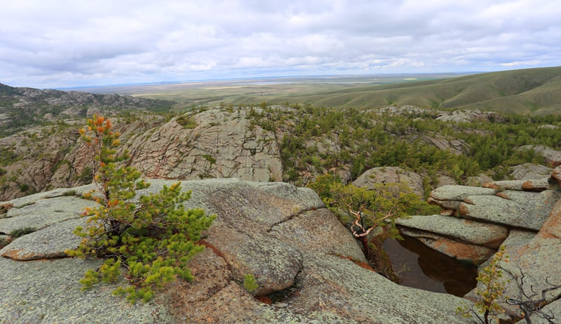
4. Upper Shankoz Ridge - 4.1 kilometers, 1 hour.
After the "gate," the climb becomes more gradual. Along the way, you encounter bizarrely shaped pine trees and sparse rosehip thickets.
After 40 - 50 minutes of climbing, you reach the ridge, where the altitude reaches approximately 1,120 meters above sea level. Here is an impromptu stone trek - a place where hikers leave a "trace" of their ascent.
Ridge offers views:
to the southeast - the Karkaraly Mountains,
to the west - the light-colored hills of the Shankoz River valley,
to the north - the boundless steppe stretching toward the Kent Mountains.
5. Return by the same route - 4.1 kilometers, 1.5 hours of descent.
The descent follows the same route. On the way back, you can stop at a spring to refill your water supply.
In summer, butterflies are often seen in the clearings at the foot of the ridge, and mushrooms (especially aspen mushrooms and butter mushrooms) are found in the shade of the pine trees.
General recommendations for hiking in Shankoz Mountains.
It's best to leave in the morning (before 9:00 a.m.) as the sun warms up the exposed areas by midday.
Bring plenty of water (0.5 – 1 liter per person) and a snack.
Wear light but protective clothing, as mosquitoes are likely near the springs.
The trail is especially beautiful in spring and fall: the forest is painted in contrasting colors, and the air is fresh and clear.
In clear weather, you can see the summit of Komsomol Peak (Zhirensakal) to the south from the Shankoz ridge, an excellent vantage point for your next journey.
Interesting facts about Shankoz Mountains.
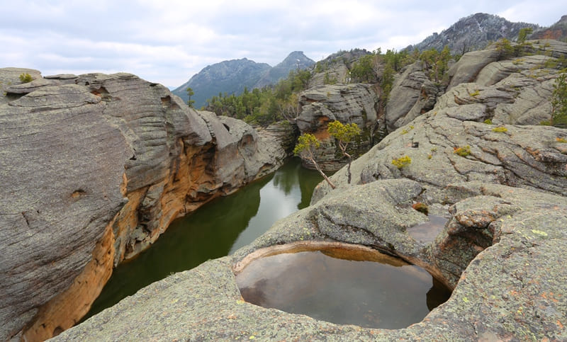
The name "Shankoz" translates as "ringing spring" or "singing water." According to legend, a girl named Shankoz once sang at this spring, and her voice is forever etched in the murmuring water. Traces of ancient settlements are often found in these mountains: flint tools and pottery fragments, indicating that the area was inhabited as early as the Bronze Age.
According to geologists, the Shankoz rocks are composed of ancient granite rocks over 1.5 billion years old.
Authority and photos by:
Alexander Petrov.