


![]()
You are here
Karagie depression.

Travel Tours on Mangyshlak.
“Karagiye” is a Turk name for a “Black Jaw”
Trip to Karagie depression on Mangyshlak.
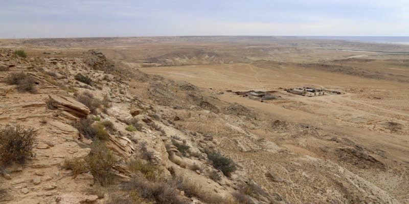
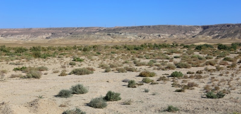
The Karagiye depression is located in the southwestern part of the Mangyshlak peninsula, 18 kilometers from the eastern part of the Aschysor depression, 22 kilometers west of the Zhetybai village to the northeast in the Karakiya district of the Mangistau region.
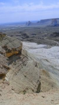
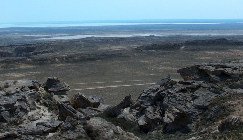
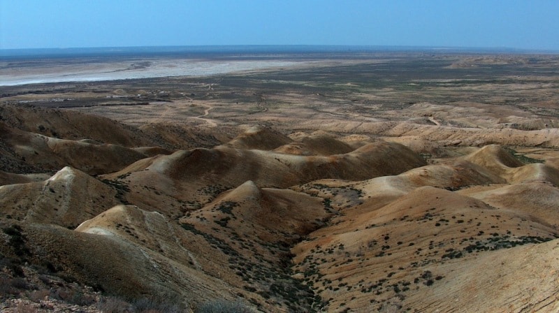
The Karagiye Depression (“black depression” from Kazakh) is the lowest point in Kazakhstan, reaching 132 meters below sea level. The depression stretches from north-west to south-east for 50 kilometers, the greatest width, in the central part in the vicinity of Batyr Sor - 15 kilometers. In the southwestern part of the Batyr saline land is the lowest elevation of the depression - 132 meters.
On the east side, the depression is limited by the Ustyurt Plateau and the Karasengirek tract. From the west, along the Karagiye depression, the Aktau-Beineua railway stretches, and in the south-western part, the depression is bounded by the Ashchisor litter.
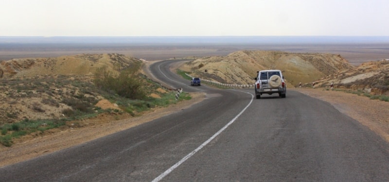
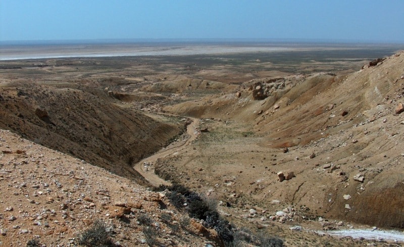
An observation platform halfway from Aktau to Munayshy on the southeastern road towards Zhanaozen gives a magnificent view over the area in clear weather. The eastern part of the Mangyshlak plateau boasts с having one of the deepest mountain trenches in the work It is located 50 km from the city of Aktau and sits 13 meters below sea level, sprawling itself from north-west t south-east.
The slopes of the trench are rather flat and it does not break a sweat to climb down. People go mushrooming in the trench in spring. One can find only champignons here, as other mushrooms do not grow in Mangyshlak.
Strikingly beautiful snakes, hares, foxes and corsaks inhabit the place. Vultures soar high in the sky, seeking the prey. Moufflons nervously take in everything that's going on around. They say that once upon a time there used to be the lake Batyr, which means a “Brave Warrior".
Then the trench came into existence. It measures 40 km in length and 10 km in width. The formation of the trench is tied up to the enleaching of salty rocks, including the funnel and karst processes that took place on the Caspian Sea.
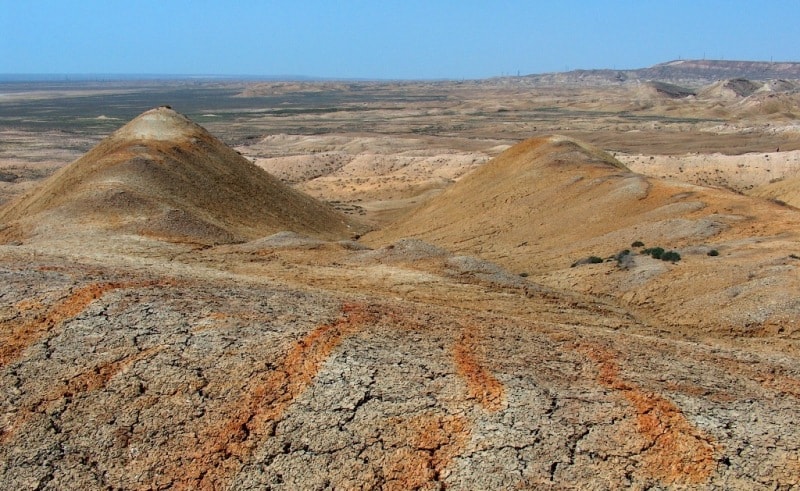
Karst is caused by underground waters washing out and dissolving the rock. Underground waters, leaking out to the bottom of the crevice in limestone, dolomite rock and gypsum, gradually dissolved the rocks, widened the crevices and created deep and narrow trenches.
The walls and beds of such indentations broadened and formed large funnels and caves. As the caves widened, their walls and ceilings collapsed under the weight of upper layers of rock. It was an ongoing process and was directed to the earth's depth, where saliferous and calcareous layers of rock were deposited.
As a result of this process, large cavities were formed. They were filled with crushed rock. Then formed funnels, potholes, blind valleys, niches and grottoes, shallows, vesicles, passages, and natural wells. The Karagiye trench was developing this way till it finally took the shape it has today.
These processes are still at work. Numerous offsets and scarps, segregated by wide and deep erosive sais, indicate that the relief-forming processes are still going on. For several years, the scientists of Kazakhstan have conducted their research in the trench. It turns out that the arid Karagiye trench is a natural generator of rain clouds.
In summer, as a result of the air ascending above the trench, kilometer-long rain clouds are formed. Photographs taken by satellites and ground-based observations confirm that. If you climb down the flat slope, you can find a small pool of streaming water and the spring Prokhladnyi that flows from a drilled well.
The water is salty. The string snakes its way at the bottom of the trench and disappears into the southern part of the trench, sinking into the sand. There is an ephemeral lake in the southwest of the trench.
There are logging stones, a mass of bedding rocks that were spared of surface damage, in the central Karagiye. Everyone should see this picturesque sight.
Geographic coordinates of the Karagiye depression: N43 ° 25'23.95 "E51 ° 45'17.00"
Authority:
The guidebook across Kazakhstan. The edition of the ministry of tourism and sports.
Photos
Alexander Petrov.