


![]()
You are here
Kastek ancient settlement. Urung-Arj.
Best historical sights of Kazakhstan.
"To the left of us, the majestic ridge of the Zailiysky Alatau rose sharply outlined against the dark azure, on the western end of which the high rounded peak of Suok-Tyube rose separately; on it, snow-white stripes, illuminated by pink light, sparkled in the sunset. When the purple sunset in the far west completely faded, over which two or three golden clouds still hung for some time, to the left, high above the mountains, a pale golden crescent of the young moon was revealed. The night that came was cool, but we rode for another three hours in the weak light of the moon to our overnight stop at the foot of Suok-Tyube, on Kastek."
P. P. Semenov-Tyan-Shansky. "Journey to the Tien Shan." 1856.
Ancient settlements of Almaty region.
Medieval town of Kastek is located at an altitude of 1300 meters above sea level, 95 meters from left bank of Kastek River, on northern slope of Kastek ridge to east of Suyk-Tobe ridge at western end of Zailiyskiy Alatau ridge, 12.7 kilometers to east of Suyk-Tobe Mountain, 3.3 kilometers to south of village of Kastek, 12.9 kilometers to southwest of village of Karakastek, in Zhambyl district of Almaty region.
The settlement is located on the left high steep bank of the Kastek River opposite the entrance to the gorge, at the exit of one of the main routes of the Great Silk Road through the mountain passes of the Zailiyskiy Alatau from the Chui Valley to the Iliyskaya and is the center of a whole series of medieval settlements designed to ensure the safety of the route.
There was a direct connection with one of the Karakhanid capitals - Balasagun. Excavations at the site have been conducted since 2011. The excavation area is 8,000 square meters (the total area of the monument is 30 hectares).
In 2019, scientists from the Margulan Institute of Archeology, together with students of the Faculty of History, excavated the lower horizon - the end of the VIIth century (approximately 660s).
Until the middle of the 1st millennium AD e. the entire territory of Semirechye and the foothills of the Northern Tien-Shan remained the habitat of nomadic pastoral tribes, staying on the periphery of the settled agricultural civilizations of Central Asia and Eastern Turkestan.
But starting from the VIth - VIIth centuries first Chuy valley, and from the VIII century. the Ili Valley is transformed into a flourishing oasis of agricultural and urban culture. In the foothills of the Zailiyskiy Alatau, cities appear, the largest of which was Talkhiz (Talgar), a capital town with a large agricultural district.
The Karluks and other nomadic Turkic tribes, who took possession of these lands in the second half of the VIIIth century, move to settled life, along with the Sogdians, they populate the cities of Semirechye, which are now located along the new transit routes of international caravan trade along the Silk Road.
One of the main routes passed to the Ili valley through the Kastek pass, which connected the urban centers of the Chu valley and the cities of the foothills of the Northern Tien Shan. At the foot of the mountains at the mouth of the Kastek gorge, a large city arose, which performed the function of protecting the caravans following the Kastek pass.
From Kastek the route ran to the settlements of Samsy, Kargaly, Kaskelen, Almaty and further to the largest city of the Talkhiz valley (Talgar). From the Ili Valley, from the Kastek settlement, the Silk Road route went through the pass to the largest city of the Chu Valley, Navaket (Krasnorechenskoe settlement).
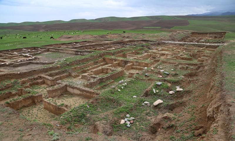
The city had an area of about 18 hectares, and its central part, shahristan, surrounded by high fortified walls with towers, occupies four hectares. The city began to form from the end of the 7th - the beginning of the 9th centuries.
City life flourished until the beginning of the XIIIth century. The Kastek pass since ancient times served to connect the valleys of the Chu and Ili rivers. The mention of this pass was preserved in the sources of the XVth century, describing Timur's campaign.
In 1375 Timur's army marched from the Ili valley to Atbash through the Kara-Kasman (Kastek) pass. However, the existence of the city during this period is not mentioned in the sources. No traces of destruction were found on the Kastek settlement, apparently, the town ceased to exist even before the Mongol conquest or was abandoned by its inhabitants shortly after the arrival of the Mongols, sharing the same fate with other cities of Semirechye, which again turned from the XIVth century into a region of dominant nomadic cattle breeding.
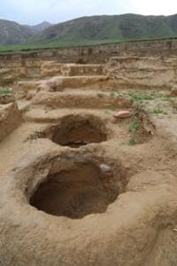
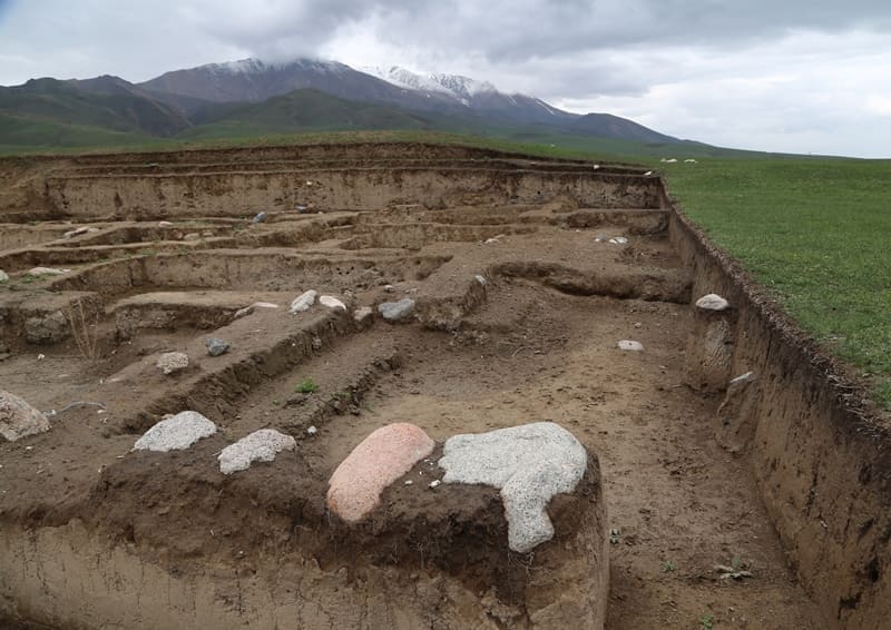
Excavations of the Kastek settlement began in 2011 and are being conducted under the guidance of the archaeologist A.A.Nurzhanov. The medieval settlement of Kastek is located at the place where a mountain stream emerges from mountain gorges onto a spacious foothill plain.
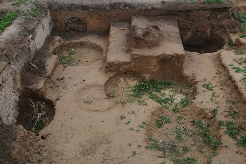
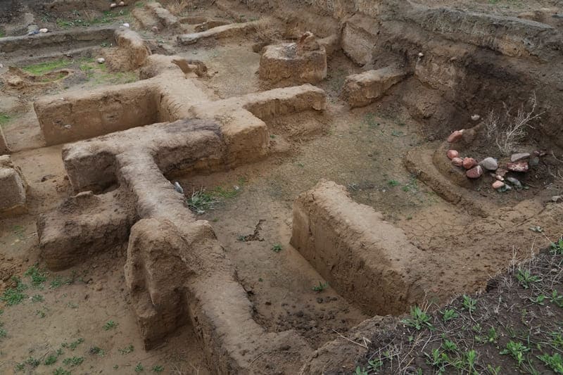
The central part of the monument is a rectangular section, raised above the general surface, surrounded by swollen ramparts of fortress walls with towers along the perimeter. The size of the shakhristan along the north-south line is 210 meters, east-west - 150 meters, which is 4 hectares.
Shakhristan is surrounded by a fortress wall, which looks like a swollen rampart up to 15 meters wide and up to 4 meters high. On the crest of the rampart, you can see depressions and hillocks in the place of defensive towers. A total of 14 towers stand out.
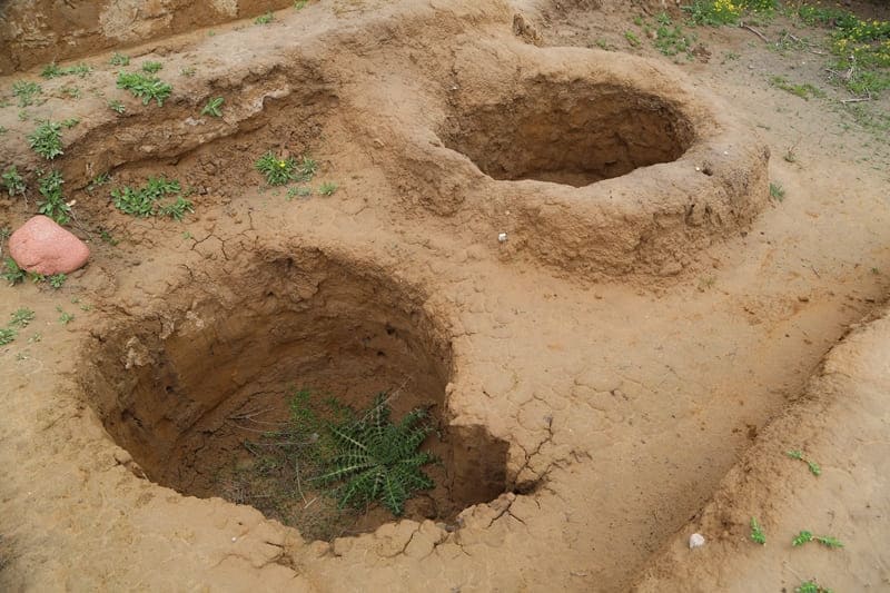
Inside the fortified territory, the contours of 32 large households and a significant number of other buildings located around the fortifications along the river are distinguished. Around the rampart from three sides, except for the eastern wall facing the cliff above the river, there is a hollow the former ditch with a depth of 0.5 - 2 meters and a width of 3 - 4 meters.
The entrances to the city are opposite each other in the middle of the north and south walls. As a result of excavations, two periods of development were revealed: the upper construction horizon of the 10th - 13th centuries. (Karakhanid), lower building horizon VIII - IX centuries (Karluk).
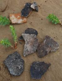
The main finds from the excavations at the Kastek settlement are represented by stucco and easel ceramics (made on a potter's wheel). These are cauldrons, pots, hums, and also dostarkhans (tables with a diameter of 30 to 50 cm).
One side of the dostarkhans is decorated with circles, zigzags, notches and stylized plant lines of ornament.
Only the reverse sides were decorated with ornaments, so that when the table was not in use, together with other tableware, it could be placed in the house with the decorated side up. The table, along with the hearth, is regarded as the sacred center of the dwelling.
The portable table, like the hearth, could serve as a place of sacrifice and enjoyed special honor. Found a ceramic jar with hemp seeds. Ceramics of the second half of the Xth - early XIIIth century unlike the previous period, it was made on a potter's wheel, and only a few minor forms were still molded by hand.
Weapons are represented by spearheads, darts, arrows, and plates from carapace armor. In the collection of metal objects there is a large series of agricultural implements, the set of which speaks of the high technology of agriculture: forged and cast plowshares, ketmen, sickles.
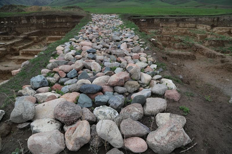
Water pipes were found at the site. Each link of the water supply system is a baked clay pipe covered with light engobe. Fragments of expensive glassware at that time were found. Among the rare finds are a toothbrush carved from bone, bone hairpins for a woman's hair.
The monument is located under state protection, but is not included in the 2010 State List of Historical and Cultural Monuments of Local Significance in Almaty Region. There is no physical protection of the monument at the site; to the north of the walls of the shakhristan part of the territory of the settlement is occupied by arable land of a peasant economy.
A large archaeological site gives an idea of the layout of the northern part of the town. Well preserved in relief is the appearance of ancient irrigation, land plots on the opposite bank of the Kastek River.
Geographic coordinates of the Kastek settlement: N43 ° 03'03.82 "E75 ° 59'08.90"

Photos by::
Alexander Petrov.