You are here
Kattu-Tau mountains.


Tourist sights of Almaty area.
“Nature is wise. You can learn everywhere and from everything”
Leonardo da Vinci.
Kazakhstan Travel Explore.
The Kattau-Tau (Solid Mountains) mountains are located on the eastern side of the Altyn-Emel ridge, the southernmost tip of the Kattu-Tau mountains is located 13 kilometers north of the right bank of the Ili River, the central part of the mountains is located on the northern side of the Aktau mountains.
A small, southwestern part of the mountain is located in the Kerbulak region, the central and northeastern parts are in the Panfilov region in the southeast of the Almaty region. The mountains stretch from south-west to north-east for 45 kilometers, in the central part the maximum width reaches 14 kilometers.
The eastern border of the mountains is the Konyrolen River, in the south the mountain range adjoins a small spur of Katu and the sands of Kumkala, in the east the mountains border the spur of Karasalpa. The central part is dominated by an unnamed mountain 1613 meters above sea level.
These are dry, waterless mountains, there are 3 - 4 artesian wells for the entire mountain system. The Kattu-Tau mountains of the Permian period are composed of lavas, tuffs, rhyolites, andesites, dacites, diabases, and basalts.
In some places they break through by Permian and Triassic intrusions of granites, diorites, gabbro. In the eastern part of the mountains, volcanic formations of the Devonian and sedimentary deposits of the Carboniferous are common.
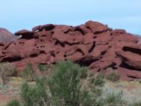
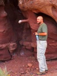
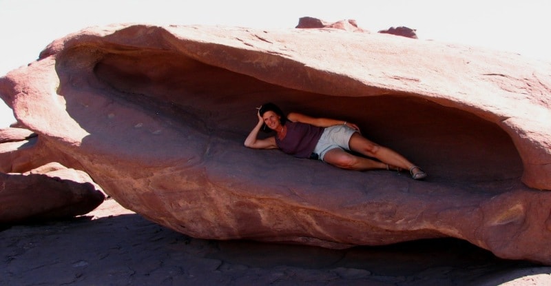
The rocks are riddled with deep weathering, which has created beautiful landforms in the stone. Not far from the entrance, into the most picturesque gorge, 6 kilometers from the southern border of the mountains, on the left side of the dry stream bed, there are the first red rocks, which fascinate with their unusual forms of weathering.
Rocky, deep gorges and canyons, completely waterless, give the impression of gloomy mountains. Rare saxaul thickets stretch along dry channels of gorges, cutting far into the rocky desert. The Kattu Tau Mountains are very picturesque and have archaeological and natural attractions.
Rock paintings in the Kattu-Tau mountains.
In a small offshoot from the main gorge, there are drawings on the rocks: a goat, a deer and a hunter chasing mountain goats with a dog. It looks like one of the goat's legs is trapped. And also a strange argali with a very long tail. At the very foot of the rock, on a large stone, there is an image of a goat.
A round body, a full tummy, shaggy legs and delicate horns clearly give out in the drawing a domestic animal - a goat, the property of pastoralists - nomads.
A cave in the Kattu-Tau mountains.
One of the few caves is located in the mountains. At the entrance to the cave, there is a mound of fine reddish rubble. The walls of the cave, illuminated by poor light, have a regular quadrangular cross-section, you can walk freely in it without bending.
The cave was undoubtedly man-made. The walls of the cave are carved with a wavy surface, forming, as it were, small, slightly protruding columns of the same width. Apparently, this feature is due to the technique of cutting the rock.
On the floor of the cave is earth mixed with rubble, and the ceiling is all black from the old smoke of fires. The direction of the cave is strictly from west to east. The cave is about 20 meters long, at the end of the cave there is a half-meter deep hole on the floor.
At the end of the cave, the room is just over two meters. Cracks in its walls are filled with the smallest crystals of gypsum. In addition, a thin coating of these crystals covers all walls and ceilings. In some places, brown clay plaster is visible on the walls of the room, very hard, almost petrified.
A round channel was drilled in the far wall, with a diameter of 3-4 centimeters, and a depth of about 50 centimeters. A groove has been carved into the floor of the room. Starting with a small indentation at the end wall of the room, the groove descends and flows into a hole in the floor.
Next to the cave are the ruins of a very old building, which left half-destroyed walls made of stone and clay. A hundred meters from the cave, on a steep mountain slope, seemingly in an inappropriate place, there is a lonely mound
On the eastern edge of the national park of Altyn Еmel one finds Aktau, the White Mountains, one more place of interest in the Land of the Seven Streams. They deliver their colour from the white gypsum crystals of which they аге composed.
Fortunately it has been decided years ago not to sell this giant gym sum resource to the construction industry. Less in vogue but no less beautiful аге the red-violet mountains Kattu-Tau (literally meaning stiffened mountains) ten kilometer to the west of Aktau, and particularly beautiful to look at in the evening light.
The tour is like traveling back to the time when the earth was much younger. Fifteen million years ago, а vast sea stretched here, the bizarre, multiсоlоmеd sediments one can admire here. White as well as red sedimentary layers аге predominant, disrupted by beautifully contrasting with blue and yellow stripes.
The mountains conical shape reminds оnе of pyramids. This area, at 300 km from Almaty, has not opened up for tourism. Untouched, without traces of human presence, silent, the valley of the Ili with its tugay forests and prehistoric-looking meanders only increase the impression that оnе finds oneself at the dawning of the ages.
Katutau Mountains are also very interesting. They lay in the east of the national park. Their shape is similar to the Martian lifeless landscape that is known based on space pictures. Mountains were formed as a result of the volcanic phenomena.
The heated underground lavas were frozen and formed huge fantastic figures. Sometimes observant tourists can meet here archers, and also other animals. А normal passenger саг for this track is not recommended, and only а jeep should do the job.
Оnе can also take the road in the direction of Narynkol and after the village of Kokpek, at 170 kilometer distance from Almaty, turn left towards Zharkent. After having crossed the Sharyn , the road bends towards the north.
After the village of Ili, one reaches across а swamp landscape the only bridge upstream the Ili in Kazakhstan. One crosses it, and right after it оnе turns left in the village of Darbazakum in the direction of the hamlets of Besmaya, Shubyrma and Kosbastau.
Also оп this track, оnе can only move with а robust саг, on foot or on horseback, and there аге 20 kilometer in front downstream along the Ili till the White Mountains. In Shubyrma, оnе turns sharply to the left and moves straight in the direction of the mountains. For this route, оnе still needs а permit to enter the border area.
Paleovolcanoes in the Kattu Tau mountains.
There are two paleovolcanoes in the eastern and western parts of the mountains. It is assumed that they have classic inlet vents filled with block-bomb chaotic andesite tuffs. The structure of the volcanoes is emphasized by the presence of bundles of radial dikes formed during the subsidence of the volcanic cone.
The span of dike beams reaches 8 kilometers. However, the most common form of supplying magma channels of these mountains was extended cracks, along with which large lava domes arose. The eruptions of the volcanic mass were powerful - heavy avalanches and scorching clouds loaded with debris covered large areas.
Bomb-ash and lava flows and covers alternate with each other and have different thicknesses sometimes reaching 100 meters. The eruptions were followed by periods of calm, during which volcanic material was eroded.
The road goes along the bed of the stream, which forms here in torrential rainy ones and ends up against red rocks, which are so picturesque that it is impossible to take your eyes off them. The rise of the red rocks is small, about 60 meters long and 20 meters wide.
Geographic coordinates of the central part of the Kattu-Tau mountains: N44 ° 09'55.71 "E79 ° 07'51.37"
Geographic coordinates of the Red Rocks Gorge in the Kattu Tau Mountains: N44 ° 00'09.97 E79 ° 03'37.39 "

Authority:
The guidebook across Kazakhstan . Authors Dagmar Schreiber and Jeremy Tredinnick. Publishing house "Odyssey".2010.
Photos
Alexander Petrov, Alexander Ezhov.


