You are here
Lebap Region.


Sights of Lebap Region of Turkmenistan.
Lebap velayat is situated on both sides of the Amu Darya River; having the Kara Kum desert on the left and the Karabil hills in the north. The Sundukli sands are located in the centre with the massif of the Kugitang in the southeast.
The area of the velayat equals 94 000 km.2. The capital is Turkmenabat, other industrial towns are Atamurat, Magdanly and Seydi. The climate of Lebap is sharply continental, droughty hot summer and moderately cold winter.
Major part of the velayats territory is occupied by desert areas with poor vegetation. The main industries are gas, food, textile and chemical branches – ammonium and carbamide works, a modernized gin in Turkmenabat.
Animal husbandry and agriculture are also well-developed branches of the region. Lebap velayat has good prospects regarding industrial and transport development. Tourist itineraries around the region include a trip to the reserved places of the Kugutang – magnificent mountains with luxurious primeval nature abundance of rare special of animals and plants. One can see here not only a sparking “Lunar landscape” and “Plateau of Dinosaurs” with paw prints of the pre-historic reptiles, but also contemplate wonderful pictures of the karst caves created by the nature’s fantasy.
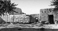
The other worldwide known reserve is Repetek Biosphere Reserve that has many endemic special of representatives of flora and fauna. Besides, Lebap land also keeps many other secrets you can get in touch with just by visiting the city-museum of Atamurat with its ancient caravanserais, mausoleum of Alamberdar and Astana-Baba, which continue to be the place of pilgrimage for many believers up to now.
Administrative the center of Lebap Region is the city of Türkmenabat of Lebap Region is formed on May 18, 1992 according to the Constitution of Turkmenistan. It is located in the east of Turkmenistan.
Lebap Region borders in the northeast and the East on the Surkhandarya, Kashkadarya, Bukhara and Khorezm regions of Uzbekistan, in the southwest - on Mary Region, in the northwest - on the Dashkhovuz velayat, in the south - on Afghanistan.
Area of the velayat of 93,73 thousand kilometers. Population: 1371,1 thousand people. Relief. The main territory of the velayat (more than 90%) - the desert plain with oases. The velayat is located on both coast of the average Amu Darya Current.
The left bank is engaged with the Kara Kum Desert which in the extreme southwest the northern suburb of a height Karabil adjoins, at the northwest of a right bank - the suburb of the desert Kyzylkuma.
In the center - the sandy massif of Sundukli.In the east of the velayat Ridge Kugitangtau is located (the highest point of Turkmenistan - the mountain Ayrybaba - 3139 meters above sea level.
Slopes of the ridge are strongly dismembered by deep ravines. On the western slopes the karst phenomena are widespread (caves, lakes, funnels). In Lebap Region 5 physiographic areas are allocated: valley of the Amu Darya River (average current).
Kara-Kum desert and left bank; the desert Sundukli and a part Kyzylkum on a right bank; Gaurdak-Kugitang mountainous area; Obruchev hilly height. Subsoil. The velayat is rich with minerals: native gray (Gaurdak).
Natural combustible gas (Achak, Naip, to Samandepa, Bagdzha, Gugurtli, Sakar, Farab), potash, cooking salts (Karlyuk), minerals, building materials and small reserves of coal. The climate is sharply continental, exclusively dry.
Continentality is shown in sharp changes of meteorological elements in the daily and annual course, dryness - in very small quantity of an atmospheric precipitation, considerable dryness of air and small overcast.
Weather extremely unstable - hot and dry, in the summer. Average temperature of July is 29,5 degree, January - from-4 to +2 degrees Celsius. The area differs in high summer temperatures: absolute maximum - 50 degrees Celsius (Repetek)
The average duration of the bezmorozny period is 231 days. The number of days with average daily air temperature over 10 degrees reaches 254. The sum of air temperatures over 10 degrees is maximum and equal on average 5590 degrees.
Changing from 4610 degrees in Dargan-At, 5040 degrees - in Chardzhou, 5300 degrees - in Kerki, to 5920 degrees - in Charshange. The main quantity of an atmospheric precipitation drops out in winter and autumn and a wound - spring the periods: their average annual quantity - 100 - 300 mm (in Kugitang-Tau - 293 and in Dargan-At - 87 mm).
Water resources. The main waterway of the velayat - the river Amu Darya, largest in Central Asia; its average current (830 km) is the share of Lebap Region. Water expenses at Kerka make 1980 m/s.
On river banks the Middle Amudarya oasis was created and almost all settlements are placed. Here more than 90% of the population of the velayat live. The Karakum Canal proceeding across the territory of the velayat throughout 220 km originates from Amu Darya (at the settlement of Basaga).
Soils. Main types of soils: gray soils, alluvial and meadow, it is irrigated - alluvial, takyrovidny and saline soils. Flora. Desert vegetation which is used as a pasturable forage prevails. Plants of the floodplain of Amu Darya - a glycyrrhiza, reddening, to callas and others.
Fauna. Mammals - a fox, a wolf, a jackal, джейран are widespread; reptiles - snakes, lizards, turtles; rodents - a gopher, a jerboa, путорак; birds and insects; the silver carp and a grass carp are found in the Karakum Canal.
Authority:
http://science.gov.tm


