


![]()
You are here
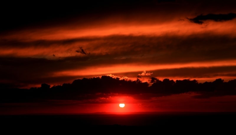
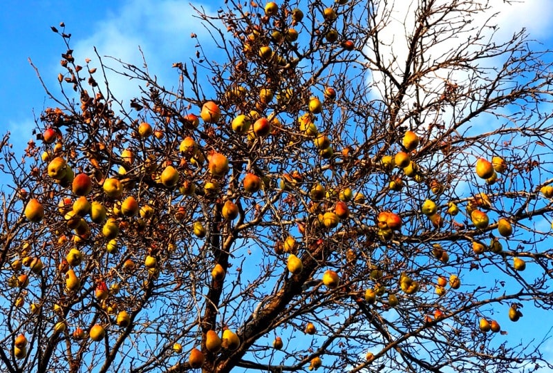
Mountains Dzhetysu.


Mountain hiking in Zailiysky Ala-Tau.
«A lake is the landscape's most beautiful and expressive feature. It is earth's eye; looking into which the beholder measures the depth of his own nature»
Henry David Thoreau.
Climbing tour near Almaty.
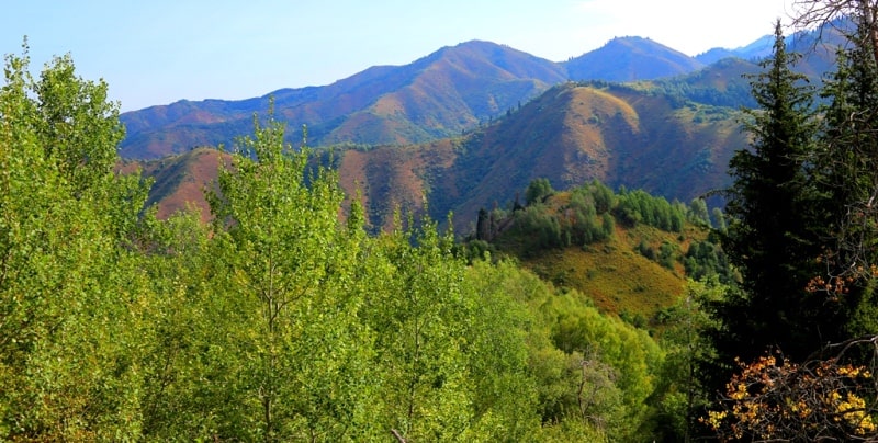
Mountains Semirechya are presented by the ridge Zailiysky Ala-Tau - extreme in Northern Tien-Shan - forms the wide arch turned by camber on the South. Ridge length about 300 kilometers, width is 35 - 40 kilometers. Its northern slopes of hollow go down to the foothill plains passing in the north into the semi-desert and the desert.
The central part of the ridge occupying river Kaskelen - Turgen, has pronounced Alpine shape of a relief. There are 22 tops with heights over 4500 meters above sea level. The highest point of the ridge - peak Talgar - reaches height of 4974 meters above sea level.
It divides all ridge into two equal parts. Zailiysky Ala-Tau reaches in the east the river Turgen and here branches on three spurs - the mountains Bakhay passing into the mountains Syugaty and Boguty and the mountain Dalashik. Treat an average spur the mountain Sarytau and Toraygyr.
To the West the ridge goes down to 2000 - 1500 meters above sea level and passes into the mountains Zhetyzhol. In Zailiysky Ala-Tau the hydrological network is well developed - the set of the rivers and small rivers relating to Ili river basin flows here.
On character of food of the rivers and location of sources they can be divided on mountainous and glacial, mid-mountain and seasonal. The first have the big areas of a reservoir, they are deepest. The largest river - Chilik - divides ridges Zailiysky Ala-Tau and Kungey Ala-Tau, receiving food from their slopes.
Further from a northern slope large inflows of Ili - Turgen, Issyk, Talgar, Small and Big Almaty, Aksay, Kaskelen and Chemolgan flow down on the West. The mid-mountain rivers and seasonal waterways do not flow anywhere, coming to an end with blind courses in a foothill zone.
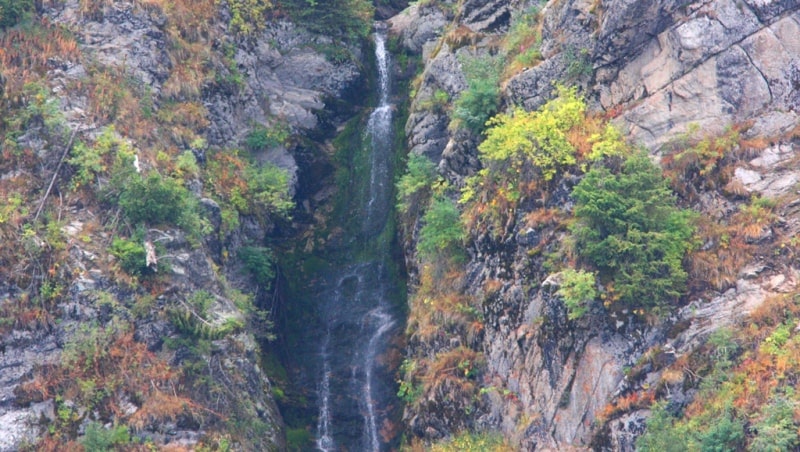
The mountain rivers have big height difference and high speed of a current. Their energy is so big that monolithic rocks cannot resist to water - they are split up, scattered in sand, conceding a way to a rough stream.
The mountainous terrain is so formed. Gorges of the rivers are extremely picturesque. The storming, foaming mass of water with a powerful roar rushes down, entraining the rolled boulders and trunks of trees. Numerous rifts and falls fill air with a fresh cool of water dust.
Such places in fir grove where air is sated with a needles smell are especially beautiful, dark green kroner of mighty trees and mosses on dark rocks create amazing contrast with storming white blue water. True decoration of mountains are lakes.
In Zailiysky Ala-Tau hundreds of lakes - from the small glacial and thin, located in a zone glaciers, - to landslide tectonic in the lower zones. The most beautiful concern the last the Big Almaty lake in upper courses of the river of the same name and two lakes Kolsay in the mountains Kungey Ala-Tau.
They are located in a belt of the fir forest, but the first is above, on a mark of 2497 meters above sea level, water is very cold here - no more than 12,8 degrees therefore in it there is no fish. In lakes Kolsay where water lives alone from the most beautiful and valuable fishes more warmly - the iridescent trout delivered from the Czech Republic.
Till July, 1963 on average a watercourse Issyk there was a beautiful mountain lake Issyk, the destructive mud stream destroyed the picturesque mountain lake from a face of the earth in a few minutes, broke through a natural dam and formed in it a canyon depth in several tens of meters.
Enormous power of elements is amazing and uncontrollable! Lakes have important value in food and regulation of a drain of the rivers, accumulation of fresh waters and formation of mud streams. They can also create threat of break and generation of a powerful torrential shaft dangerous to the settlements located in floodplains of the rivers.
Also esthetic value of mountain lakes is big. The large rivers and lakes receive the main water from thawing of glaciers of which in Zailiysky of Ala-Tau it is more, than in other ridges of Northern Tien-Shan. The large region of a freezing - a river basin Talgar - contains 92 glaciers, from them the most powerful glacier of Dmitriyev has length of 5,1 kilometers and the area - 18,8 square kilometers.
Approximately the glacier of Shokalsky and Sredniy Talgar upper courses has the same parameters. In Small Almatinka sources there are 12 glaciers with a total area of 11,4 square kilometers, in Big Almatinka upper courses - 49.
In total on a northern macroslope of Zailiysky Ala-Tau of 307 glaciers with a total area of 308,3 square kilometers. On the southern slope of 159 glaciers with a total area more than 200 square kilometers. At sources of the river Chilik the largest region of a freezing where 86 glaciers of 161 square kilometer enter that makes more than a third of all glaciers of this ridge is concentrated.
The largest glaciers Athlete and Korzhenevsky. Glaciers comprise huge reserves of fresh water and are the main sources of filling of the rivers and lakes. Thanks to thawing of ices tens of thousands of hectares of lands are irrigated, the livestock production develops.
Unfortunately, the little it is allowed to see greatness of eternal ices. The way to them is far, difficult and dangerous. Who at least once will visit a kingdom of white silence, that will remember cold hostility of the giant rocks covered with snow and ice and shrill silence well.
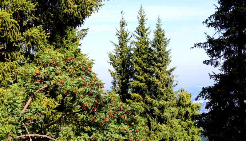
Even in good weather it seems as if in air unknown danger hid. During a thunder-storm, at bright flashes of lightnings and deafening peals of a thunder, you see blind rage of elements, thoughts of doomsday begin to flash involuntarily. In mountains of Zailiysky Ala-Tau regularities of vertical zones which distribution of types of soils, vegetation and fauna are classically accurately expressed.
Here, as in a miniature, it is possible to observe alternations of zones, for example, as in a midland of Russia at advance from the South to the North - from steppes to the tundra and polar ices. But if there change of natural complexes happens through hundreds of kilometers, then in the Zailiysky ridge a similar picture in only 30 - 40 kilometers.
Authority:
"In the region of Seven rivers. Zhetysu". Author and originator B. Gubanov. Alma-Ata, Kaynar publishing house, 1989.
Photos
Alexander Petrov.