


![]()
You are here
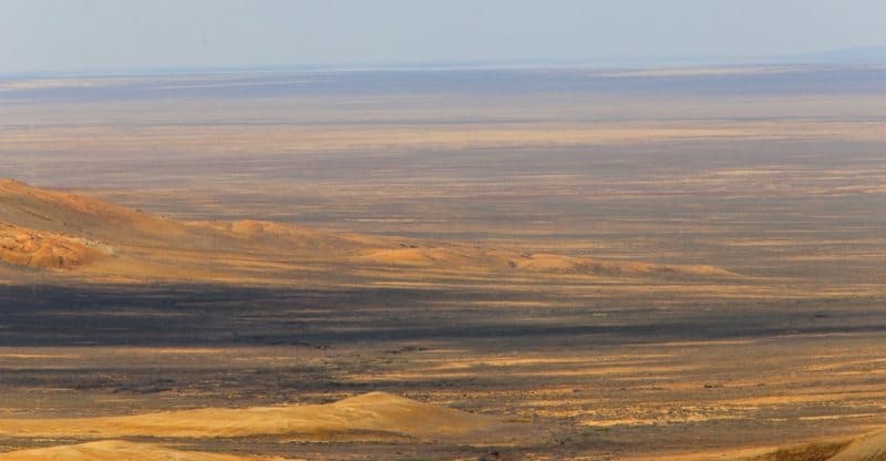
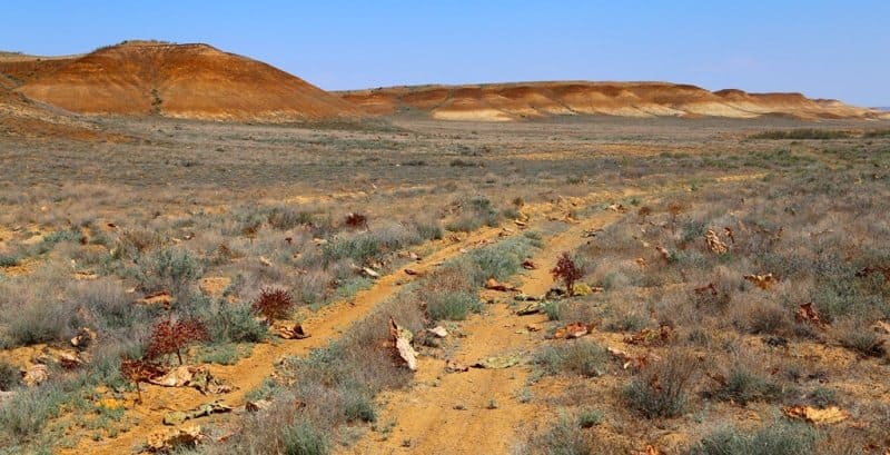
Northern Сliff Ustyurt plateau.

Tours on northern cliff of Ustyurt plateau.
"For almost eight days, from the Aral Sea itself, we walked across a clay steppe as flat as a floor. It would seem that, having crossed such a vast plain, a traveler would have to climb uphill, but on the ninth day we reached a steep descent: this was the northern edge of the Ust-Urta Plateau, along which we had been traveling until now. Ahead, as if in a fog, the vague outlines of the Mugodzhar Mountains were visible, and below stretched another steppe, this time much more vibrant. Here, the wormwood was denser; in places, there was even green grass and low shrubs."
A. M. Nikolsky. "In Land of Clay and Sand." 1894.
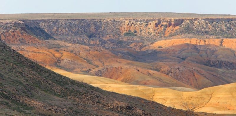
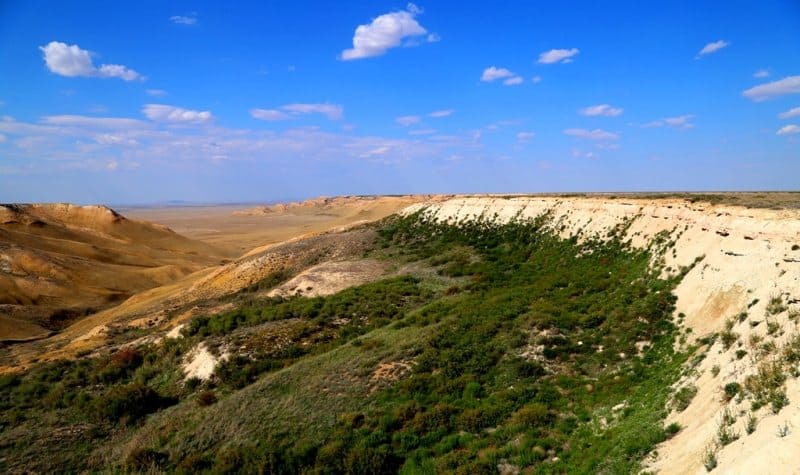
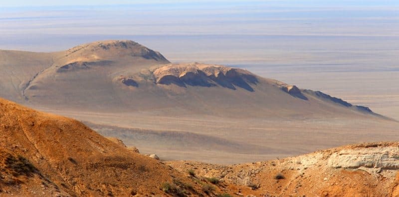
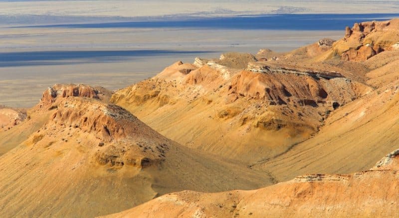
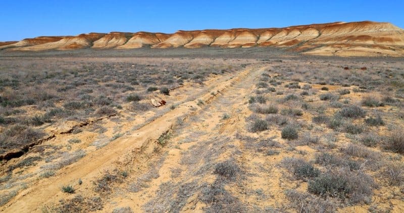
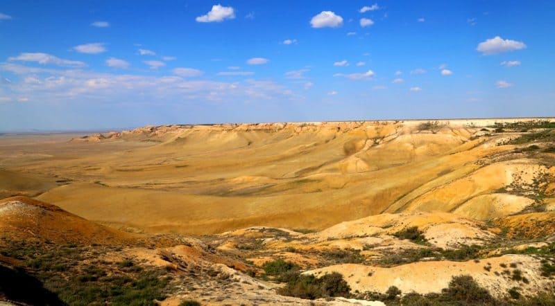
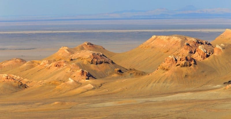
Northern Chink. The spurs of the Ust-Urta Plateau, the so-called Northern Chink, approach the northwestern shore of the Aral Sea. These hills, sometimes reddish-brown, sometimes grayish-white, descend in ledges and cliffs right to the sea. Long-standing wind-driven action has given the shores a bizarre appearance in places. Ravines, gorges, and caves, bleak cliffs up to 10 sazhens high, and solitary, gloomy hills with completely bare peaks form a picturesque landscape that is untiring to the eye and possesses a unique, wild charm. The mountains are composed partly of brown ironstone boulders and sandstone, partly of chalk and limestone, with a noticeable presence of gypsum. The northern cliffs mingle with the sand dunes of Bolshiye Barsuki, and along the seashore, they extend to the Chubara Peninsula.
N. Khokhlov. "Essay on Turgai Region." 1909.
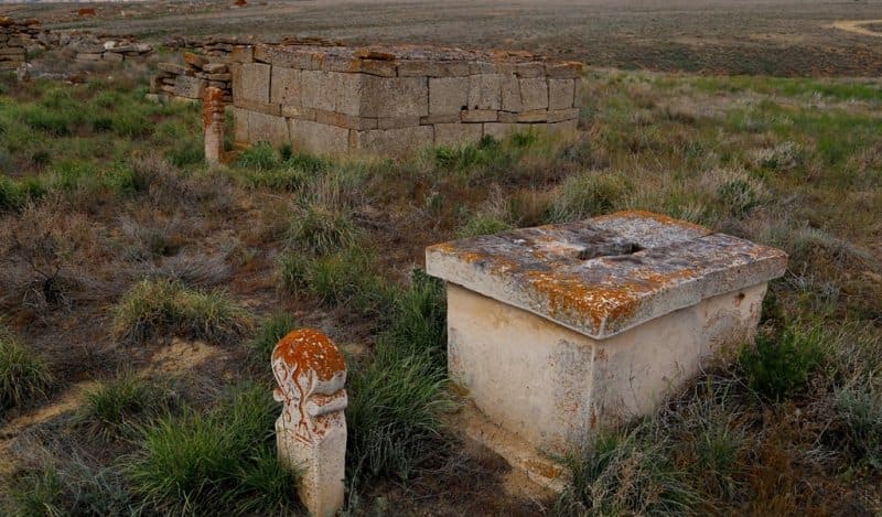
Sights of Northern Cliff of Ustyurt plateau.
Northern Cliff of Ustyurt Plateau extends from westernmost tip of Ustyurt Plateau in eastern part of settlement of Beineu and extends eastward for approximately 530 kilometers. Cliffs begins in Beineu District of Mangystau Region and then northeastward into Zhalyoiskiy District of Atyrau Region. Further east, it passes through Baiganinsky District of Aktobe Region and ends at western edge of Bolshie Barsuki Desert.
Geographical location of Northern Cliff of Ustyurt Plateau.
From the beginning of the Northern Cliff of the Ustyurt Plateau, for approximately 270 kilometers, the chink is called Donyztau Cliff, which extends north, northeast, and east for approximately 120 kilometers. Then, after the end of the Donyztau Cliff, between the Tushchyairyk natural landmark and the abandoned village of Ustyurt, the Northern Cliff of the Ustyurt Plateau begins again and continues, reaching the western edge of the Bolshie Barsuki Desert.
The Northern Cliff of the Ustyurt Plateau begins at the Ashyktpaik saline land and stretches like a steep, winding wall, dissected by deep, often long, ravines. In places, outliers separate the plateau. To the east, the cliff extends to the lower reaches of the Chegen River and then disappears before reaching the Bolshie Barsuki sands.
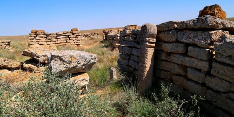
A journey along Northern Cliff of Ustyurt Plateau.
These are completely deserted expanses, devoid of settlements, gas stations, repair stations, or mobile phone service. Roads are rare here, but there is at least one steppe dirt road running along the Northern Cliff, along its southern side. It's best to travel here with mobile navigation, which will take you to the right place.
Relief of Northern Cliff of Ustyurt Plateau.
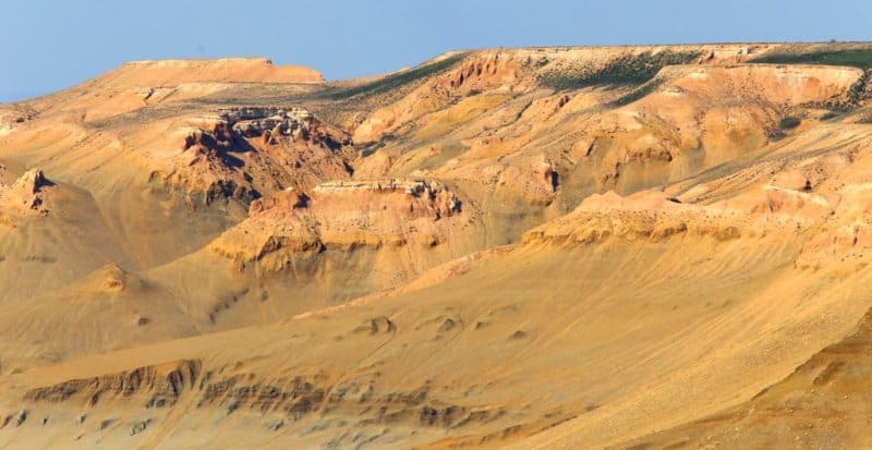
The relief of the Northern Cliff of the Ustyurt Plateau is determined by the horizontally bedded Sarmatian limestones that compose this plateau. A desert climate has preserved the surface of the Ustyurt Plateau; erosion processes within the plateau are virtually absent.
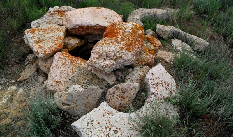
Some basins of the plateau are ancient lake basins; sinkholes and sinkholes are the result of suffusion. Structurally and tectonically, the Ustyurt Plateau is a Tertiary horst surrounded by basins flooded by ancient seas and lakes. Steep cliffs – cliffs - in some places can be considered ancient, abraded plateau shores.
Terraces have been discovered along the eastern edge of the plateau.
Soils of Northern Cliff of Ustyurt Plateau.
The soils of the Northern Cliff vary from north to south. The northern, elevated part is characterized by semi-desert features and is covered predominantly by brown carbonate soils. The "saline land" strip, extending further south, has a skeletal, undeveloped soil cover and is partially occupied by varieties transitional to chernozems.
The central and southern regions are deserts with solonetzic, gypsum-bearing, gravelly chernozem. The Ustyurt Plateau is home to saltwort and wormwood deserts, which are dominated by subshrubs and much less by shrubs and woody plants, such as black saxaul.
Microrelief significantly influences plant distribution. Salsola ustjurtensis (Salsola ustjurtensis) typically grows in shallow and small depressions, along with feather grass (Stipa hohenackeriana). The deeper the depressions, the more abundant the feather grass, and then it becomes dominant - patches of Salsola ustjurtensis intermingle with those of feather grass. In larger, deeper, and better-watered depressions, small trees or large bushes of black saxaul (Holoxylon aphullum) grow.
They form fairly dense thickets. In some areas of the Northern Cliff of the Ustyurt Plateau, finely hummocky sands are found. These are stabilized by black saxaul; Sand sedge (Carex physodes) grows quite densely on the sands, while white wormwood (Artemisia terracota) and caragana are less common.
White saxaul is very rare, due to the salinization of the soils.
Fauna of Northern Cliff of Ustyurt Plateau.
The fauna of the Northern Cliff, especially its central parts, is not as rich as that of the sandy areas. Rodents inhabiting the plateau include jerboas (small jerboa, thick-tailed jerboa, Severtsev's jerboa, and common ground hare), mole vole, yellow ground squirrel, and common hare.
Steppe polecats prey on ground squirrels. Hedgehogs are common. Less common are wolves, foxes, and goitered gazelles. Birds include larks (crested and little larks), and sand grouse (saja and black-bellied sand grouse). The discontinuous marginal zone surrounding the plateau, which boasts a greater diversity of physical and geographical conditions, is richer in fauna.
Wolves, jackals, scaly-toothed rats, tamarisk gerbils, and Caspian voles live in these areas, and the black-and-gold pheasant nests there. The cliffs of the cliffs are home to nesting birds: white-tailed eagles, common kestrels, desert owls, eagle owls, and jackdaws.
The rock chough (Keklik) is also common.
Ustyurt area adjacent to Northern Cliff.
The area located between the Ustyurt plateau and the southeastern protrusion of the Kara-Bogaz-Gol is known as Dzhanak. This area differs from the Ustyurt plateau in its greater dissection. It is occupied by flat-topped cuestas extending from the southwest to the northeast.
The southwestern slopes of the uplands are steep (up to 300 m), while the northeastern slopes are gentle, gradually descending to the sands. The dissection of the cuestas increases to the west. Between the uplands are large, elongated depressions, the most significant of which is occupied by the Uchtagan Sands.
The Uchtagan Sands have much in common with the Zaunguz Karakum. Typically, they feature alternating relatively high ridges composed of unwintered sands, clays, and elongated basins. The Chilmamedkum Sands, wedged between the Dzhanak and Krasnovodsk Plateaus, are very similar to the Uchtagan Sands.
The Krasnovodsk Plateau has an average elevation of approximately 200 m; its southern edge is elevated to over 300 m and abruptly terminates in the Kyuryanyn and Kuvadag escarpments. To the north, the plateau's cliffs toward the Koshobin Valley are only 75-80 meters high.
The plateau's surface topography is characterized by gentle contours. Numerous endorheic basins, elongated in a direction close to the latitudinal, are characteristic. The largest of these reach 10-15 km across. The basins are several tens of meters deep.
Their bottoms are flat, often occupied by salt marshes and takyrs. Numerous outliers, no more than 30-40 meters high, rise above the general surface. The Krasnovodsk Plateau is home to wormwood and saltwort-wormwood desert vegetation.
Typical wormwood species include Badkhyz and Kemrud, while saltworts include Boyalych and Keurek. In summer, fall, and winter, the Krasnovodsk Plateau serves as a pasture. In wet years, livestock grazing also occurs in the spring.
Geographic coordinates of beginning of Northern Cliff of Ustyurt Plateau in west: N45°24'43 E55°19'22
Geographical coordinates of end of Northern Cliff of Ustyurt Plateau in the east: N46°20'34 E58°35'33
Geographical coordinates of Northern Cliff of Ustyurt Plateau: N46°24'51 E57°27'28
Authority:
http://big-archive.ru
Photos by:
Alexander Petrov.