You are here
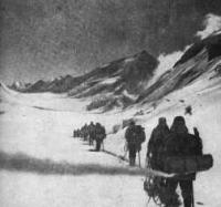
Pamir firn plateau.


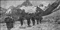
Journey through the Muksu River Valley.
“We enter the mountains, as if entering the garden.
Its top is in blooming snow-white.
Its trunks are sheer and vast
And glaciers hang like petals”
Yuri Vizbor. "Garden of the peaks".
Helicopter flight in the Pamir mountains.
The Pamir firn plateau is located in the Sangvor district of Tajikistan. The Pamir firn plateau is an alpine plateau in the Fortambek Glacier Basin in the Northwestern Pamirs. The Pamir firn plateau is located at the headwaters of Fortambek Glacier on the northern slope of the peak of Communism.
From the south, the Pamir firn plateau is limited by the watershed of the Peter the Great ridge, along which the plateau extends 11 kilometers from west to east from Abalakov peak at a height of 6446 meters above sea level to Ismoil Somoni peak (previously - Communism peak, 7495 meters above sea level).
The width of the plateau increases from west to east from 600 meters to 1400 meters. The Pamir firn plateau has a maximum width of up to 2000 meters at the longitude of the Kirov peaks, an altitude of 6372 meters above sea level and a Kuibyshev height of 6189 meters above sea level.
The surface area of the plateau is about 16 square kilometers. The total area of the plateau is - 20.9 square kilometers. The height of the plateau decreases from west to east from 5730 (at the slope of Abalakov peak) to 5500 meters above sea level in its center (in the vicinity of the Tramplinnoy glacier), and then rises again to 6000 meters above sea level (under the slope of Khokhlov peak).
Abalakova peaks are located along the border of the Pamir fir plateau, with a height of 6446 meters above sea level, Leningrad is 6507 meters above sea level, Kroshka is 5854 meters above sea level, Kuibyshev is 6189 meters above sea level, Dushanbe is 6985 meters above sea level, Ismoila Somoni height 7495 meters above sea level, Khokhlova height of 6685 meters above sea level and Kirov height of 6372 meters above sea level.
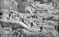
The ice and firn first flow to its lower central part, and then rush north into the narrow passage between the rocky bastions, forming an icefall that passes into the Tramplinny glacier. This glacier, which rises 600 - 700 meters above the surface of Fortambek Glacier, is the outlet of the Pamir firn plateau, and the main runoff of firn and ice flows through it.
Lumps breaking away from the glacier collapse into the ablation region of the Fortambek glacier, forming huge cones of firn and ice. The clear ice of this peculiar revived glacier can be traced down the Fortambek glacier for a long distance.
On the Pamir firn plateau, accumulation lasts almost the entire year. In 1976, it amounted to 94 grams per centimeter square, and on average for 1963 - 1976 - 117 grams per centimeter square. The ice temperature at a depth of 10 - 12 meters at an altitude of 5700 meters above sea level was -18 °.
Within the plateau, there are zones of ice formation - from ice and firn to intermediate between cold firn and snow firn. The snow zone on the firn plateau was not observed (Dyurgerov, Urumbaev. 1977).
Authority:
"Glaciers." L.D. Dolgushin, G.B. Osipova. Series "Nature of the world." Moscow, the publishing house "Thought". 1989. Vikipedia.


