


![]()
You are here
Peak Nansen.
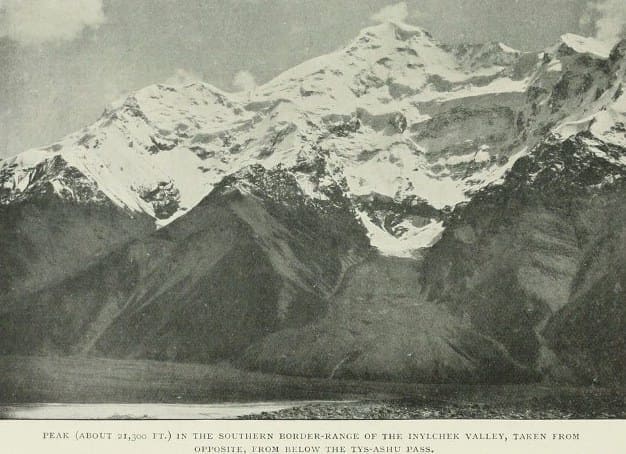
Peaks in mountains of Central Tien-Shan.
"Mountains are the only place where I can rest."
Igor Tamm.
Ridge Inylchek-Too in mountains of Central Tien-Shan.
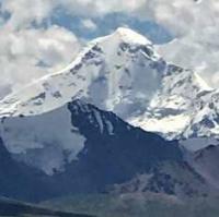
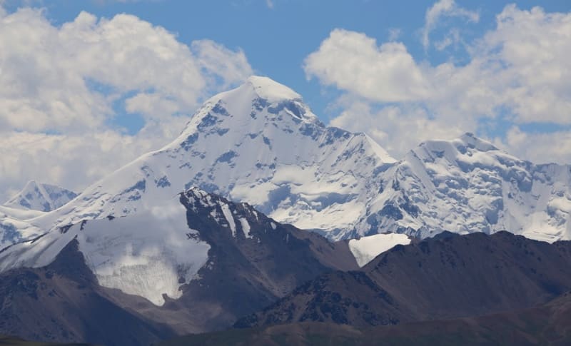
Nansen Peak, 5697.2 meters above sea level, is located in Nansen massif, in mountains of Central Tien Shan, 4 kilometers north of main ridge of Inylchek-Too ridge, in Ak-Suu district of Issyk-Kul region. Nansen Peak is the second highest, after Shokalsky Peak with a height of 5722 meters above sea level, located in the eastern part of the Inylchek-Too ridge.
The peak of Nansen is located in the central part of the Inylchek-Too latitudinal ridge. In the north of the Nansen massif there is the South Inylchek glacier with a length of 63.5 kilometers, in the south there is the Kaindy glacier with a length of 25 kilometers.
The northern slope of the peak is a semi-oval wall, stretching from west to southeast and northeast for 2.2 kilometers. The peak is a snow-ice dome, ending in rocky-ice slopes to the southeast and east. Three ridges close at the top. In 1937, participants from A. Letavet’s expedition climbed the northern ridge.
The south-eastern ridge, which breaks off to the west with an almost 600-meter wall. In an easterly direction, a ridge extends from the top, which after 230 meters diverges into northeastern and southeastern ridges. In the northeast of the peak, almost 900 meters down the slope, at an altitude of 4905 meters above sea level, there is a snow plateau with an area of 1.25 square kilometers.
From the southern slope of Nansen Peak begin the sources of the Kanjailau North glacier, which is 9.3 kilometers long. In the northwestern ridge is the West Col of Nansen Peak, 5247 meters above sea level. 17 kilometers southeast of Nansen Peak, in the Inylchek-Too ridge, there is Shokalsky Peak, 5722 meters above sea level. 1
9.9 kilometers east and slightly south of Nansen Peak is the Ukrainian Miners Peak, 5132 meters above sea level.
First ascents of Nansen peak.
1937
Climbing from the north to the Nansen peak, from the Kan-dzhailau glacier by the expedition of August Letavet. It was possible to lead a caravan of horses up the glacier for 15 kilometers. At an altitude of 3700 meters above sea level, the first camp was organized.
At an altitude of 5000 meters above sea level, after overcoming the icefall, on a tiny platform, at the edge of the crack, a second camp is set up. After a day of acclimatization, on August 27, the summit of the peak begins. They go to the western shoulder of the peak, located at an altitude of 5300 meters above sea level.
The summit was reached by climbers: A. Cherepov, G.I. Beloglazov, N.M. Popov, V.I. Ratsek.
Geographic coordinates of Nansen Peak: N42°09'01 E79°37'47
Authority and photos by:
Alexander Petrov.