


![]()
You are here
Ridge North Aktau on Mangyshlak.
Birding Tours on Mangyshlak.
"Flying an airplane would be perfectly safe if there were no land"
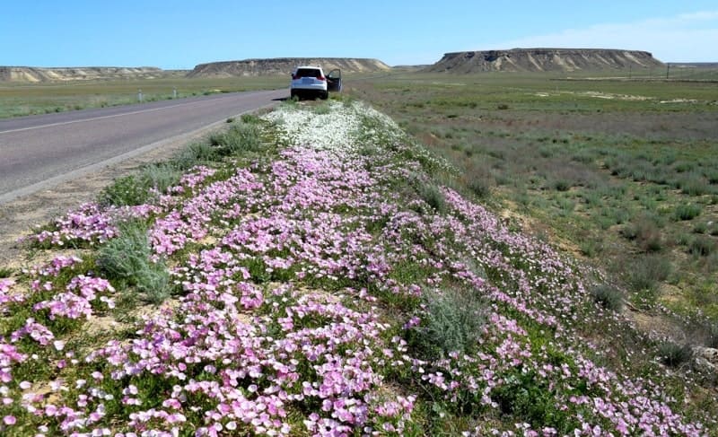
Travel in mountains of Mangyshlak.
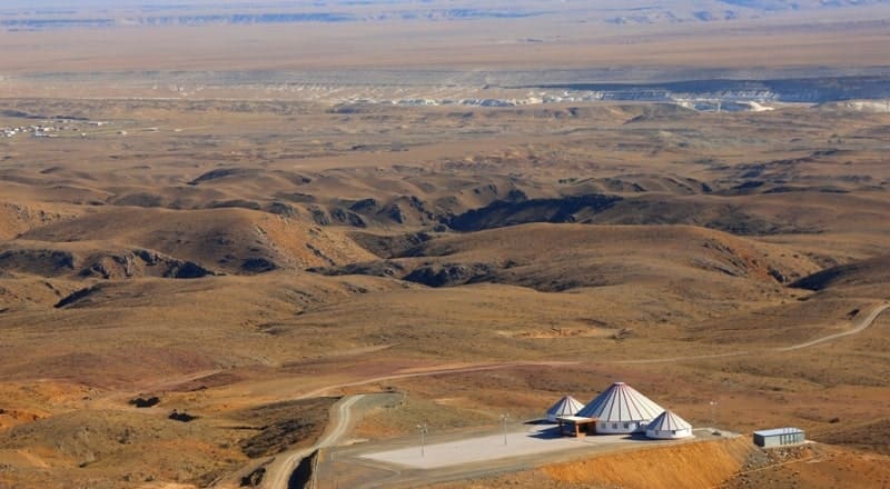
Northern Aktau Ridge (Kazakh Soltustik Karatau) belongs to Mangyshlak Upland, is located in northern part of Mangyshlak Peninsula on territory of Tyub-Karagan and Mangystau districts of in region of same name.
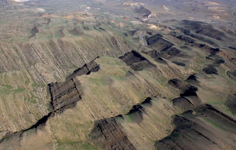
The length of the Northern Aktau ridge from southeast to northwest is 111 kilometers, the maximum width in the central part is 13 kilometers. This is the longest, separate range in the Mangistau mountain system.
The highest peak of the ridge is Mount Aksiyrtau, 330.2 meters above sea level, which is located on the southern side of the ridge in a separate chalk massif. The second highest peak is Mount Kush, 322.1 meters above sea level, which is located on the northern part of the chink of the ridge.
The second highest peak is Mount Kush, 322.1 meters above sea level, which is located on the northern part of the chink of the ridge. Mount Kush is located 13.6 kilometers northwest of Mount Aksiyrtau. The third highest peak of the ridge is Mount Zhylshy, 312.7 meters above sea level, which is also located on the northern part of the chink of the ridge, 3.3 kilometers northwest of Mount Kush.
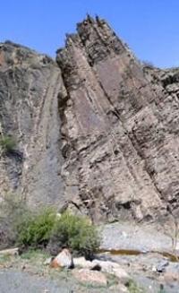
The mountains are cut by deep ravines-sai, composed of sandstones, limestones, marls, clays and sands. Northern Aktau is expressed almost throughout its entire length as a single ridge, cut through by several erosion passages, or “caps”, which divide it into parts that have independent names.
In the westernmost part of the ridge there is a small ridge Ushauyz stretching from the southeast to the northwest for 5.3 kilometers, its width is also small and reaches only 3 kilometers in the southeastern part. To the east of the Ushauyz ridge there are the sublatitudinal Myrzatai Mountains, stretching in a narrow strip from the southeast to the northwest for 11 kilometers, their width is also small and reaches only 1.5 kilometers in the southeastern part.
The northern part of the Myrzatai Mountains is a groundwater reservoir, more than 6 underground water reservoirs are concentrated here. To the east of the Myrzatai mountains are the Akmai mountains, which are located in the northwestern part of the Northern Aktau ridge.
Akmai Mountains stretch in a narrow strip from the southeast to the northwest for 13.5 kilometers, their width is also small and reaches only 1.5 kilometers in the southeastern part. In the southern part of the Akmaya Mountains, they border on the Altankazgan valley, and to the south, the Zhamansay valley is located. In the northern part of the Akmay mountains, there is the famous Kostam necropolis near the Shiili winter road at an altitude of 58.5 meters above sea level.
Further, the mountains spread to the southeast as a single ridge Northern Aktau. It should be noted that from the Sharymkopy area and the Kada tract located in the southern part of the Northern Aktau ridge, there is a noticeable increase in the height of the southern slopes of the ridge.
Here, along the edge of the southern tip of the ridge, there are separate mountains: Kozhakhmet 257.7 meters above sea level, Koksepke 277.4 meters above sea level, Zhangyzespe 299 meters above sea level, Karykbasan 298.6 meters above sea level.
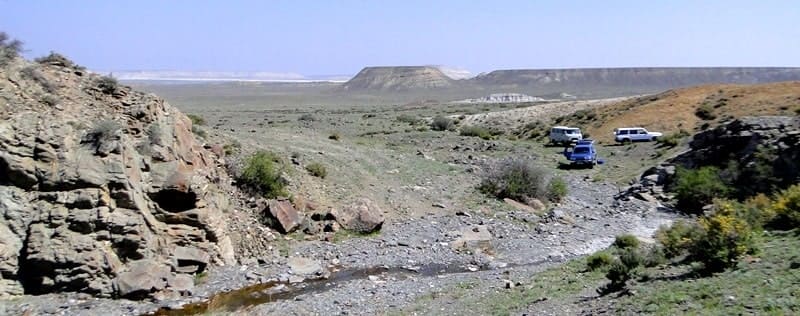
Through the Karatau Compe gorge in Northern Aktau, the railway Mangyshlak - Beyneu passes, built in the period from 1964 to 1965 of the last century The northern Aktau ridge is composed of piedmont plains and chink within 100 - 200 meters in height with a foot strewn with large fragments - rocks, boulders, stones.
Sometimes the cliff is hidden by the sands leaning against it. The northern macroslopes of the ridge are gently sloping, cut by countless ravines, gullies, logs, especially in the lower part. Peaks located at an altitude of 100 - 322.1 meters above sea level.
The ridges of Northern Aktau are composed of Upper Cretaceous and Paleogene limestones, chalks and sandstones. They are characterized by various relief elements (remnants, boulders, sheds, caves, etc.). Only in two places of these mountains was found a very rare endangered endemic species (included in the Red Books of Kazakhstan and Mangistau region) - Rubia cretacea Pojark. (chalk madder).
Geographical coordinates of Northern Aktau ridge: N44°14'44 E52°16'15
Geographic coordinates of Mount Aksiyrtau: N44°11'57 E52°21'22

Authority:
Alexander Petrov.
N.N. Safronov “Mangyshlak Desert” (sketch of vegetation). St. Petersburg, 1996.
Photos by
Alexander Petrov.