


![]()
You are here
Rivers of Semirechye.


City Kazakhstan tours.
“Sweetness shudders through the land
as if, freed from the heat,
nature’d scooped spring waters in her hand
and splashed her burning feet”
Fyodor Ivanovich Tyutchev. “Summer evening”.
Recommended excursion in Almaty.
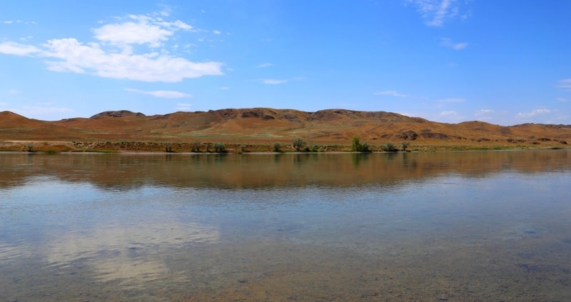
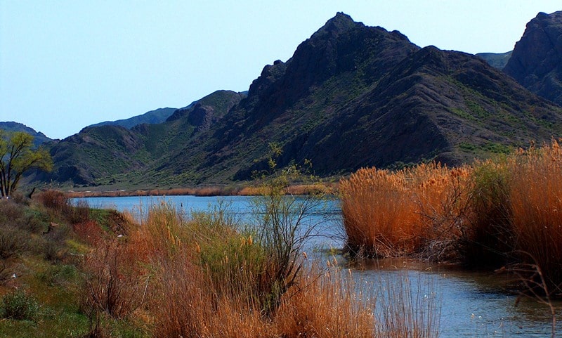
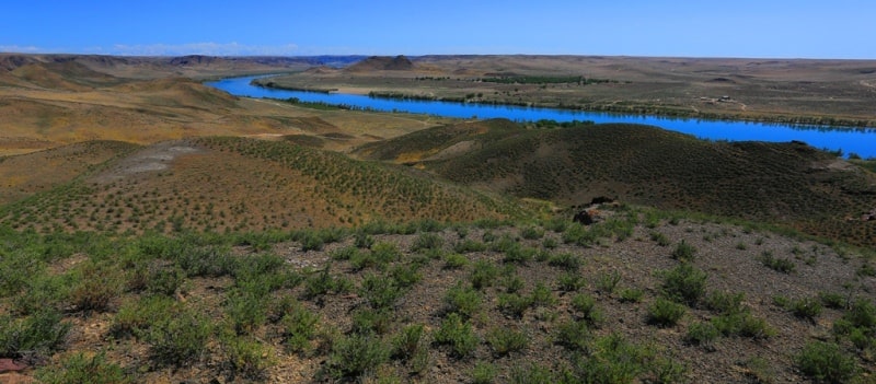
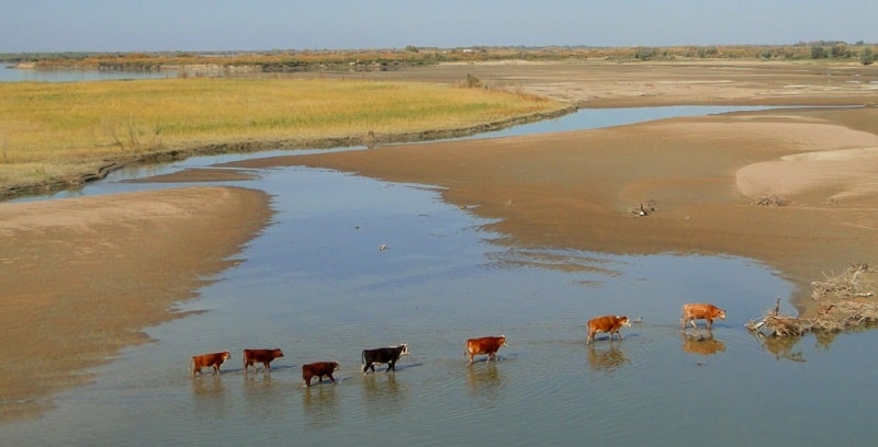
The rivers, life-giving vessels, penetrate the desert plain, bring with themselves life and decorating a landscape. Ili - the largest river in Semirechye. Its length makes 1439 kilometers, the area of the pool occupies 140000 square kilometers.
On this square there are more than 800 rivers and rivulets over 10 kilometers long. The majority of these rivers originate among glaciers and snow tops. The largest inflows Ili, falling on the left side, - Chilik (length of 250 kilometers) and Charyn (length about 430 kilometers). Ili brings to Balkhash more than 70 percent of all waters coming to it.
The river is formed of two small rivers - Tekes and Kunges. Tekes originates among snow of a northern slope of Ridge Terskey Alatau. On the 150-kilometer section of the current it flows on the territory of People's Republic of China where merges with Kunges.
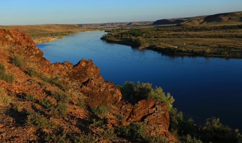
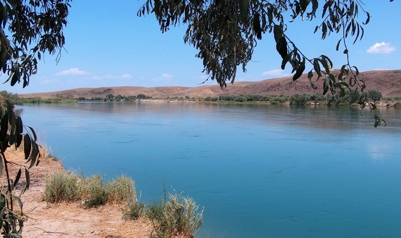
Across Kazakhstan these rivers flow a uniform stream and are called the river Ili. River width sometimes reaches more than 100 meters, at a speed of current of 4 - 5 kilometers per hour Ili carries by more than 400 cubic meters of water in a second.
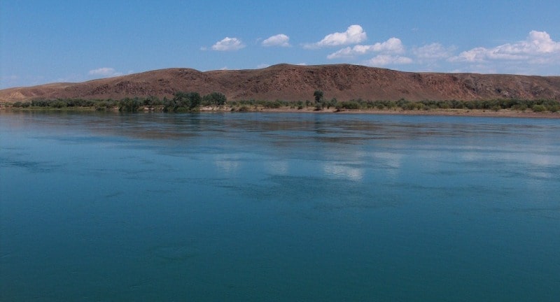
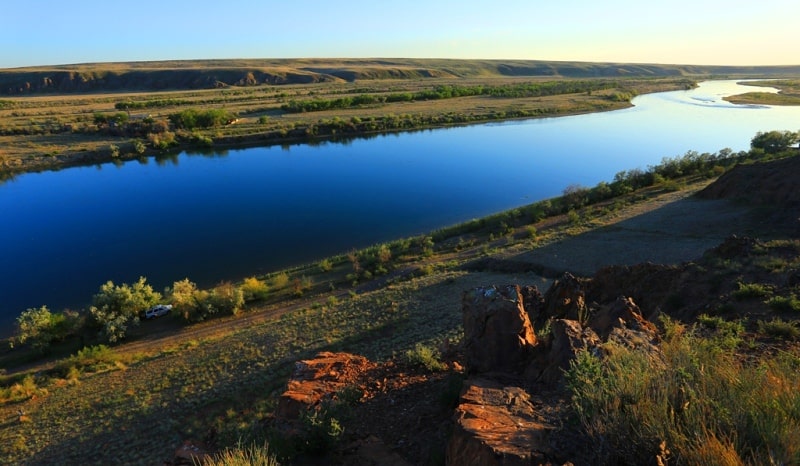
To the right of Ili the snow ridge the Dzungarskiy Ala-Tau, at the left - the mountains Ketmen covered with the wood passing into Zailiysky Ala-Tau. Or flows along loamy soils, its coast go down to water, rise steeps.
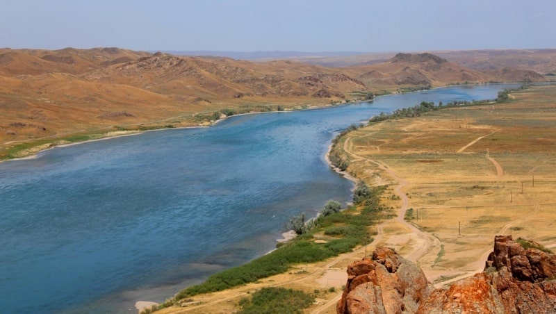
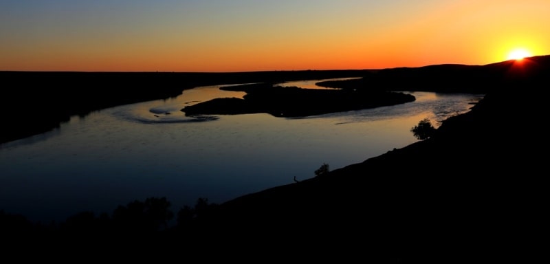
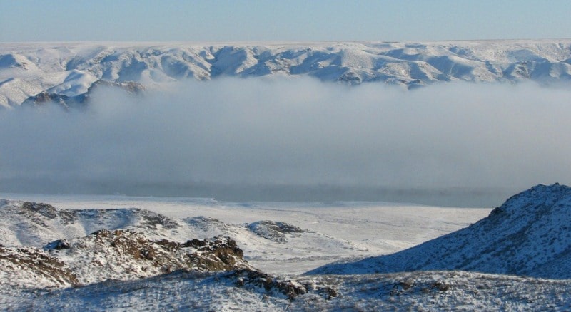
The way of the river is twisting: it forms a set of bends and sandy islands. Near the Singing mountain the current Ili is slowed down, and the river spreads, forming the small delta. Here the reservoir where muddy waters Ili behind a dam of Kapchagay hydroelectric power station the river continues the way transparent begins.
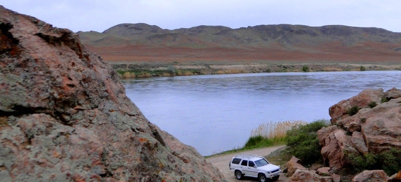
The Kapchagay gorge, stretched for 30 kilometers, cut through the river in porphyritic rocky breeds of two plateaus - Itdzhon, being on the right, and Karoly - at the left. Height of a canyon reaches 100 and more meters.
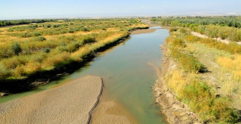
Further Ili flows on the plain, at the left Kurty inflow falls into it. The river is divided connects to one course, spreading in width on 500 - 600 and more meters. Coast Ili almost throughout grow at thickets of the riparian woodland inundated woods.
The second-large river to Dzhetysu the ambassador Ili - Karatal - originates in glaciers and snow of the Dzungarskiy Ala-Tau, feed her rivers Kora, the Tchizhe and Tekeli. Karatal length of 390 kilometers, the area of the pool makes 19100 square kilometers.
A third of all way Karatal flows among mountains and, having passed through the city of Taldykorgan, gets to the wide valley where from the West it Coke approaches the river abounding in water. Merging, both rivers a uniform stream direct to the fertile valley where are used for irrigation of crops.
Further Karatal proceeds among sands of Pribalkhashya and for 40 kilometers to a confluence with Lake Balkhash spreads the wide delta which width reaches 100 meters, the speed of a current of water - about 7 kilometers per hour.
At the average level the drain of the river makes about 60 cubic meters per second, in flood time - more than 100. The river Semirechye, the third on water content, is considered Lepsa who originates in mountains, at the height more than 3 thousand meters above sea level, among rocks and glaciers of a northern slope of the Dzungarskiy Ala-Tau.
Length of the river is 417 kilometers, the area of a reservoir is 8110 square kilometers. Form Lepsy generally two mountain the small river Aganakty and Sarymsakty (or Small Lepsa). Having connected from Aganakty, the river Lepsy is included into the Lepsinsk gorge stretched by a canyon on 6 kilometers from which directs to the Kargalinsky valley.
Here a part of its water is spent for irrigation. Through the mountains Ketebayburly on the Cherkassk gorge of Lepsy comes to the foothill plain and disperses on shallow canals. On the way the river accepts in itself inflow Baskan originating in glaciers of the Dzungarskiy ridge.
Passing low mountains Kyskach, Lepsy Kokunyzhen bends around the rocky massif, her current accelerates, the course becomes and the river turns on the North where spreads, and then flows into Lake Balkhash. An average consumption of water of Lepsy 40 - 42 cubic meters per second, maximum - about 300 cubic meters per second.
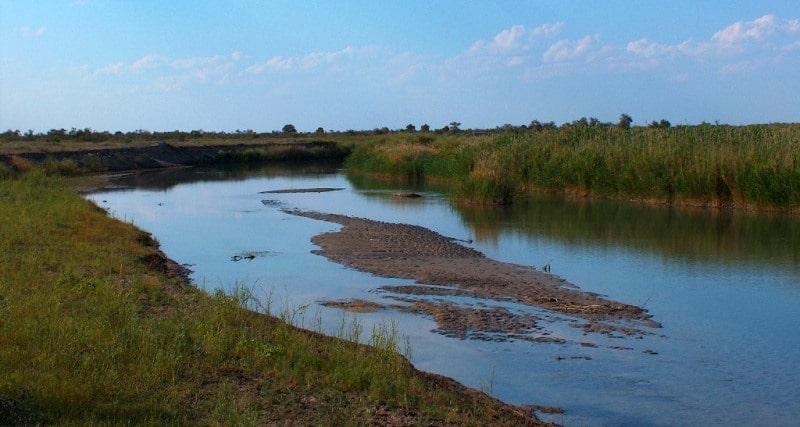
Great economic value of the river. Waters irrigate it tens of thousands of hectares of agricultural grounds, rotate turbines of hydroelectric power stations, are used in the industry and for domestic needs. The river Tentek belongs to the basin of the Alakol lakes and flows into the lake Sasykkol.
Many scientists share the idea of the academician V. A. Obruchev considering that in far times, it is possible till the Middle Ages, there was a communication between the basins of Lake Balkhash and group of the Alakol lakes.
Tentek also originates from glaciers and eternal snow of the Dzungarskiy Ala-Tau which area in its sources about 100 square kilometers. It is the river abounding in water with an average drain of water 42 meters per second, the maximum more than 110 meters per second.
Length of the river makes 187 kilometers. At a confluence with Sasykkol Tentek forms the delta with canals and swamps, overgrown with reed. The large rivers Dzhetysu have much in common. They are born in glaciers and eternal snow, a way in gorges of mountains, then they escape on foothill plains and further flow among sands of Saryesik-Atyrau.
The small rivers, as a rule, do not reach Balkhash, being lost in sands. Are that Tokrau, Naryn, Dzhanasu and some other.

Authorship:
"Zhetysu is the Land of tourism”. A Tourist Guide-book. Almaty. 2003. 68 p. and the material for this page is taken from the printed edition."
Photos
Alexander Petrov.