


![]()
You are here
Ryn-Sands. West Kazakhstan.


Tours to Ryn-Sands.
“Happiness is just a glass of water, but not in the middle of the river, but in the desert”
Valentin Borisov.
Trip to Ryn-Sands from Atyrau.
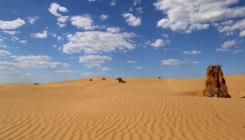
Hilly ridge and dune Ryn-sands (or Naryn-sands (Naryn kumy - narrow sand) sandy massif of sands mainly located in the West Kazakhstan region on the watershed of the Volga and Ural rivers and the southeastern part of the sands in the Atyrau region.
The territory of the sands is drainless, for the most part devoid of a river network and fresh water bodies. There are salt lakes with sodium chloride brine (100 - 120 g/l), periodically flooded with salt water in the spring, located in mesorelief depressions.
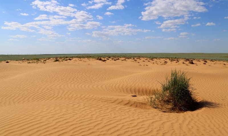
The sands are covered with herbaceous and shrubby vegetation. Fresh groundwater is shallow. The area is about 40,000 square kilometers. Ryn-sands, this is a huge expanse of sandy mounds and dunes in the Caspian lowland, located on the watershed of the Volga and Ural rivers.
Ryn-sands were formed as a result of scattering of ancient lacustrine and alluvial deposits, during the movement of lake and river sands. Dry winds and dust storms are typical for Ryn-sands. Fresh water is relatively shallow.
The sands begin near the village of Khan Ordasy (Urda) of the West Kazakhstan region of Kazakhstan, which is heavily covered by them, and from it they continue to the southeast with a strip of 21 to 43 kilometers in width and up to 160 kilometers in length.
All this sea of sands or dunes is in some places rather high hills, up to 13 meters high, consisting of completely pure, reddish-yellow sand, containing sea shells. The surface is composed of deposits of the Khvalyn and Khazar ages, which are underlain by weakly dislocated Permian-Triassic sedimentary rocks.
The relief is dominated by small-hilly and hilly-dune semi-fixed sands. The massifs Batpaysagyr, Terektikum, Zhamankum, Orda, Bozanay, Kosdaulet, Menteke stand out. The northeastern part is occupied by the Kamys-Samar valley.
The climate is continental. Average temperatures in January are from - 10.4 to - 12.2 °C, in July 34.9 - 34.5 °C. The average annual rainfall is 214 - 246 mm. The thickness of the snow cover does not exceed 10 cm. Evaporation is 5 - 6 times higher than atmospheric precipitation.
Dry winds and dust storms are typical. There is no surface runoff. Fresh groundwater occurs at a depth of 1.5 - 2 m. In spring, part of the flood waters of the Karaozen and Saryozen rivers penetrate through separate channels into the Ryn-sands.
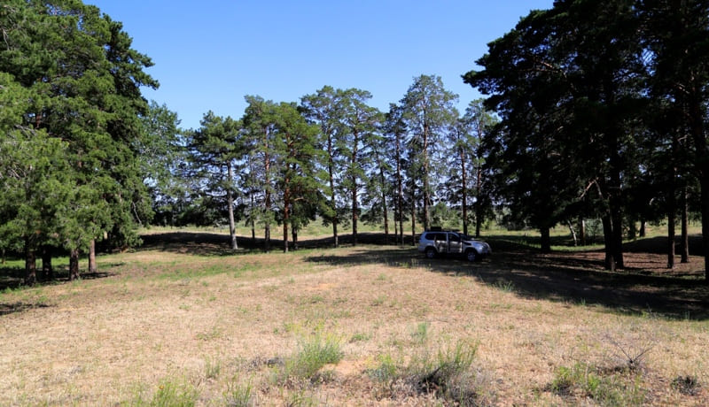
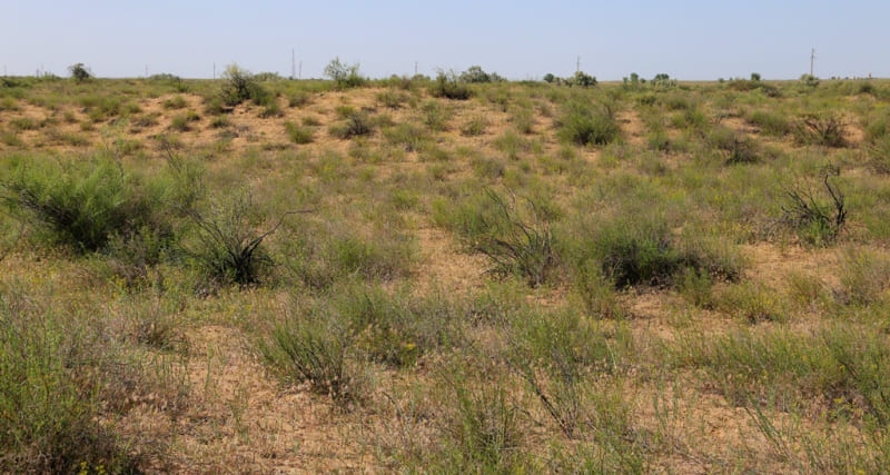
Zhuzgun, astragalus, tamarisk, wormwood, wheat grass, etc. grow on light brown soils. Small groves of poplar, alder, and aspen are found in depressions among sandy mounds. Herbaceous and shrubby vegetation.
Gopher, hare, jerboa live. On the territory of the Ryn-sands, the Ordinsky geobotanical reserve was organized. In the XIXth century, Ryn-sands were synonymous with the Bukey Horde for the inhabitants of the nearest provinces.
In 1887, a plan was developed for the formation of a forestry in Ryn-sands, from the tracts of Dzhaskus and Kandagash, with an area of 16,895 hectares, and in the rest of the sands, it was decided to strengthen supervision to prevent the extermination of the remaining woody vegetation from the forest that once existed in this area.
The settlement of the territory of the Ryn-sands by humans began about 11.5 000 years ago. Most of the Ryn-Sands is located on the territory of the Republic of Kazakhstan.
Geographic coordinates of Ryn-sands: N48°30'30.29" E48°22'18.45"

Authority:
When writing this article, material from the publication Kazakhstan. National Encyclopedia ”(1998 - 2007), provided by the editors of“ Kazakh Encyclopedia ”under a Creative Commons BY-SA 3.0 Unported license.
http://www.caspianmonitoring.ru/
Photos by
Alexander Petrov.