


![]()
You are here
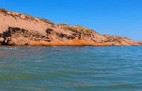
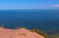
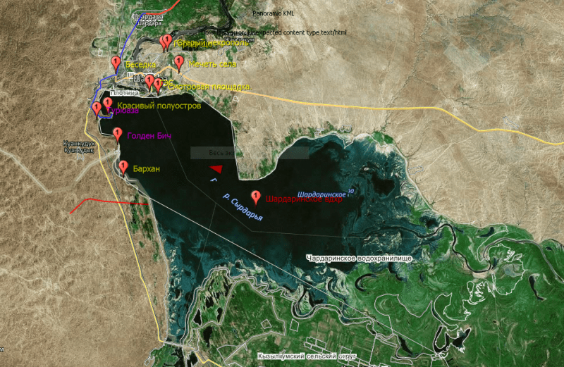
Shardara reservoir.
Tour Kazakhstan.
"Thousands of people live without love, but no one without water"
Hugh Auden.
Hiking group Kazakhstan.
The Shardara reservoir (Kaz. Shardara bugeni) is a reservoir located in the southeastern part of the Kyzylkum desert, on the Syrdarya river, in the southern part of the Shardara village, 180 kilometers south-west of the city of Shymkent, in the Shardara district in the southern part of the Turkestan region.
Built in 1966. The third largest reservoir in Kazakhstan. It carries out long-term flow regulation, it is also used for energy, the Shardarinskaya HPP is located on the dam and the Kyzylkum canal for irrigation. It is a source of water for the city of Shardara.
The length of the reservoir from south-east to north-west is 27 kilometers, width from west to east is 24 kilometers. The Syrdarya river flows into the southeastern part of the reservoir, in the southwestern part the Shardara reservoir is connected with the Arnasai lake located in the Jzak region of Uzbekistan.
The area of the reservoir is 783 square kilometers, the total volume is 5.7 cubic kilometers, the useful volume is 4.2 cubic kilometers. In 2008, it was reported that the critical maximum is 5.5 cubic kilometers. In dry years, it can be triggered below the "dead volume", but when the volume decreases to 0.5 cubic kilometers, "dirty slurry" remains.
Water consumption in the Shardara reservoir:
- long-term average - 626 cubic meters per second,
- summer minimum - 56.3 cubic meters per second,
- winter minimum - 137 cubic meters per second,
- through all 4 turbines at a design head of 780 cubic meters per second.
Outflowing streams from the Shardara reservoir - the Syrdarya river, Kyzylkum canal, a channel to the Arnasai lakes, leading a channel to the Dostyk channel. Locks were installed to control the water level in the reservoir. In 1969, there was a severe flood, the sluices were opened, since the capacity of the hydraulic units was insufficient.
From February 1969 to February 1970, 21 kilometers of cubic water (almost 60% of the annual flow of the Syr Darya) was directed from the Shardara reservoir to the Arnasay lowland. As a result, Arnasai Lake was formed.
Since 1969, Aydarkul has regularly received inflow from the Syrdarya if the Shardara reservoir overflowed. So the Aransay lowland was gradually filled with water and the second largest lake in the region was formed (after the drying up Aral Sea).
In 1993-2001, almost 30 kilometers of cubic water were discharged. For two years (2002 - 2003), another 7 cubic kilometers were produced. The increase in discharges was associated with the transfer of the Toktogul reservoir to the energy regime and a significant increase in winter passes.
In the 2000s, the volume of water in Lake Aydarkul (Uzbekistan) exceeded the useful capacity of the Shardara reservoir by 10.5 times.
Geographic coordinates of the Shardara reservoir: N41 ° 08'43.91 "E68 ° 05'37.44"
Authority:
https://ru.wikipedia.org/wiki/%
Photos by
Alexander Petrov.