


![]()
You are here
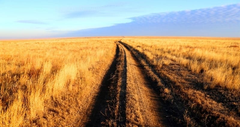
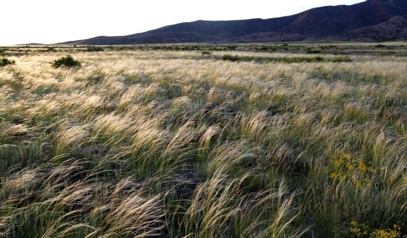
Soils of Korgalzhyn reserve.

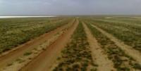
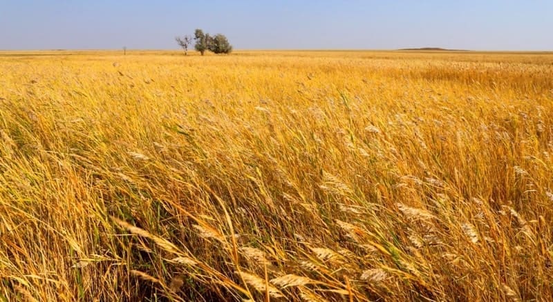
Traveling through Korgalzhyn reserve.
“But between those sips - notice! –
We are given a lot to choose from:
You can sit at home and have tea,
You can drink from distant wells.
If life is not easy, not smooth,
If you go far in life,
It's not that short
And it would be cruel to scold her.
Through mountains, thickets, sands,
Without fear of fog or wind,
You went from the sources of the river -
And he reached the mouth unnoticed.
So the long journey is over, -
You are not drinking medicine from a glass:
It's your lips that are soaking
The bitter swell of the Ocean."
"A sip". Vadim Shefner.
Ecological tours to Korgalzhyn nature reserve.
The reserve is located in the zone of chestnut soils, but zonal automorphic soils in its limits are not represented. The territory is characterized by hydromorphic soils a number of: meadow chestnut, meadow, meadow marsh, marsh, solonetzes and solonchaks.
They form either homogeneous contours, or combinations and complexes. Soils are developed on lake alluvial deposits, which are sometimes lined with saline clays. According to the mechanical composition of the soil, clay, less often heavy loamy.
A significant part of the soil cover is saline. Prevails sulfate-chloride type of salinization. Salt is characteristic of some soils. Meadow-chestnut soil. Soils are represented by carbonate, solonchak, solonchak and washed water.
According to morphological indicators of the soil or thin and their humus horizon (A + B) does not exceed 30 cm, or medium-power and have a humus horizon of not more than 40 cm. Content humus ranges from 4 - 5 to 6 - 8%. Boiling from hydrochloric acid is noted from the surface.
Visible emissions of carbonates, gypsum and readily soluble salts are noted from a depth of 60 cm. The water regime of the soils is pulsating - short periods abundant moisture alternate with periods of normal regime of automorphic soils.
Ground water located at a depth of 4 - 7 m and do not affect the course of the soil formation process. The soil found everywhere on the slightly undulating surface of the lake alluvial plain and are covered steppe vegetation.
Sites of such soils in summer have a relatively good cross, in spring and in the autumn traffic on them is difficult. Meadow soil. Soils are characterized by significant humus content in the upper horizons. Its value ranges from 3.7 to 4.9%. The distribution by profile is of a nature.
Boiling from hydrochloric acid is observed with depths of horizons B1 and B2, less often from the surface. The largest amount of carbonates is observed either on a depth of 28 - 53 cm, or 42 - 76 cm. The soils are formed under conditions of constant moistening with groundwater, lying at a depth of 1 - 3 m, and when flooded in spring with fresh melt water for 1 3 weeks.
This causes an unstable water regime not only by season but also by year. Soil reserve territories are of limited distribution.
They occupy pronounced flat lakes are lacustrine alluvial plain and covered with meadows. In spring, in the period flooding by surface waters, passage in these areas is difficult. Meadow marsh soils. Characteristic features of the morphological structure of the profile: the presence on the surface of the semi-peaty layer and the accumulation of acidic iron compounds in the lower part humus horizon.
The humus content varies widely: from 1.9 to 7.4%.
Boil off hydrochloric acid comes from the surface. The greatest amount of carbonates is observed in the horizon Sun and below. The water regime of soils is unstable and varies from year to year depending on the number of hollow soils.
Water Flooding with hollow waters continues annually for at least 30 days. Ground water level located at a depth of about 1.5 m. Soils are widespread on the lake-delta plain of the river Nora and covered with meadows of reeds, tubers of reeds, wheatgrass.
Movement on such sections in the spring is impossible, at the beginning of summer it is difficult, at other times of the year cross is good. Bog soils. The soil profile is moist, highly oxidized and gleyed (oxide and sour iron compounds).
A peaty horizon is developed on the surface. The humus horizon is permeated a large number of living and semi-decomposed plant roots. The power of the horizon is 25 - 35 cm. The humus content in the upper horizon ranges from 1.7 to 2.5%, in the lower lying horizon sharply decreases to 0.8 - 0.9%.
Soils from the surface and throughout the profile are carbonate, their maximum accumulations are noted in a layer of 30-90 cm. Groundwater occurs at a depth of 0.5 - 1.5 m, and in winter-spring the period and partially in summer merge with surface waters.
Soils occupy the lowest relief elements within the lake-delta plain of the Nura River and the delta plain of the river Kulanutpes. Movement on such soils is impossible due to excessive moisture and high vegetation (continuous thickets of reeds).

Authority:
"Korgalzhyn State Nature Reserve." Sidorova T.
Photos by:
Alexander Petrov.