


![]()
You are here
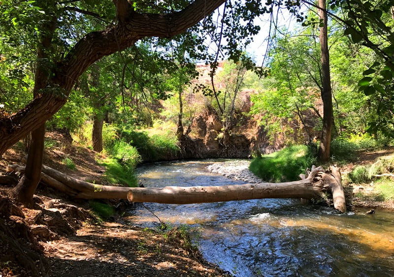
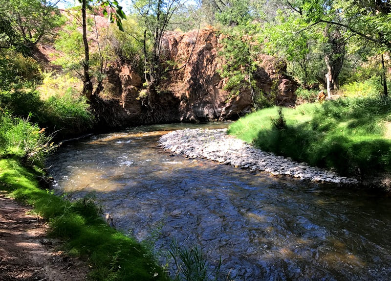
Temirlik river.
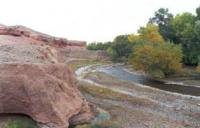
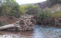
Trip to Temirlik river.
"Every ledge of Temirlik Canyon is like a page in a chronicle,
where instead of letters there is sand, wind, and silence."
The cliffs of Temirlik don't speak; they remember.
And in their memory are the echoes of the ancient mountains' forge hammers.
When the sun touches the sandstones of Temirlik,
it seems as if the earth itself remembers its flame."
Rest on Temerlik River.
Temirlik River is right tributary of Charyn River, sources of river are in Ketmen Range and Temirlik Mountains in Uigur and Rayymbek districts of Almaty region.
The Temirlik River is formed from the confluence of the eastern tributary of the Zhanakarasai and the western Komirshi North. The sources of the Temirlik River are located at an altitude of 2819.8 meters above sea level in the western part of the main Ketmen ridge.
The length of the Temirlik River is 58 kilometers, the area is 523 square kilometers. The river belongs to the Ili basin. There are no glaciers in the Ketmen ridge, Temirlik belongs to the rivers of a mixed type of supply - it receives water from snowfields and springs.
Floods and floods on the river continue from April to June. Water levels and discharges are uneven throughout the seasons. Water consumption, for example, in May, June exceeds the autumn and winter norms by four to five times. The water of the river is used for irrigation.
Vegetation in the river valley is represented by poplars, ash, barberry, relict saxaul, ephedra. There is a naked osman in the river. Among wild animals you can meet hares, foxes, among birds - partridges and pheasants.
Geographical coordinates of Temirlik River: N43°10'48 E79°17'03
Right tributaries of Temirlik River.
After 8.4 kilometers after the sources, the Temirlik River receives 6 small tributaries on the right, originating from the western slopes of the Ketmen ridge.
Zhanakarasai river.
After 8.4 kilometers Temirlik on the right receives the tributary Zhanakarasai with a length of 10.5 kilometers. The sources of the tributary are at an altitude of 3190.6 meters above sea level. The river flows through the gorge of the same name, the northern slopes of which are overgrown with Tien Shan firs. The mouth of the river is located at an altitude of 1840 meters above sea level.
Geographical coordinates of Zhanakarasai River: N43°08'01 E79°34'30
Karasai river.
9 kilometers after the confluence of the Zhanakarasai tributary, on the right into Temirlik, the longest river of the Temirlik tributaries flows - Karasai with a length of 26.5 kilometers, which in turn consists of two left tributaries of the rivers: Oyzhaylyau and Saryaygyr. The upper sources of Karasai consist of tributaries: Orta-Karasai and Zhenishke-Karasai.
The main channel of the Karasai River is formed at an altitude of 2334.3 meters above sea level.
Geographical coordinates of Karasai River: N43°08'30 E79°24'42
Orta-Karasay river.
The origins of the Orta-Karasay River, 10.3 kilometers long, are located on the western slope of the Ketmen Ridge at an altitude of 3436.4 meters above sea level. The mouth of the river is located at an altitude of 2334.3 meters above sea level in a spruce forest. At an altitude of 2937.9 meters above sea level, the river flows through the Karasai tract. On the left, 7 small tributaries flow into the river, mostly of spring origin. The river gets its sources from springs and snowfields.
Geographic coordinates of Orta-Karasay River: N43°10'20 E79°36'45
Zhanishke-Karasay river.
The sources of the Zhanishke-Karasay River, 10 kilometers long, are located on the western slope of the Ketmen Ridge at an altitude of 3275.8 meters above sea level in the tract. To the north of the sources, on the eastern slope of the Great Aksu gorge, there is the Ushsala tract.
At an altitude of 2937.9 meters above sea level, the river flows through the Karasai tract. The mouth of the river is located at an altitude of 2334.3 meters above sea level in a spruce forest. The river gets its sources from springs and snowfields.
Geographical coordinates of Zhaniske-Karasay River: N43°11'01 E79°36'54
After the confluence of two rivers, Karasai flows for 8.5 kilometers, while receiving three tributaries on the left. The longest of them is 6.9 kilometers.
Oyzhailau river.
After 8.5 kilometers, the Oyzhaylyau River, 10.2 kilometers long, will flow into Karasai on the right. The sources of the river begin at an altitude of 3148.7 meters above sea level on the western slopes of the Ketmen ridge. The mouth of the Oyzhaylyau River is located at an altitude of 1873 meters above sea level.
Geographical coordinates of Oyzhailau River: N43°10'27 E79°30'57
Saryaygyr river.
4.8 kilometers after the confluence of the Oizhailyau, the Saryaygyr tributary flows into the Karasai on the right 19.7 kilometers long. The sources of the river are located at an altitude of 3263.6 meters above sea level on the western slopes of the Ketmen ridge. On the left, the Saryaygyr receives 4 small tributaries, on the right, 7 small streams. The mouth of the Saryaygyr River is located at an altitude of 1673 meters above sea level.
Geographical coordinates of Saryaygyr River: N43°10'47 E79°29'39
After the right tributary of the Saryaygyr, the Temirlik river receives two minor tributaries on the right, which originate from the western slopes of the Shoshanai ridge at an altitude of 1884.3 meters above sea level.
Left tributaries of Temirlik River.
West Komirshi River.
The first left tributary in the upper reaches of Temirlik is the Komirshi Zapadnaya River, 6.8 kilometers long. The sources of the river are located on the northern slopes in the Temirlik mountains. The northern spring and snow sources of the river are located at an altitude of 2957.6 meters above sea level.
The southern sources of the river are located on the northern slopes of Mount Aigyrshoky, 3033.1 meters above sea level. The eastern sources of the river are located at an altitude of 3215 meters above sea level in the Komirshi tract.
The main channel of the Komirsha Zapadnaya is formed at an altitude of 1875 meters above sea level from two tributaries: an eastern tributary with a length of 7 kilometers and a southern tributary with a length of 7.4 kilometers.
Geographical coordinates of Komirsha Western River: N43°04'59 E79°30'02
River Koktas South.
3.8 kilometers after the confluence of the Komirshi West tributary, the Koktas Yuzhny tributary, 5.5 kilometers long, flows into Temirlik from the left. The sources of Koktas are located on the eastern slopes of the Temirlik mountains at an altitude of 2646 meters above sea level. The mouth of the Koktas South River is located in the spruce forest zone at an altitude of 1716 meters above sea level.
Geographical coordinates of river Koktas South: N43°06'04 E79°26'20
Zholdakbulak river.
4.4 kilometers after the confluence of the Koktas Yuzhny River into Temirlik, a tributary of Zholdakbulak with a length of 7.6 kilometers flows from the left. The spring and snow sources of Zholdakbulak are located on the eastern slopes of the Temirlik mountains, in the vicinity of Mount Kuraila, 2862.1 meters high above sea level. The mouth of Zholdakbulak is located at an altitude of 1662 meters above sea level and 2.7 kilometers northeast of the village of Tuyuk.
Geographic coordinates of Zholdakbulak River: N43°04'50 E79°25'51
Kazybay river.
After 1.8 kilometers after the confluence of the Zholdakbulak, the Kazybay tributary, 9.1 kilometers long, flows from the left. The spring and snow sources of Kazybay are located on the eastern slopes of the Temirlik Mountains, in the vicinity of Mount Kuraila, 2862.1 meters high above sea level.
The Kazybai River in its lower reaches, 3 kilometers before its confluence with Temirlik, flows through the western part of the Tuyuk village. Here, in the central part of the village in Kazybay at an altitude of 1810 meters above sea level, a small stream 2.9 kilometers long flows into the left. The mouth of the Kazybai River is located at an altitude of 1620 meters above sea level.
Geographic coordinates of Kazybai River: N43°04'41 E79°24'37
Kenbulak river.
3.6 kilometers after the confluence of the Kazybay, on the left, the Kenbulak tributary, 9.8 kilometers long, flows into Temirlik. The spring and snow sources of Kenbulak are located on the northern slopes of the Temirlik mountains, in the vicinity of Mount Kuraila, 2862.1 meters high above sea level.
At 5.2 kilometers after the sources, there is an automobile bridge on the Kegen-Tuyuk road on the river. The mouth of the Kenbulak River is located at an altitude of 1550 meters above sea level. In the upper reaches, 2.8 kilometers after the sources, the tributary Uzunbulak, 3.2 kilometers long, flows into Kenbulak on the left.
The sources of Uzunbulak are located on the northern slopes of the Temirlik mountains in the vicinity of the Sarytau mountain, 2773.4 meters above sea level. After 2.6 kilometers after the confluence of Uzunbulak on the left into Kenbulak, in the vicinity of the automobile bridge, an unnamed tributary 4 kilometers long flows into it. The sources of the tributary are at an altitude of 2280.6 meters above sea level.
Geographical coordinates of river Kenbulak: N43°06'15 E79°20'55.52"
River Koktas North.
After 7.8 kilometers from the beginning of the sources of the Kenbulak River and 2.4 kilometers after the confluence of the nameless tributary, the Koktas North tributary, 9.7 kilometers long, flows into Kenbulak on the left.
The sources of Koktas North are located on the northern slopes of the eastern part of the Temirlik mountains in the vicinity of Mount Saryzhaz, 2444 meters above sea level. The mouth of the river Koktas Severny is located at an altitude of 1624 meters above sea level.
After 6.8 kilometers from the beginning of the sources, the tributary Burylsay, 3.9 kilometers long, flows into the Koktas North on the left. The sources of Burylsay are located on the southern slopes of Mount Burylsay with a height of 2023.1 meters. above sea level. In the middle reaches Burylsay flows from west to east along the valley of the same name.
Geographical coordinates of river Koktas Notyh: N43°07'16 E79°19'43
River Katuldruk.
10 kilometers after the confluence of the Koktas Severny with Temirlik, a tributary of the Katuldruk with a length of 8.8 kilometers flows from the left. The sources of Kutuldruk start from springs and are located in the western spurs of the Ketmen ridge at an altitude of 1935.2 meters above sea level. In the middle course, the river flows through the eastern part of the Berimtai vakkey. The mouth of the river is located at an altitude of 1309.3 meters above sea level.
Geographic coordinates of Katuldruk River: N43°09'31 E79°15'59
From the mouth of the Katuldruk to the confluence with the Charyn River, there are no tributaries to Temirlik on the left.

Authority and photos by
Alexander Petrov.