


![]()
You are here
Tour Torysh valley Tuzbair.

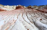

Photo Tours to valley Torysh on Mangyshlak.
«That good traveller who does not know where it goes. The ideal traveller does not know, whence has come»
Lin Ytan.
Short description of tour route on Mangystau:
Aktau – canyon Kapamsay – mosque in a rock Shakpak ata – canyon Shakpakatasay - globular concretion Torysh – valley Kokala – Sherkala mount - valley Zhylshy – valley Ayrakty – village Shetpe – village Zharmysh – Tuzbair saline march – village Shetpe – Aktau town.
Distance of route: 840 km.
Season: from April till Oktober, 15th.
Best time for travel: April, May, June, September.
Duration of tour: 5 days, 4 nights.
Detailed program day by day on Mangistau region:
Photo Tours on Mangyshlak.
1 Day. Aktau – canyon Kapamsay – mosque in rock Shakpak ata – canyon Shakpakty - valley Torysh (160 km).
Departure from Aktau. We drive on asphalt road of 100 km, 10 km on grader road, other part of way on steppe country road. In 27 km from city acquaintance with small Turkmen-Kazakh necropolis (sacral architecture).
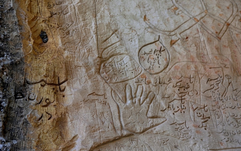
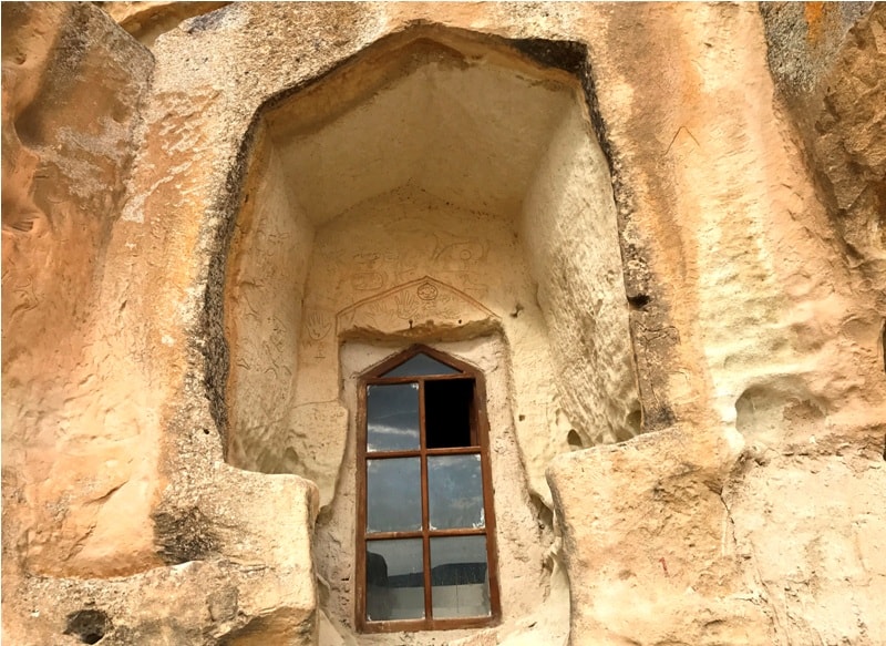
Photographing of panorama of canyon Shakpakty. Transfer to rocky mosque of XIV century Shakpak ata (20 km). Walk in mosque. Transfer to cretaceous canyon Kapamsay (6 km), walk on vicinities of canyon (3 km.) Photographing of vicinities. Lunch on the way.
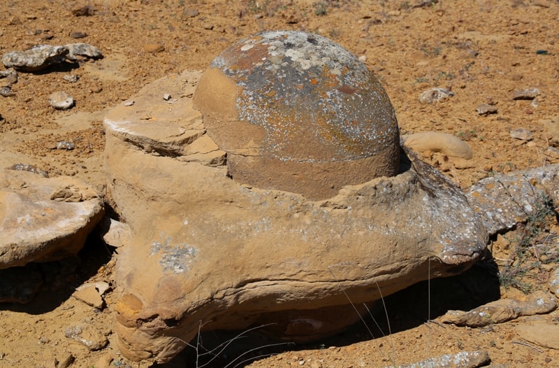
Photographing panoramas of canyon Kapamsay, walking of vicinities. Transfer to field globular cencretion Torysh on grader road, asphalt and country road (60 km). Placing of camp. Self-dependent walks on vicinities of valley Torysh. Photographing of vicinities. Dinner and overnight in the tents.
2 Days. Globular concretion Torysh - multi-colour Jurassic formation Kokala – Sherkala mountain – cretaceous gorge Zhylshy (60 km).
Breakfast. Final walk on field globular cpncretion (2 km.). Photographing of vicinities. Transfer to fantastical, washed away, color, Jurassic the loam, on steppe road (30 km.). Paleontologic opening and finds of petrifaction ancient precinctive vegetation. Photographing of vicinities.
Short rest at spring with fresh water. Lunch in the way. After lunch, transfer to mountain Sherkala on grader oad (15 km.). Photographing of vicinities. Short walk in vicinities of mountain. Transfer on steppe road to cretaceous gorge Zhylshy (15 km.). Walk in vicinities of cretaceous gorge (3 km.), photographing in vicinities. Placing of camp. Dinner. Overnight in the tents.
3 Days. Zhylshy gorge – mountain valley Ayrakty-Shomanay – village Shetpe – Aktau town – valley Karashymrau (200 km).
Breakfast. Transfer to mountains Ayrakty-Shomanay. Photographing of vicinities. Walk with an ascention on mountain from which the kind on the next valley (an ascention and descent opens do not demand special preparation and equipment) (3 km.). Photographing of vicinities.
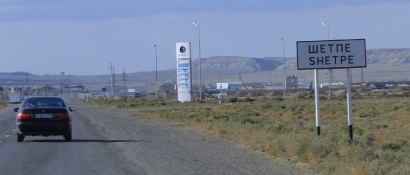
Transfer on steppe road to oasis Akmysh (20 km.). Walk on archeological excavations of ancient site of ancient settlement Kyzylkala. Lunch in the way. Transfer, in the beginning on asphalt and then on steppe road (50 km.) in gorge with small fresh lake through village Shetpe (refuelling of cars, shopping). Placing of camp. Swimming in lake. Dinner. Overnight in the tents.
4 Days. Valley Karashymrau – Tuzbair panoramas – Tuzbair salt marsh (160 km).
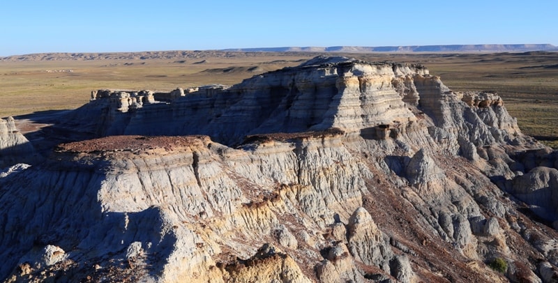
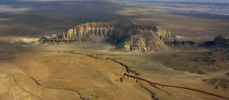
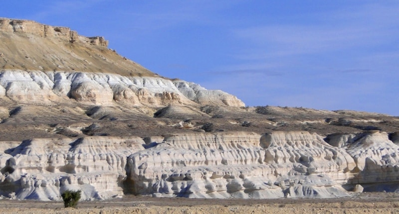
Breakfast. Transfer on an old grader to the first panorama at mountain Tuzbair. Photographing Western Ustyrt. Transfer on second panorama Tuzbair, transfer through slope Manata on plateau Ustyrt. Photographing of plateau and vicinities. Survey of the hunting shelter. Lunch in the way.
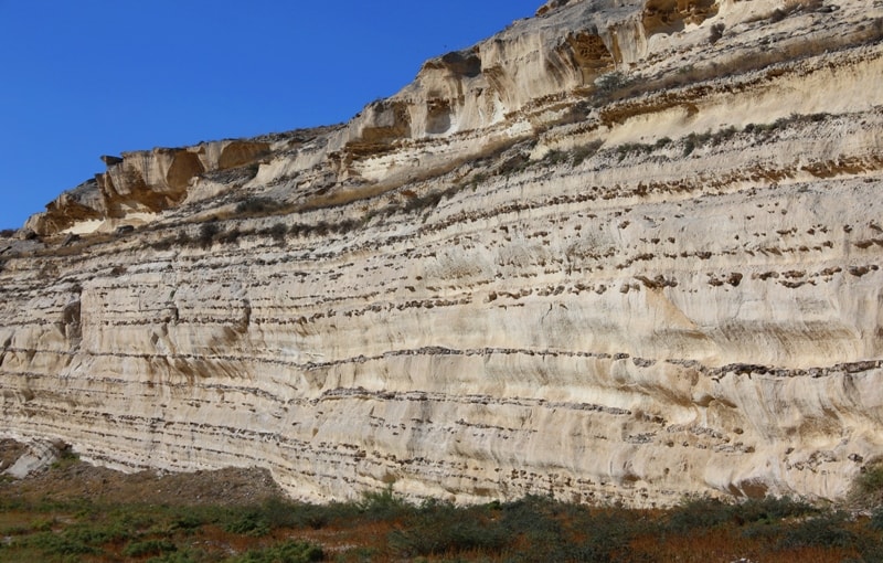
Transfer on steppe road on plateau Ustyrt. Transfer on descent Syndy and further transfer to salt marsh Tuzbair. On an entrance to place of camp, we see, unusual show - high cretaceous ledges, freakish scour of water-currents. Photographing of vicinities. Transfer on bottom of salty lake. Placing of camp. Walks on vicinities. Dinner. Overnight in the tents.
5 день. Tuzbair saline marsh – village Shetpe – Aktau town (260 km).
Breakfast. After a breakfast walk on bottom of salty lake with crystallization of the salt, covered by thin layer of water. Photographing of mirror reflections in lake water. Lunch in way. Returning in Aktau in the beginning on country road (80 km.) and further on asphalt highway (190 km.).Arrival in Aktau.
Distances on route «Tour Torysh valley and Tuzbair».
Aktau town – village Shetpe – 155 km
Aktau town - mountain mosque Shakpak-ata – 120 km
Mountan mosque Shakpak-ata – Torysh valley - 63 km
Torysh valley – Sherkala mountain – 45 km
Sherkala mountain – Shetpe village – 20 km
Village Shetpe – slope Manata – 100 km
Tuzbair sor – village Shetpe - 135 km.
Notes for tour on Mangyshlak.
1. Transfers on jeeps Toyota, Nissan Patrol. Motor vehicles UAZ, it is used for transportation of luggage, equipment and cargoes. The route concerns to a category extreme (high heat, cretaceous dust) with residing at field conditions of desert.
2. Quantity the person in group - no more than 12 person.
3. Two days of transfers and everyone will be in waterless places, water of 5 litres in day on the person in day in view of sanitary use.
4. Toilets on the nature.
5. Personal equipment for the tourist - sleeping bag, karemat (sleeping rug), small lamp. Recommended clothes and footwear: running shoes, with a rigid sole, mountain boots, cap or Panama, sunglasses.
6. Accommodation in tents - on 2 persons.
7. In springs water is used for preparation of meals and technical needs.

Note:
Author program is Alexander Petrov. Copying and introduction - only from the sanction - petrovsra@mail.ru
Alexander Petrov
Photos