


![]()
You are here
Turktul Onere.
Travel along Karynzharyk depression.
"Bon voyage and safe return!"
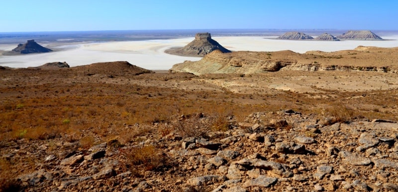
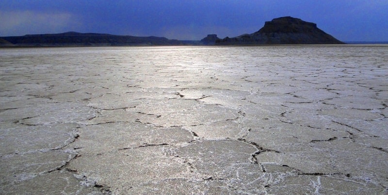
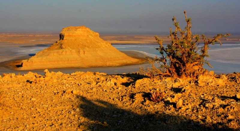
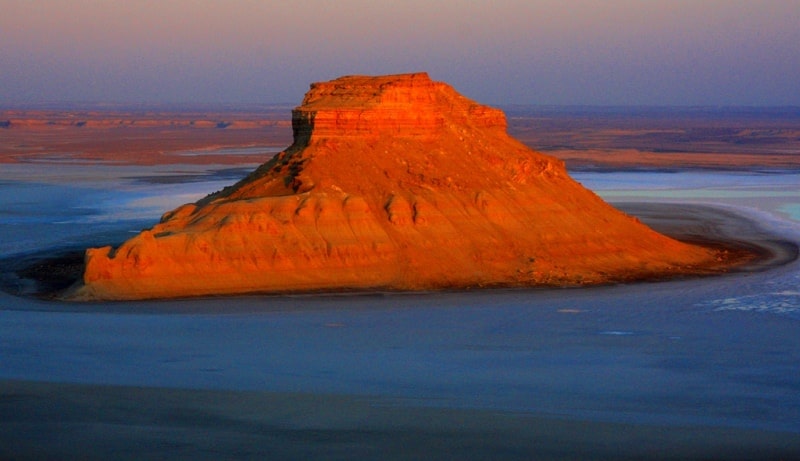
Sights of Karynzharyk depression.
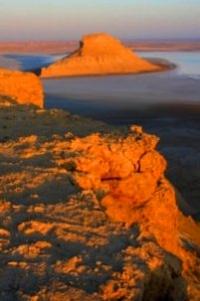
Turktul Onere are located in the southern part of the Karynzharyk depression in the southeastern part of the Mangistau region, on the territory of the Ustyurt natural reserve, 42.3 kilometers southeast of the Ak-Kuduk village and 65.7 kilometers to the east and slightly south of the Basgurly depression in Karakiya district in the southeast of Mangistau region.
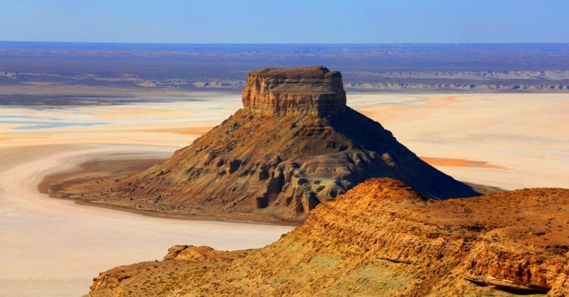
In the southern part of the depression there is a denudation mountain range of five isolated table outliers:
- the southwestern outlier turktul Onere with a height of 104.7 meters above sea level.
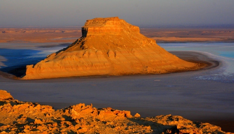
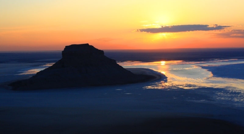
Turktul Onere stretches from the southeast to the northwest, almost in a latitudinal direction, its base at the bottom of the depression is: length 1.1 kilometers, width in the central part 621 meters, the perimeter of the outlier along the bottom is 2.7 kilometers.
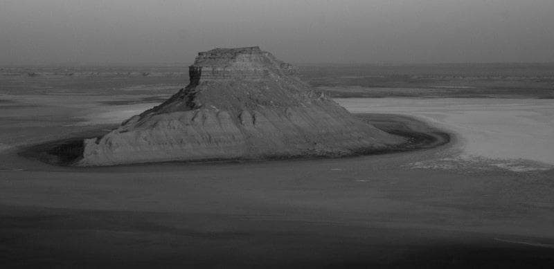
The distance from the Western cliff of Ustyurt to the southwestern outlier is 1.7 kilometers, from the western part of the depression - 3.2 kilometers. Turktul Onere is located at the bottom of the depression, approximately - 63 meters below sea level.
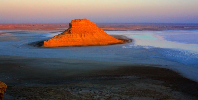
Turktul Onere is located 3.6 kilometers to the east and slightly south of the delta of the Onere brook, which is why it got its name. This is one of the most picturesque creations of nature in the Karynzharyk depression, in the sunset rays and at sunrise it leaves an indelible impression of visiting this unique place.
Geographic coordinates of turktul Onere: N42 ° 36'41.52 "E54 ° 16'04.17"
Authority and photos
Alexander Petrov.