You are here
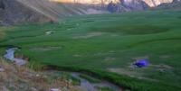
Ugam River in Kazakhstan.

Flower Tours Sairam-Ugam Natural Park.
“Nature abhors annihilation”
Marcus Tullius Cicero.
Birding Tours Sairam-Ugam National Park.
The Ugam River in Kazakhstan flows from the north-east to the south-west on the northern slope of the Ugam Range in the mountain system of the Western Tien-Shan in Kazygurt (administrative center - the village of Kazygurt) and Tolebi district (administrative center - the village of Lenger) of the Turkestan region.
The Ugam River is located on the territory of two branches of the Sairam-Ugam National Natural Park - Toleibi and Kazygur. The Ugam River flows through the Kazakhstani part of the Ugam Gorge from the headwaters on the northern slope of the Ugam Range to the 55-kilometer crossing of the state border of the Republic of Kazakhstan and the Republic of Uzbekistan.
At a distance of one kilometer and 100 meters along the river, there is a border between Kazakhstan and Uzbekistan between the mouths of the right tributaries of the rivers - Karakuzisai and Kurgantaysay. The sources of the Ugam River are located at an altitude of 2476.7 meters above sea level, at a place where the river crosses the state border of Kazakhstan, the height is 1620 meters above sea level.
The area of the Ugam River basin is 869 square kilometers.
The racherge food of the river is mainly snow, partly rain and spring. The average annual water consumption is 20.9 meters per second cubic. High water on the river begins in March and lasts until August. The highest daily water discharges were observed in April-August, reaching 177 meters per second cubic in high water and 54.5 meters per second cubic in dry years.
Ugam is a right tributary of the Chirchik river after it flows from the Charvak reservoir. The average slope of the river is 34 metro per one kilometer. The Ugam river has a fast flow, below the Ugamsk leshoz its speed is 1.6 meters per second, then, in the section between the confluence of the tributaries of Karatashsai and Talas, it increases to 2.6 meters per second.
The width of the river in the middle course (Bugunchalpek tract) is 20 meters, the depth is up to 1 meter, the bottom soil is rocky; the width in the lower reaches (above the village of Charvak) is 24 meters, the depth is 70 centimeters, the bottom soil is viscous. Ugam's bed is rapids.
The sources of the river are located at the ridge of the Ugam range, in the Tolebi district of Turkestan region near the border with Uzbekistan. Ugam is formed by the merger of several streams of spring origin. The lower confluence point is located at an altitude of about 2760 meters above sea level.
The Ugam basin from the north is bounded by the Talas Alatau ridge, from the west by the Karzhantau mountains, and from the east by the Ugam ridge. In the middle reaches Ugam forms a valley with wide terraces, where there are groves, shrubs and pastures.
In the lower reaches, it crosses the border of Kazakhstan with Uzbekistan and flows through the territory of the Bostanlyk district of Tashkent region. It flows into Chirchik at the lower pool of the Charvak hydroelectric station, at an altitude of about 750 metres above sea level.
On the left bank of Ugama is the village of Khojikent, on the right bank - the village of Charvak. In the river valley there are boarding houses and summer camps for children, in particular, the famous resort village of Humsan.
Authority:
Wikipedia and Alexander Petrov.
Photos used
with permission of Alikhan Abdeshev, Tourism Manager of Sairam-Ugam National Park.


