


![]()
You are here
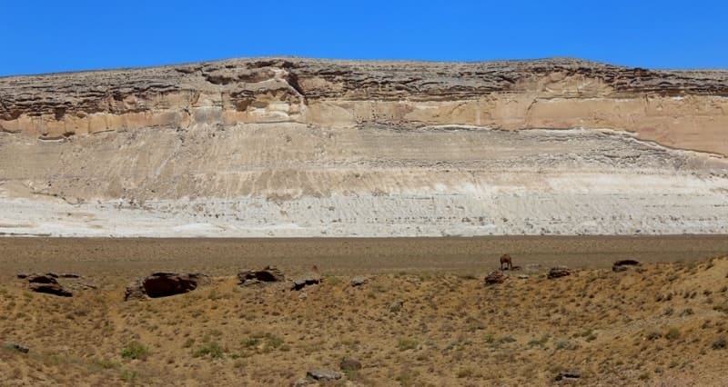
Ungoza Mountains on Mangistau.


Mountain sights of Mangistau.
"Walking - long life"
Russian folk proverb.
Trip to mountains of Mangyshlak.
Ungoza mountain range consists of three ancient hills: Ungoza East with a height of 196.5 meters above sea level, Ungoza South with a height of 206.6 meters above sea level, Ungoza North with a height of 199.2 meters above sea level, located north of Kaushe mountain range, between gorges Kumakapa in east and huge Shakpak ata sai gorge in west, 3.1 kilometers south of southern coast of Sarytash Bay, in northern part of Mangyshlak peninsula, in Tyubkaragan district in Mangystau region.
During the formation of the modern relief, the Ungoza massif separated from the Kaushe mountain range.
Area of Eastern Mount Ungoza is 1.3 square kilometers, the perimeter of the mountain reaches 6.66 kilometers. The height of the surface on which the mountain is located is 78 meters. The longest upper surface is the elevation of Mount Ungoza East, it is 3.2 kilometers.
Area of Mount Ungoza South is 0.18 square kilometers, the perimeter of the mountain reaches 2.33 kilometers. The height of the surface on which the mountain is located is 98 meters. The length of the mountain's surface is 909 meters.
Area of Mount Ungoza North is 0.38 square kilometers, the perimeter of the mountain reaches 2.81 kilometers. The height of the surface on which the mountain is located is 80 meters. The length of the mountain is 1.2 kilometers.
To the southeast of Ungoza East, 2.3 kilometers away, there are small mountains 193.8 meters above sea level. In the southwest of the Ungozy massif there is the Shakpatasai canyon, in the south of Mount Kaushe with a dominant elevation of 218.2 meters above sea level.
In the east, 6.8 kilometers away, there is the valley of the Kumakapa River, along the bed of which at the end of the 30s of the last century, a narrow-gauge railway was laid from the Sarytash pier to the coal mines near the village of Taushyk. The Ungoza massif can be classified as table mountains composed of sedimentary rocks.
The slopes of Ungoza are steep and almost vertical in places. In cross-section, this type of geological formation has an oblong shape, that is, in one direction the plateau at the top of the mountain is elongated. The Ungoza Mountains owe their upper part to the processes of denudation - erosion and weathering.
Geographic coordinates of Mount Ungoza East: N44°26'10 E51°13'20
Geographic coordinates of Mount Ungoza South: N44°25'39 E51°12'19
Geographic coordinates of Mount Ungoza North: N44°26'15 E51°12'08


Authority and photos by:
Alexander Petrov.