


![]()
You are here
Walk on Ulken Keme on Boszhira.

Mangyshlak Tours, Travel and Excursions.
«Nature does nothing without purpose or uselessly»
Aristotle.
Tour catalogue - Mangyshlak Silk Road Adventures.
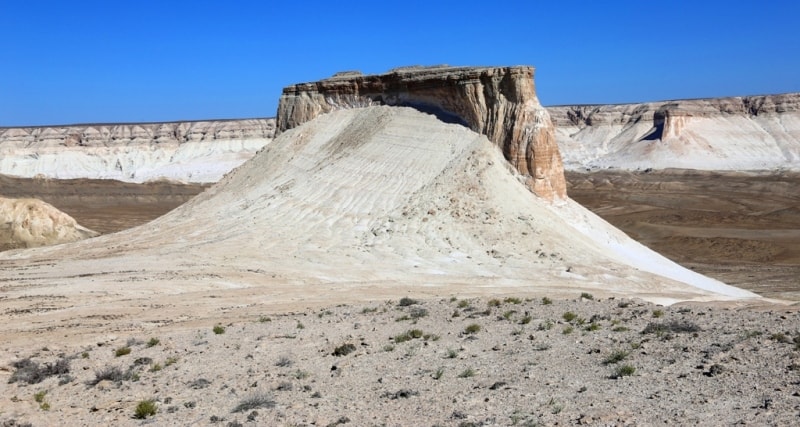
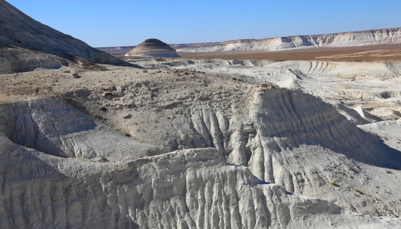
In the vicinity of Boszhira, each elevation, or rather, the remains of the ancient chinks that survived the destruction have their own names. This elevation to which we will take a walk is called Ulken keme. This part of the insular cliff has an elongated, oval shape; on the ground, it stretches from northwest to southwest.
On the western and eastern sides, it has cliffs 20 meters high, and in some places there are more steep cliffs. The length of Ulken keme from the point of exit to it, from a stone ancient wall with a passage, to a cliff ending with a discharge to the Azu tisteri outliers is 200 meters.
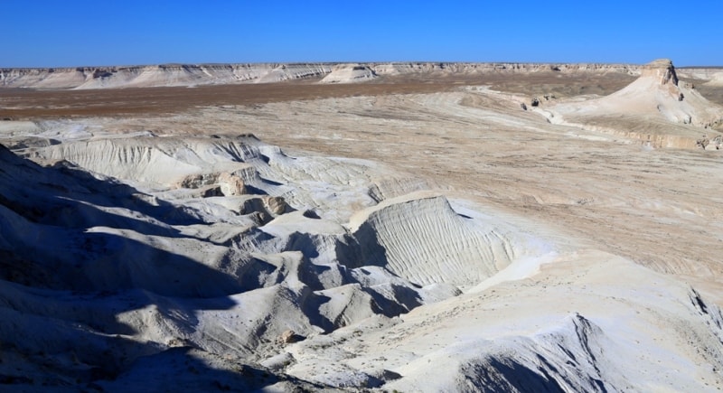
In the southernmost part of Ulken Keme, the width does not exceed 20 meters, and in the initial, northern part, the width is just over 40 meters. These elevations, the so-called mountains, are separated from the main Western cliff of Ustyurt and are located somewhat in the depths of the depression.
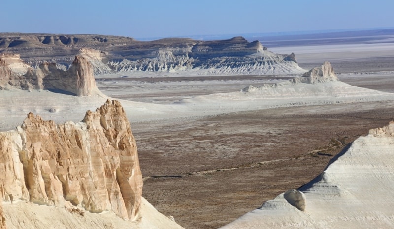
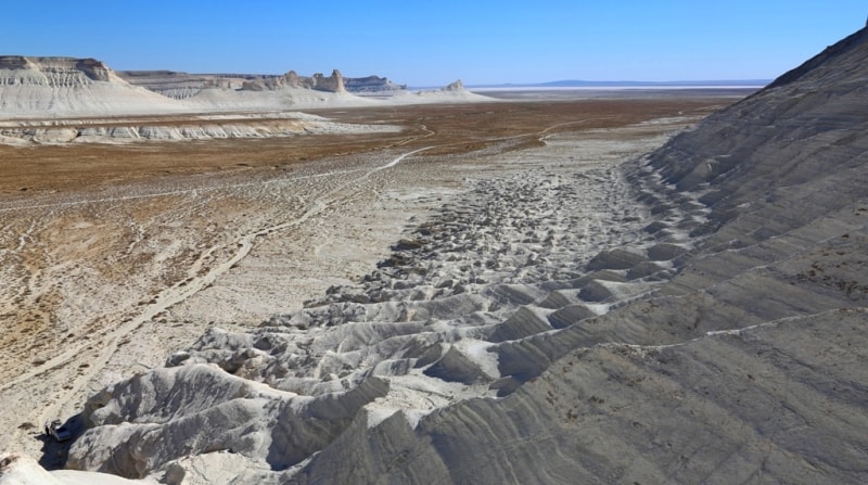
The depression itself, or rather Sor Karashek, is located 10 kilometers south of the Boszhira tract. The path to Ulken keme begins from the north, from the Ortasha plateau, where we get by car from the Zhusaly slope.
After the descent of Zhusaly, the road winds bypassing the Silicon Valley and gradually leads to the Ortasha plateau, where Shoky tau mountain is located in full view, remaining on our right and along the winding road we approach the chalk hill.
Here, on one of the patches of the flat surface of the earth, you can leave the car and start the ascent along the path to the surviving Zhogarly plateau, which is later connected by a jumper with Ulken Keme. Having climbed the plateau, we move to the southeast, the path is not visible, but the logical path of movement is traced along the surface and soon it leads to a place from where the path is already visible, which leads to the ancient fortress-shelter made of stones.
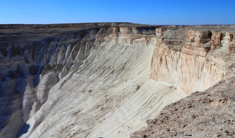
This ancient wall, apparently, was built in order to fence off the secluded cliff place of the surviving chink from the rest of the mountain, thus it was a kind of shelter. Passing the gate in the stone wall, we enter the surface of the surviving ancient chink and here we are at Ulken Keme.
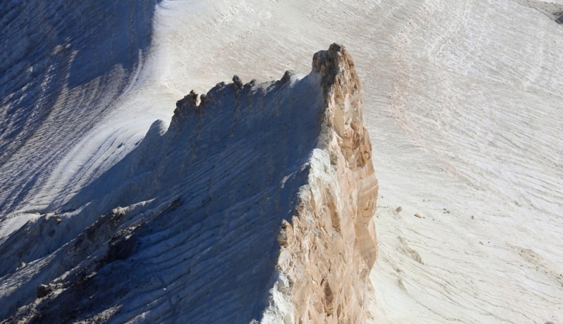
In some places, the surface of Ulken keme is cut with cracks. Be extremely careful when approaching the edge of a cliff. Many tourists like to take pictures on the edge of the southern cliff, against the background of Azu tisteri Boszhira.
I recommend that you first lie down on a stone surface and then crawl to the very edge of the cliff, so you can protect yourself from the unpleasant sensations of approaching an abyss. Return to the car along the ascent path. Return to Aktau.

Authority and photos
Alexander Petrov.