


![]()
You are here
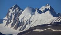
History of study of Kyzyl-Asker and Dankov massifs.
Tours to Kyzyl-Asker peak.
“I have always loved and love nature, and in its true form, virgin, not resort. Probably, I fell in love with mountaineering because it is especially close to nature, unthinkable outside of it. I love it for its uniqueness, because each hike, each ascent gives something completely new. And one more thing: in what other sport does purely athletic struggle, overcoming incredible difficulties so organically merge with elements of scientific knowledge of the world around us?”
A. Letavet. “Ten Journeys in the Mountains of Central Asia.” 1949.
Tours and travels in mountains and lakes of Naryn region.
History of the conquest of the Kyzyl-Asker peak has nothing to do with the researchers and travelers of the late XIXth and early XXth centuries who visited the western part of the Kokshaal-Too ridge for the purpose of landscape description, topographic research and resolution of border issues between the Russian Empire and China.
Almost none of the researchers mention the area of the Kyzyl-Asker or Dankov mountain range.
One of first to visit area was Chokan Valikhanov on September 19, 1858, while traveling with a merchant caravan from Verny to Kashgar. Ch. Valikhanov carried out the mission of a secret merchant in the guise of a merchant under the fictitious name of Alimbay Abdillabaev. Ch. Valikhanov wrote down his impressions of the trip to Kashgar in a notebook, notes were taken on the way from the Zaukinsky Pass to the southern slope of the Terekty Pass, which is located in the Kokshaal-Too ridge and back, from the Chinese picket Islyk to city of Verny.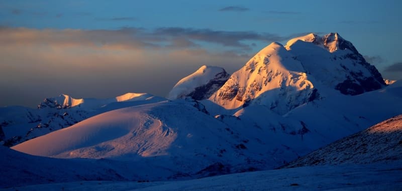
From the upper reaches of the Naryn River, the caravan went up the Chakyrkorum River and through the pass of the same name at an altitude of 3882.4 meters above sea level descended into the valley of the Karakol River, fording it to the left side and along the valley of the Karachukur River climbed through the Kubergenty Pass at an altitude of 3907.2 meters above sea level and reached the Kagalyachapi plateau
From the diary “Kashgar Diary. The summit of the Zaukinsky Pass”. Chokan Valikhanov. 1858:
“September 19. Kalmak-Ochak (20 miles). The terrain from Kelintaigan keeps rising. The road up the Kubergenty, the exit to the table land, about 15 in. in radius; round hills lie around. This place, one must assume, lies very high; the hills and gullies are covered with snow and therefore streams flow in all directions.
It serves as a watershed of the Naryn and Aksu system. One tributary of the Aksu flows to the south-east, the other to the west; our route goes along the latter. Along the left bank there are parallel snow-capped mountains of quite considerable size, along the right - the same.
We walked along the right bank and spent the night in the Kalmakochag tract. The path is good, only at the very ascent to the plateau on the right bank of the Kubergenty River there is a slope slippery from the snow: several camels and horses rolled down, but, however, remained alive.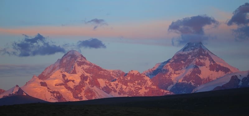
The ground is hard, it was even dusty. All these days the weather was clear, the winds are sharp and cold, and changeable, mostly south-westerly. They say that even in summer there are snowstorms here. The nights are terribly cold. It was warm up to 20 degrees, cold - up to 25.
The vegetation of Syrt is very poor: one kipets is visible, already yellowed, today there were yellow bushes of hellebore, from Kubergenty there is granite, whetstone, quartz; marble is not visible. There are an awful lot of rats, the whole crust of the earth is dug up with holes.
They say there are a lot of foxes and marmots. Wolves live - at night they attacked our rams. Judging by the skulls lying on the road (along Naryn), there must be a lot of argali here. Of the birds, crows, ducks and geese are visible, we also saw a vulture once."
Cartographic material for the Tien-Shan and in particular the Kokshaal-Too ridge was the forty-verst map of Turkestan published in 1913, but it did not reflect the essence of the region, only the two-verst military topographic survey of 1911 removed the veil of mystery from this corner of the Tien-Shan.
The planchette of this survey was used in the release of ten-verst maps in 1925, which N. Palgov actually used. On the map, in addition to the usual topographic details, the places of modern glaciation were indicated, and the glaciers were designated right up to the southern part of the cirques that fed them. The highest peaks and groups of large glaciers without names were indicated on the map.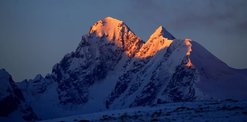
On July 23, 1913, the expedition of V.V. Sapozhnikov, the caravan from the upper reaches of Taragay descends down to Naryn through the Chakyrkorum pass, descends into the valley of the Karakol River and at the confluence of the Dzhagalmay with the Kara-chekur goes up a wide path leading to the Kubergenty pass into the valley of the eastern Aksai. Passing the Kubergenty pass, through the right tributary of the Kara-chekur they came out onto the Kagaliachap plateau.
From the diary of V.V. Sapozhnikov about visiting the Kagaliachap plateau "Explorations in Naryn River Valley". 1913.
"The plateau is closed from the south by the border ridge Kokshal with a number of snowy peaks, from which parallel glaciers creep. The plateau, without a noticeable watershed, bends to the west - to the upper reaches of the Eastern Aksai and to the east to the upper reaches of the Uzen-gegush River; one part of the glaciers gives water to Aksai, the other to Uzen-gegush.
Both rivers break through Kokshal and go to the borders of China. The plateau lies at an altitude of 3700 meters above sea level, and the glaciers located in the side valleys descend to an absolute height of 3860 meters. Depending on the altitude of the place, the climate here is very severe; in the middle of summer it often snows, and at night there are frosts (from July 23 to 24 my thermometer - minimum noted a drop to - 9.5).
The plateau is occupied by flat areas of dense clay, from which huge lonely boulders stick out here and there; the dense soil has cracked into characteristic polygons, which gives the entire surface the character of takyr. Lonely bushes stick out on the clay."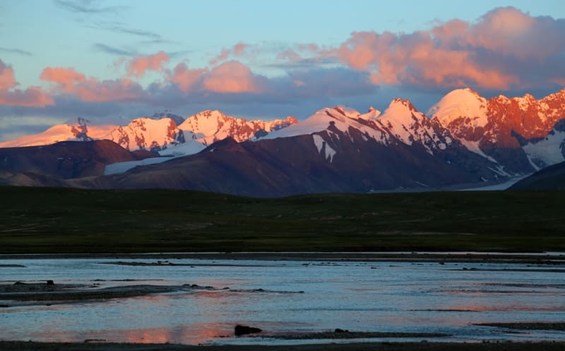
In summer of 1929, area was visited by surveyor Nikolai Nikitich Palgov, who from 1927 to 1930 worked in the Kyrgyz People's Commissariat for Land Relations and the Central Asian Department of Water Production. The goal of the famous researcher of the Tien-Shan glaciers was a compass survey and description of the glaciers of the Uzengegush and Eastern Aksai river basins.
Having started his small expedition with two accompanying people, Palgov reached the Kagaliachap plateau through the Kubergenty Pass, where the approaches to the glaciers of the northern slope of the Kokshaal-Too ridge began.
Narrative. N.N. Palgov about the work on studying the glaciers of the northern slope of the western part of the Kokshaal-Too ridge. "Along the Central Tien-han". 1929.
"Not so long ago, the central part of Kok-Shaal was a dark, unknown spot for geography. Venerable researchers of the Tien-Shan, who came close to it, still left it outside the sphere of their routes. The reason for this was not any special difficulties of advancement, but a certain remoteness of the region from the usual routes, which passed significantly to the side.
Due to such random circumstances, the idea of this part of the Tien Shan was vague and uncertain for a long time." N. Palgov began his first description with the Kyzylunet River, which belongs to the Eastern Aksai basin. In the upper reaches of the river there was a glacier, which N. Palgov named in honor of the vice-president of the USSR Academy of Sciences and scientific secretary of the State Russian Geographical Society V. L. Komarov.
The next study was the exploration of the upper reaches of the Kotur River, which N. Palgov calls Oto-Tash. He names the glacier that gives rise to the river in honor of the famous explorer of Central Asia D. I. Mushketov. N. Palgov, when examining the middle reaches of the Oto-Tash River on the Kagaliachap plateau, finds that the channel has two directions: one towards the Eastern Aksai River basin, the other towards the Uzengegush River basin.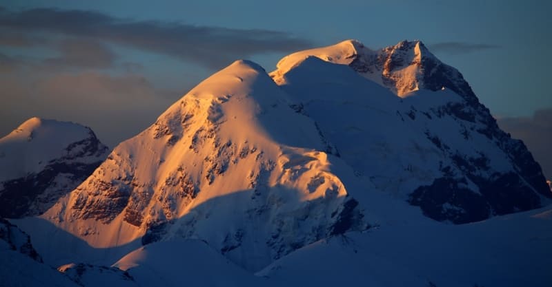
In the valley of the Aytala River, he described two glaciers: one that stood out with ice ridges, the other with waterfalls. The first one is named after the famous geologist D. V. Nalivkin, the second one - after the chairman of the Central Asian State Russian Geographical Society N. G. Malitsky.
The next glacier in the upper reaches of the Sarychat River, which was explored by N. Palgov and which was named in honor of academician A. E. Fersman, consists of three branches. Thus, 5 glaciers of the Uzengegush River basin were explored and described.
In 1933 (from August 1 to September 1), Avgust Andreevich Letavet organized and conducted the 3rd expedition to the Tien Shan to the Kokshaal-Too ridge. The detachment was organized by the Moscow House of Scientists. The detachment's route was as follows: Karakol - Pokrovka village - Djuuka pass - Arabel valley - Djetym pass - Kara-sai valley - Chakyr-korum pass - upper reaches of the Dzhe-galamay river - Kara-chukur river - Kubergenty pass - Kizil-unet (Komarova) glacier - Aytala river - Djurek-nar tract - Chon-uzengegush river.
Back through the Chakyr-korum pass - Tien-Shan observatory - Kashka-su pass - Pokrovka - Karakol. A. Letavet and V. Nemytsky explore three glaciers and give them names belonging to the Uzengegush river basin: Palgova and a glacier consisting of two branches - Grigorieva.
Short notes by A.A. Letavet about his stay in area of Kyzyl-Asker peak "In Central Tien-Shan". 1934.
"The glaciers of the upper reaches of the Ak-sai River flow down from Kok-Shaal-tau onto a wide plateau called the Kogalyachap ridge. The relief of this plateau-lake, huge boulders - reveals its glacial origin. Therefore, all the glaciers of the upper reaches of Ak-sai can be considered the remains of an ancient glacier, which in the last stage of retreat had the character of the glaciers of Alaska.
It is interesting to note that even now the main glacier of this area, Kizil-unet (Komarov glacier), has a similar character. It consists of three parallel branches, each of which has its own feeding area. Merging together, they form a grandiose stream 4 - 5 km wide. " A. Letavet, V. Nemytsky. "New data on glaciation in the Chakyr-Korum and Borkol ridges
In 1934, A.A. Letavet conducted another expedition to the Tien-Shan. As a result, the Uzengi-Gush group of the Kok-shaal-tau ridge was explored. An attempt was made to climb the highest point of the group, Krasnoarmeyets Peak. Alpinist Peak (Chonturasu group of peaks) was discovered.
Geographical coordinates of Kyzyl-Asker ice massif: N41°03'28 E77°22'27
Geographical coordinates of Dankov ice massif: N41°04'26 E77°41'22
Authority and photos by:
Alexander Petrov.