


![]()
You are here
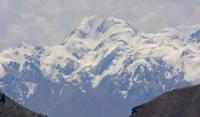
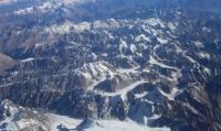
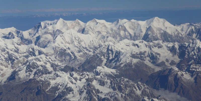
Ridge Kakshaal-Too.
Excursions in Kyrgyzstan.
“... From the pass, a wonderfully beautiful view of the Kok-shaal ridge opens up. Rarely where in the Tien Shan you can find such a picturesque and grandiose panorama. The Kokshaal-Too ridge faces the pass in this way. which is visible to the eye for a considerable distance along its length, directed from east to west. First of all, the viewer is struck by white sparkling colors, which break away from the dark foundation of the mountains in an even line and stretch out over a blue background with bizarre strokes. These are snows that have enveloped the ridge to the very foot. Winter tundra snatched from the polar country. The crest of the mountains is cut by deep gorges. It seems that each vertex is not connected to the other by anything. Pointed steep peaks soared upward, as if trying to get further away from each other. In the midst of a continuous snow shroud, bare sheer cliffs protrude, like terrible ulcers. Millions of centuries of hostile inaccessibility gravitate over lonely peaks. If it were not for these white clothes, then what gloom, preserved from the primitive days of the Earth, would have pressed from there from above onto the valley lying at the foot. But the severity of grandeur was softened by boundless eternal beauty. An inexhaustible variety of forms, bold wild curves, and the inconsistency of content for a long time chain the poor thought of a person.
N.N. Palgov. 1929.
Tours on SUVs on roads of Internal Tien-Shan.
Kakshal (Turkic word) - literal translation - dry wood, fallen forest, collected in the mountains for fuel, which is usually taken in bundles or taken by donkeys to the valley. Kakshaltau - mountains of fallen forests (X.X. Khasanov). The Kakshaal-Too Range is the southern border of the Inner Tien-Shan.
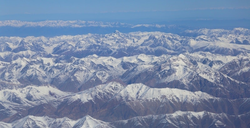
Kakshaal-Too (Kakshaaltau), a ridge in the Tien-Shan, in Kyrgyzstan, on the border with China. This territory belongs to two regions of Kyrgyzstan. Djety-Oguz district of Issyk-Kul region is located east of the Kotur gorge, and Atbashinsky district of the Naryn region to the west. It stretches from southwest to northeast for almost 400 kilometers, adjacent to the Meridian ridge.
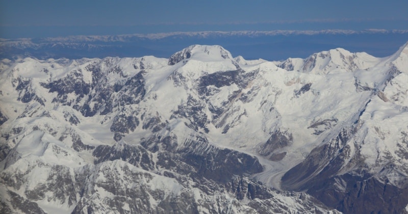
The highest altitudes: Pobeda Peak 7439 meters above sea level, Dankov Peak 5982 meters above sea level, Wesngyu-Kuush 5041 meters above sea level and others. The gorges of the Sary-Jaz, Chong-Uzengyu-Guush, Kakshaal-Too and other ridge are cut into 4 parts: Northern, Central, Latitudinal and Southern Kakshaal-Too.
In the northern part, the most significant are parallel to the south-west spurs of the Engilchek-Too and Kaindy ranges, each 100 km long, which are connected to the Kokshaal-Too Kuyukap pass, 5100 meters above sea level.
The highest points in the Engilchek-Too ridge are Shokalsky peak, 5722 meters high above sea level and Nansen peak, 5617 meters high.
The easiest way to cross is the Atjaylo Pass, 3,674 meters above sea level. The highest points of the Kaindy ridge are 5484 meters above sea level in the east and 5042 meters above sea level in the west. The easiest way to cross is the Uchat mountain pass chain, 3372 meters above sea level, Kara-Archa 3608 meters above sea level and Chichar, 3164 meters above sea level.
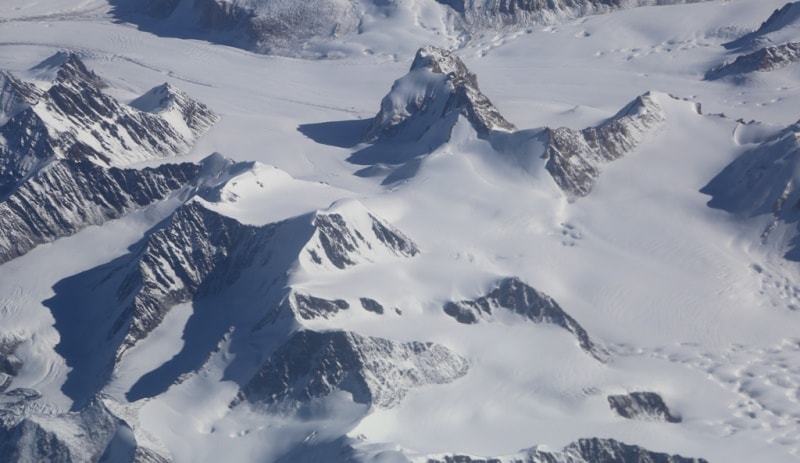
In the ridge Engilchek-Too about 30 passes. There are over 10 passes in the Kaindy Range. There are about 10 passes in the northern spurs of Kokshaal-Too. The northwestern slope of the Kokshaal-Too ridge has about 1000 glaciers with a total area of about 1,500 square kilometers.
On the northern slope of Kokshaal-Too and the northwest slopes, the Engilchek-Too and Kaindy ranges, there are about 300 glaciers with a total area of over 625 square kilometers. The Aksai glaciation site (153 glaciers with a total area of 443 square kilometers) is one of the largest in the Tien-Shan.
On the Central section, between the gorges of the Sary-Jaz and Chong-Uzyung-Kuush rivers, from Kokshaal-Too spurs extend more than 50 kilometers to the north-west. These spurs divide the valleys of the tributaries of the Ak-Shyyrak and Cholok-Kapchagay, Ishtyk, Karabel, Pickertyk, Kayche, Dzhangart.
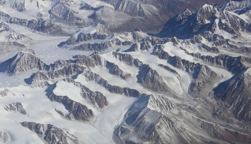
There are more than 200 glaciers with a total area of over 300 square kilometers. The most powerful glaciation is located on the Latitudinal section in the area of Dankov peak (over 450 glaciers with an area of more than 500 square kilometers.
The southwestern tip of the Kokshaal-Too ridge connects with the Torugart ridge, where the spurs Kokkiya and Sarybeles branch off Kokshaal-Too, carrying about 40 glaciers, mainly glaciers of flat tops and caravans, with a total area of about 70 square kilometers.
The snow line runs at altitudes from 3900 - 4300 meters above sea level. The vegetation of the alpine tundra is replaced by alpine meadows above 3,000 meters above sea level, nival and nival-glacial landscapes above 3,500 meters above sea level.
A characteristic feature of the ridge is a combination of alpine forms (many sheer walls with differences of 1,500 - 2,000 meters) with great snow and powerful glaciation. River valleys have a large absolute height of 3000 - 3500 meters above sea level.
Wetlands are often found up to heights of 4000 meters above sea level. The climate of the Kokshaal-Too ridge is severe. The average monthly summer temperature is 5 - 8 °, the average monthly rainfall is 20 - 30 mm. The weather is unstable. To the north of Kok-Shaal-Too, separated by Aksai syrts (altitude 3900 - 3800 meters above sea level) and the Chon-Uzengi-Kuush valley, the Borkolda ridge stretches from the south-west to the northeast (the highest point is 5170 meters above sea level ) - a complex, deeply dissected system of mountain ranges with a length of about 100 kilometers (glaciation of 250 square kilometers).
The vegetation is very sparse. Separate shrubs are found in the deep narrow gorges of the southern slope of the Borkoldoi ridge. Of the animal inhabitants: a lot of hares, marmots, argali and mountain goats, there are wolves, foxes and bears.
Geographic coordinates of Kakshaal-Too ridge: N41 ° 28'07.03 "E78 ° 33'41.85"
Authority:
Book "Soviet Encyclopedia". Climbing regions of Kyrgyzstan, guide, author Vladimir Komissarov. G. Bishkek, 2010.
Photos by
Alexander Petrov.