



You are here
Karategin ridge.

Photo tours in the mountains of Tajikistan.
“Traveling as the greatest and most serious science helps us to find ourselves again”
Albert Camus.
The mountain ranges of Pamir.
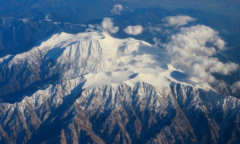
The Karategin ridge is a mountain range in the Pamirs in Tajikistan, the southern spur of the Gissar range. Located along the left bank of the Kafirnigan river in the Sughd region.
The length of the ridge is about 80 kilometers, the maximum height is 3950 m. a s. l. In the east, the ridge is bounded by the Yarkhich River Valley. Most peaks reach 4000 m. a s. l., more than 15 peaks - 4500 m. a s. l.; the highest point is 4600 m. a s. l.
It is divided by long and branched valleys with a length of 8 to 35 kilometers with a height difference of 2,000 to 3,900 m. a s. l. In the vicinity of the Takali mountain junction, the north-western slope is relatively steep, with the length of the valleys from 5 to 15 kilometers, the height difference is from 1800 to 3600 m. a s. l.
The southeastern slope is gentle, divided by valleys with a length of 15 to 25 kilometers with a difference in elevation of 1,500 to 3,600 m. a s. l. Significant spurs are distinguished - Ak-Tash (50 km long, 4300 m. a s. l.), Kobudkrym (30 kilometers long, 4200 m. a s. l.).
The ridge is composed mainly of granites. The lower part of the slopes is covered in places with woody and shrubby vegetation, there are areas of walnut forests, higher up are grassland steppes, subalpine and alpine meadows. Above 3800 - 4000 m. a s. l. - nival landscapes.
The height of the snow line on the northern slope is from 3800 to 4100 m. a s. l., on the south from 3400 to 4300 m. a s. l. The total area of glaciation of the Karategin ridge is about 100 sq. km. About 12 passes are known. The main approaches from the south from the valleys of the Vakhsh and Surkhob rivers.



Authority:
"Glaciers." L.D. Dolgushin, G.B. Osipova. Series "Nature of the world." 1989.
Photos by:
Alexander Petrov.