


![]()
Вы здесь
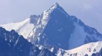
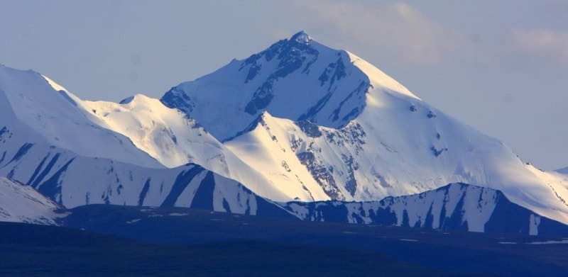
Sary-Djaz ridge. Kyrgyzstan
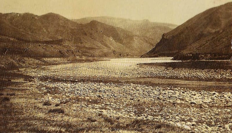
Trekkings in Sary-Djaz mountains.
"On this day, I wished to reach the sources of Sary-Jas, which originate from glaciers descending into a side valley of the Tian Shan. From the longitudinal valley of Sary-Jas, where we were, we had to first walk for about two more hours upstream along the river, and then, moving away from it and climbing up, cross a diagonal mountain ridge that the river flows around. After about three hours, we emerged back onto Sary-Jas, but in that upper part of its flow, where it had not yet exited the transverse valley into which its sources, originating from the glaciers descending from Tengri-Tag, flowed. I headed towards the one that seemed the largest to me and closed off the transverse valley, while I left to my right two very beautiful glaciers descending towards the southwest into a side valley that was three versts wide."
P. P. Semenov-Tyan-Shansky. "Journey to Tian Shan." 1856-1857.
Jeep tours in ridge of Sary-Djaz.
Sarydzhaz ridge is located as a mighty snow-covered barrier in mountains of Central Tien-Shan, 80 kilometers east of town of Karakol, in Aksu district of Issyk-Kul region in eastern Kyrgyzstan. The ridge is located between the Sary-Djaz river in the north and its left tributary of the Inylchek River in the south.
It adjoins the Meridional ridge on the western side in the area of the Marble Wall peak, 6146 meters above sea level. The Sary-Dzhaz ridge stretches in an arc from the southwest to the northeast and east, with a length of about 95 kilometers (throughout the territory of Kyrgyzstan) and a width of up to 16 kilometers.
The average height is 4370 meters above sea level, the highest point of the ridge is Semyonov peak 5816 meters above sea level, located in the eastern part of the Katta-Ashutor ridge. The height of the ridge in the western part reaches 4799 meters above sea level, to the west of this peak the ridge degrades quite quickly - the heights of the peaks drop sharply, snow cover and glaciation sharply decrease.
In the north, the Katta-Ashutor ridge connects the Sary-Djaz ridge with the Terskey-Ala-Too ridge. The continuation of Sary-Dzhaz are the Kyolyu-Too and Kyoluu-Too. The northern slopes are dissected by the tributaries of the Sary-Jaz River into spurs 10 - 15 kilometers long, the southern slopes fall steeply into the valley of the Enylchek River.
There are more than 20 peaks over 5000 meters above sea level in the ridge. From Ignatiev peak, 5488 meters above sea level, the Adyrtor ridge extends to the northwest, 28 kilometers long, with a dominant height of an unnamed peak 4654 meters above sea level, located in the eastern part of the ridge.
The northern arc is formed by the Sary-Dzhaz ridge, which separates the valley of the Northern Inylchek glacier from the Tekesa River basin (the upper reaches of the Bayankol River) and the upper reaches of the Sary-Dzhaz River. The northern slope of the Sary-Dzhaz ridge is covered with an ice shell to the very foot; all saddles of the ridge, starting from the easternmost (under the peak of Karly-Tau and the Karly-Tau pass) are extremely difficult to access.
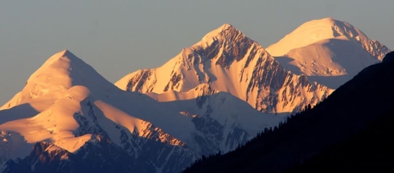
The southern slope of the ridge also has powerful glaciation, numerous side tributaries of the Northern Inylchek glacier, falling from the southern side of the Sarydzhas ridge have a sharp drop and, as a rule, are torn apart by icefalls. About 40 passes are known in the Sary-Dzhaz ridge and the Adyrtor spur. From the northern ridge of the Sary-Dzhaz ridge, at its junction with the upper reaches of the Turuk gorge, located on the northern slope of the Terskey Ala-Too ridge, a panorama of the Khan-Tengri peak, 6995 meters above sea level, opens up.
At the confluence of the Northern Inylchek glacier and South Inychek glaciers, there is a high-mountain lake Mertsbakher. located at an altitude of 3321 meters above sea level. The ridge is composed of metamorphic schists, marbled limestones, and granites.
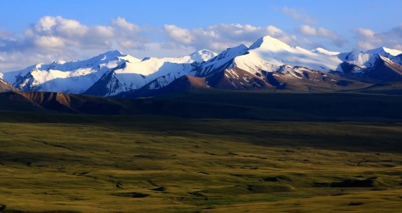
Starting from an altitude of 3000 meters above sea level, perennial frozen rocks are widespread. On the slopes there are high-mountain steppes and tundra, there are small forests of Tien-Shan spruce. The Sarydzhaz ridge is characterized by strong glaciation of the slopes of the northern exposure, the southern slopes have a less powerful, but rather developed glaciation.
On the northern slope are the Semeonov and Mushketov glaciers, at the foot of the southern slope is the Northern Inylchek glacier. The total area of glaciation is more than 525 square kilometers, over 300 glaciers. On the southern slopes there are over 20 short tributaries of the Northern Inylchek glacier and about 20 independent glaciers.
Geographical coordinates of Sarydzhaz ridge: N42°14'37 E79°37'05


Authority:
Big Soviet encyclopedia.
Alexander Petrov.
Photos by:
Alexander Petrov.