


![]()
Вы здесь
Fany Mountains.
Tours to Fany Mountains.
“Mountains seem to answer an increasing imaginative need in the West. More and more people are discovering a desire for them, and a powerful solace in them. At bottom, mountains, like all wildernesses, challenge our complacent conviction - so easy to lapse into - that the world has been made for humans by humans. Most of us exist for most of the time in worlds which are humanly arranged, themed and controlled. One forgets that there are environments which do not respond to the flick of a switch or the twist of a dial, and which have their own rhythms and orders of existence. Mountains correct this amnesia. By speaking of greater forces than we can possibly invoke, and by confronting us with greater spans of time than we can possibly envisage, mountains refute our excessive trust in the man-made. They pose profound questions about our durability and the importance of our schemes. They induce, I suppose, a modesty in us”
Robert MacFarlane. «Mountains of the Mind: Adventures in Reaching the Summit».
Walk in Fany Mountains.
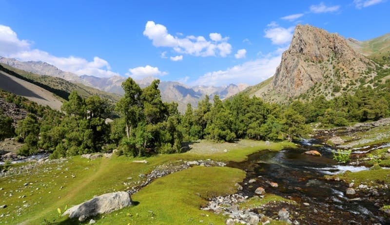
From the central knot of the Pamir two long, раrallel ranges head in а straight westerly tangent for Samarkand. Both аге spectacular by European standards, with countless peaks over 5000 m. Both аге almost unknown outside the CIS but popular among climbers and walkers inside it.
The road to Pendjakent climbs beside the Zerafshan River between the two ranges; the Turkestan to the north and the Zerafshan to the south. The Fan Mountains are a popular tourist destination situated in north-west Tajikistan.
The Fan Mountains area is convenient for visiting. A paved road from Dushanbe going to the largest Pamir-Alai lake - lake Iskanderkul - leads to this place via the Anzob Pass 3372 meters above sea level. Another paved road runs from Panjakent.
One more road from Khujand runs through Istravshan (formerly Uroteppa) and the Shahriston Pass 3351 meters above sea level. The Fany Mountains area road system includes both paved and unpaved roads. The area is ideal for organizing hiking tours lasting several days.
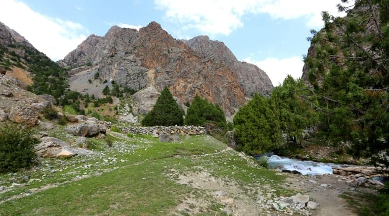
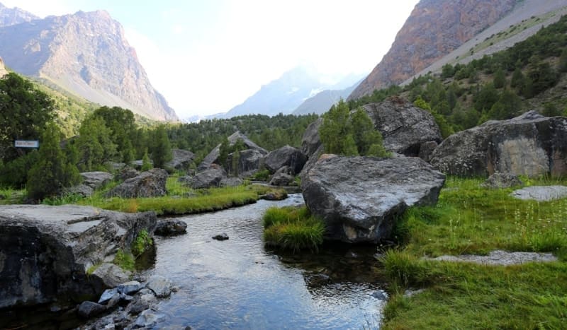
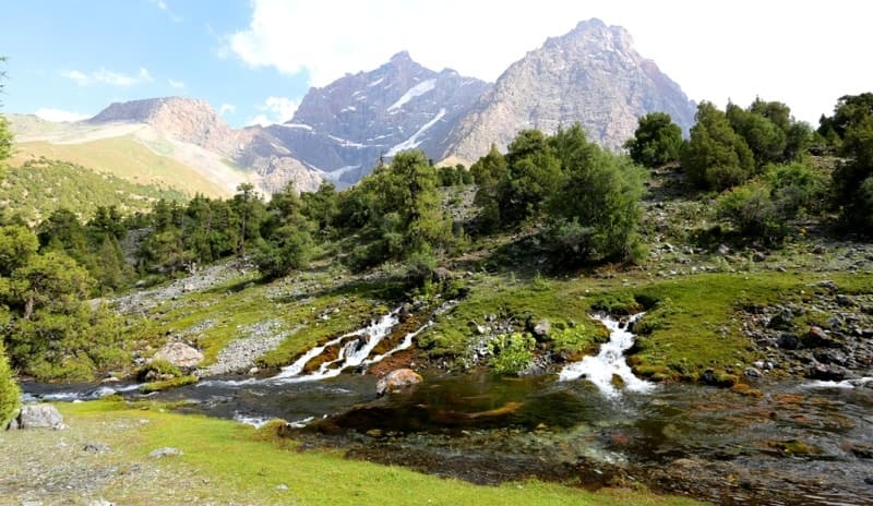
Going from one valley to another, from one beautiful lake to another no less stunning, via numerous rocky outcrops with occasional hanging glaciers, tourists can't help but recognize the fantastic environment through which they are travelling.
Among the most beautiful and interesting peaks (from a mountaineer's point of view) are Chapdara 5050 meters above sea level, Bodkhona 5138 meters above sea level, Zamok 5070 meters above sea level, Maria 4970 meters above sea level, Mirali 5120 meters above sea level, and Zindon 4800 meters above sea level.
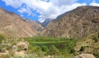
Both the good and the ordinary routes on the south and west sides of Chimtarga 548 meters above sea level, the highest peak of Fan Mountains, lead to its top. Besides the high peaks and narrow valleys with their noisy streams, which are typical for the Fany Mountains, there are also about 30 clear lakes of a variety of colours.
To the south of the main range is Lake Iskanderkul - 2.5 km in length, 1 km wide, and about 72 m deep, at an altitude of 2,255 meters above sea level - on the shores of which a hostel with the same name is situated. Apparently this lake came into existence several thousand years ago as the result of a landslide.
The water in the lake is bluish-green, slightly turbid and very cold, so only the bravest dare swim there. From the north the Serima River flows into the lake, from the west, the Saritag River (with the larg est volume of water), and from the south, Hazor-Mech River.
Only one river, Iskandar-Darya, flows out of the lake. It has a waterfall which cannot be seen from the road and one has to come close to it to enjoy its charming beauty. There are almost no fish in the lake because of the concentration of minerals in it.
Only small loach (similar to catfish) survive in such water. Next to the lake is Chulboi Mountain 3358 meters above sea level, also known as Dozhdemernaya (Rain Gauge) Mountain. It was called this after a precipitation gauge was set up near the mountain top.
There are good paths leading to the top, which is flat and covered with grass. A panoramic view of Lake Iskandarkul and its vicinity is visible from there. Iskandarkul's flora is not particularly abundant but it is exceptionally diverse.
You will come across forest, steppe, meadow and high mountain flora (everything from apricot-trees to moss and lichens) there. Near the lake one can sometimes see rabbits, foxes, wolves, red marmots, black and brown bears, mountain goats and their companions - palang (snow leopards) and other animals.
As for birds, mountain turkeys (snow cocks), stone partridges, griffons, and quails are also found here. Many legends are connected with Iskandarkul. According to one of them, Alexander the Great, during his march to India, reached the lake and camped on its shores.
After a very hard march through the mountains, his favorite horse became sick after drinking water from the lake. He did not wait for it to recover and continued his march, leaving the horse with several soldiers on the lake shore to recover.
After a short time the horse recovered, but one day it suddenly behaved strangely and threw itself into the lake and sank to the bottom. Now, during full moon, it is possible to see a white-manned horse coming out of the lake, which grazes and plays in nearby meadows all night long, then at dawn returns to the lake depths.
According to local legend, Alexander's horse went to the bottom of the lake, anticipating the death of its master, who fell ill and died on the way back from India. Unlike Iskanderkul, the Bolshoi (Greater) Allo Lake 3360 meters above sea level in the Zindon Valley was formed relatively recently.
In 1916 there was a large rockfall from the southern slopes of the main range which blocked the valley. The dam was formed from ancient moraines blocked by this mighty landslide. "Allo" in Tajik means "echo". On the right and left sides of the lake are sheer cliffs, on the north, scattered giant blocks and on the south is a bottle-neck, where the Levy (Left) Zindon River winds its way over the slippery rocks.
It is possible to see rare flowers such as edelweiss (Leontopodium alpinum) near the lake. On its left shore the vegetation ends and further afield a stone desert begins, resting on the cliffs of Moscow Peak (H-5183).
The Lake is also near other peaks over 5,000 meters above sea level - Mirali, Chimtarga, and Energiya. To the north, where glaciers once lay, is Lake Kulikalon and its neighbours - Chukurak, Ziyorat, Bibi-Jannat, Dushoha as well as the popular Alauddin lakes 2700 meters above sea level with a mountaineer's base.
Lake Kulikalon (big Lake) is situated at an altitude of 2,800 meters above sea level, and is the second largest lake (after Iskandarkul) in this area. The lake actually consists of two lakes: Bolshoi (large) Kulikalon and Maly (smaller) Kulikalon, which are connected by a channel.
The northern shore of the lake is indented with large and small creeks separated by capes and crevices. The lake shores are wooded. The water from Maly Kulikalon goes underground and emerges again 600 meters above sea level below as the Urech River.
The water at the southern end of Bolshoi Lake is noticeably cooler than at the northern end where it is possible to swim. Its colour also changes near the shores. It looks as if the black bodies of dead animals lie motionless in the bluish-green water.
There are marinka (Schizothorax) fish in the lake. There is a good trail along the lake's western shore but the eastern shore is difficult to traverse due to rock falls. Over the Bolshoi Lake there are abandoned fluorite quarries in which it is possible to find beautiful gemstones.
The Alauddin Lakes are a group of reservoirs upstream in the Pasrud valley. All the lakes are situated on the steps of ancient and modern moraines. Pure, clear water pours from one step into another and the level of water in the lake remains constant.
There are no fish in the lakes. Only the most experienced and adventurous will bathe in the water for any length of time since it is very cold. It is possible to set up a base camp not far from the astonishingly blue Alauddin lake.
Along all of its shores there are juniper forests and the reddish 2 km-long Chap-dara Wall overlooks the splendour below and its large rock falls. If you climb the Alauddin Lakes Pass then you will see the lake in all the various shades of blue: from light-blue near the shore to dark-blue in the middle with clear borders separating the various shades.
Higher up the Chapdara River there is a beautiful view of the valley with its majestic rocky bulwarks on both sides. The Chapdara Wall faces north-west and hence reflects an astonishing gold colour during sunset.
On the opposite side of the valley is the Adamtash (Stone Man) 4940 meters above sea level massif with vertical bulwarks on its north-west face. From the mountaineers camp a route leads along the northern ridge directly to the top.
If you climb up from the lakes along the valley then within two hours you will reach the beautiful Mutnye (Muddy) Lakes 3490 meters above sea level, located in the circle between the slopes of two mountains - on the western side Zamok and on the eastern Chimtarga.
The vertical bulwarks of Bodkhona and then Zamok, riding one after another, appear to your left as you cover the two last steep ascents. The north-eastern Chapdara Wall rises from a side valley located a lot lower than the base camp.
This is a 1500 m, almost vertical, smooth, rocky cliff-face. It ends with a huge semicircle and opens up the to the whole Fan Mountains region - a wonderful sight for those who have braved the 10- 12 long hours of snaking mountain roads built along the tops of cliffs hundreds of meters deep.
A very pretty view begins at the Kaznok Pass 4000 meters above sea level on the incredible south and west cliffs of Chimtarga Peak with a formidable sub-peak bulwark, through which a number of complex rocky routes run in parallel.
Mutnye Lakes is a good base camp from which to attempt these cliffs. There is no vegetation in the lakes area; all that exists is rubble. The grand northern cliffs of the Adamtash (with a 1,000 m cliff-face), Maria and Mirali (with 1,500m cliff-faces) enclose the valley, hanging over the scenic Dush-okha Lake each with its formidable magnificence.
There are actually two lakes - the Upper and the Lower with a narrow strip of land between them. The two-hour climb up from Lake Kulikalon will take you to the grand northern cliff of Maria Peak, which has a complex combination of routes and its own cold microclimate with a cliff-face of more than 1,500m.
Alauddin Peak 4237 meters above sea level, rising to the west of the Alauddin lakes, serves as a good point from which to view the area and can also be used for the first part of the climb from Alauddin Pass 3730 meters above sea level.
It is practical to camp here overnight to acclimatize (it is 2-3 hours walk from the lakes). The Pravy (Right) Zindon Valley, the northern cliff of Zindon Peak ("Prison Peak") 4800 meters above sea level, encloses the surrounding area, making the scenery gloomy.
The 1 km vertical cliff with an ice "ceiling" at the top can be very intimidating. Climbing becomes hard here since the rocks are always damp - water flowing down leaves black marks on the cliff. Before it turns south and over the Anzob Pass 3373 meters above sea level to Dushanbe, innumerable tracks lead off it towards the foothill villages and high pastures of the Fan Mountains, the highest and most beautiful in the Zerafshan range. In normal times any of these could be the start of an epic adventure.
Geographic coordinates of Fany Mountains (Zeravshan Range): N39 ° 14'43.01 "E68 ° 11'22.40"
Authority:
Books of: "Mountain Fanye". Authors A.S. Mukhin, V.F. Gusev: «Nature of Tajikistan » publishing house " Idea ", 1982: Pavel Luknitsky.” Travel across Pamir”, «Molodaya guards », 1955: "Pamir", publishing house " Planet " 1987, under edition of membercorrespondent AN the USSR M.S. Asimova.
Photos by
Alexander Petrov.