


![]()
You are here
Aksay Horseshoe spur in Zailiysky Alatau.

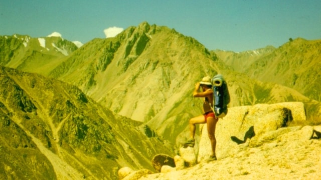
Climbing peaks in Zailiysky Alatau.
“Among the continuous snowy shroud, bare sheer cliffs protrude, like terrible ulcers. Millions of centuries of hostile inaccessibility gravitate over lonely peaks. If it were not for these white clothes, then what gloom, preserved from the primeval days of the earth, would have pressed from there from above on the valley lying at the foot. But the severity of grandeur was softened by boundless eternal beauty. An inexhaustible variety of forms, bold wild curves, and the inconsistency of content for a long time chain the poor thought of man. These are not tedious hours of everyday life, where a boring petty life is repeated with regular accuracy, but a powerful uplift of spirit, a dismissive indifference to what is too, too ordinary.
N. N. Palgov, In the Central Tien-Shan.
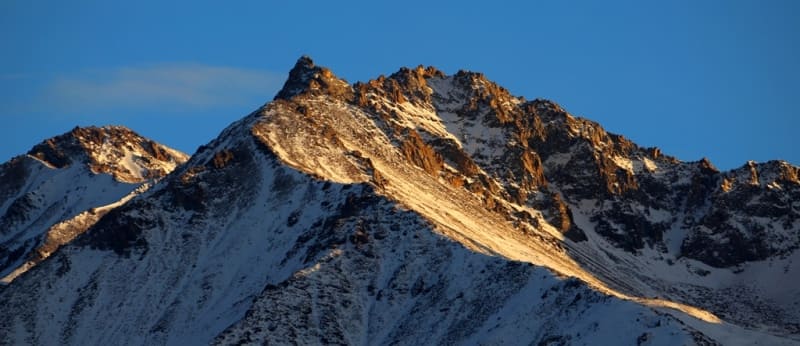
Peaks in Zailiysky Alatau.
Aksai Horseshoe Spur is located at an altitude of 3852.7 (Zhalpak or Kaskelen Peak to 4085.5 (Peak Mira) meters above sea level. It is located in latitudinal ridge of Kaskelan Spur between sources of Pravyi Kaskelen River and Levyi Aksai River in eastern part of spur, on northern slope of Zailiyskiy Alatau ridge in Karasai district of Almaty region.
The Aksai Spur is a horseshoe-shaped mountain region between the Aksai and Kaskelen gorges. It is located 33 kilometers southwest of Almaty. The state border between the Kyrgyz Republic and the Republic of Kazakhstan runs south of the spur along the main ridge of the Zailiyskiy Alatau ridge.
There are high mountain passes of the ridge and the Kaskelen Spur at an altitude of over 4000 meters. above sea level up to 2A category of difficulty. The horseshoe stretches from west to east and northeast for 13 kilometers. The horseshoe begins from the peak of Zhalpak or Kaskelen with a height of 3852.7 meters above sea level, including the peak of Mir in the spur with a height of 4085.5 meters above sea level.
Between the southern spurs of the Aksai horseshoe and the inner spur, which is located between the main ridge of the Zailiysky Alatau ridge, there are two small glaciers: Zhalpak with a length of 1.7 kilometers and Ostry with a length of 1.2 kilometers.
At the head of the glaciers in the ridge of the spur is the peak of Zhalpak with a height of 4198.2 meters above sea level. On the northern side of the Aksai horseshoe spur there are three minor glaciations, one of which is the easternmost glacier Kraevedov with a length of 1.1 kilometers.
In the northeastern part on the northern slope there are four moraine lakes: Lower Kazachka at an altitude of 3,217 meters above sea level, Upper Kazachka (Egizkol) at an altitude of 3,314 meters above sea level, Lower Aksayskoye at an altitude of 3,309 meters above sea level and Upper Aksayskoye at an altitude of 3,361 meters above sea level.
The glaciers form the mountain rivers Aksay and Kaskelen. Passing the Shnitnikov Pass, the ridge of the spur comes to the Gorbunov peak at an altitude of 4,023 meters above sea level. Soon the spur sharply turns to the west and branches.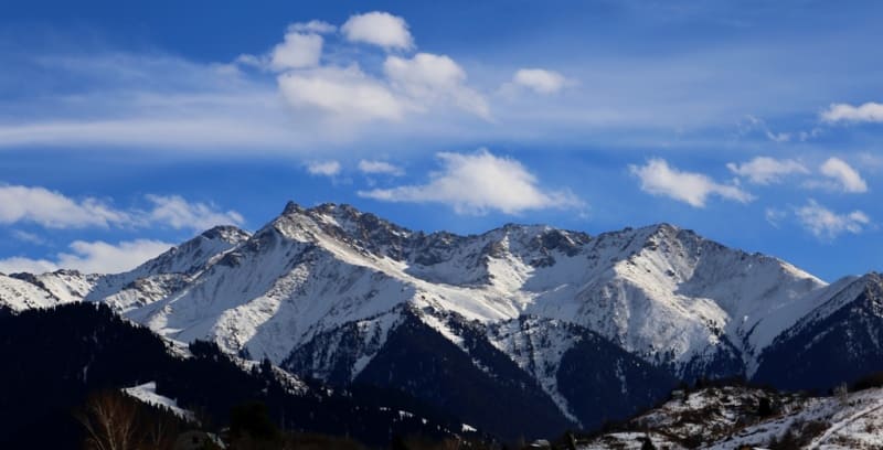
At the place of the branch is the Kraevedov glacier, which descends from the northern slope of the Gorbunov peak and flows around the mountain range in which the Mir peak is located at an altitude of 4,085.5 meters above sea level. Its main branch stretches in a northerly direction passing the Mezhozerny Pass, the Pogranichnik peak at an altitude of 3,824 meters above sea level and further through the Uchebny Pass at an altitude of 3,470 meters above sea level.
The second branch also goes north, separating the western source of the Left Aksai from the eastern.
In the book by V.I. Stepanova "Peaks of Zailiyskiy Alatau" there is a description of the passage of the traverse of the Aksai horseshoe through 14 peaks.
First passage of peaks of Aksai horseshoe.
1958. In March, for the first time, the traverse of the Aksai horseshoe was completed by a group of Almaty climbers under the leadership of B.A. Studenin.
Geographic coordinates of Aksai horseshoe: N42°58'31 E76°42'32
Authority and photos by:
Alexander Petrov.