


![]()
You are here
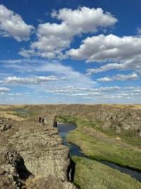
Canyon Bestobe (Silety).
Natural attractions of Akmola region.
“Travel is a book. Only those who can read between the lines of observed life can read it. The one who is looking for the original, the exotic, is set "poetically", inevitably falls into error, because in normal conditions of life he is looking for the abnormal.”
EM. Murzaev.
Nature of Selety canyon.
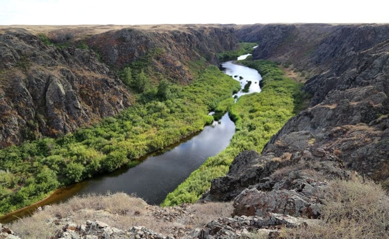
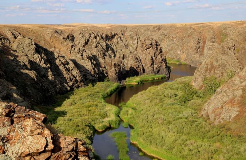
Bestobe or Siletinskiy Canyon is located at an altitude of 164 to 177 m. a. s. l., located on Silety River, between villages of Siletinskoye and Izobilnoye, in urban territory of Stepnogorsk akimat and Yereymentau district in north-east of Akmola region.
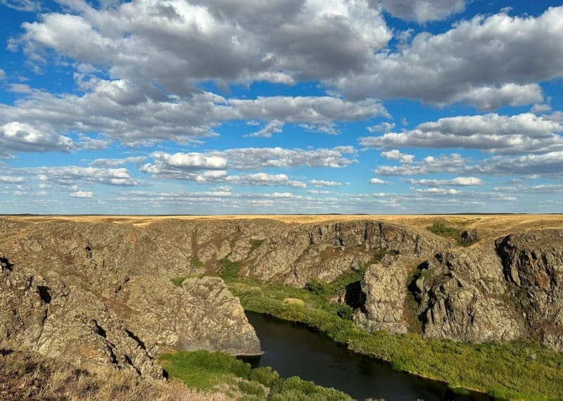
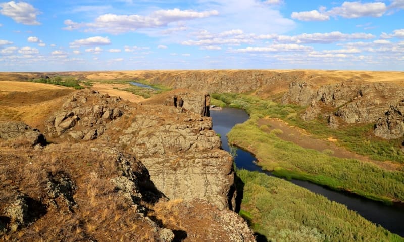
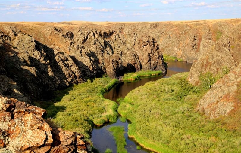
The Siletinsky Canyon stretches for 26 kilometers; it is the most interesting part of the river mountain valley with steep, steep and sometimes inaccessible slopes and a narrow bottom occupied by the river bed. The canyon was formed in the process of weathering and erosive activity of the river, including the erosion of rock in the massif by the river.
A great diversity is brought in by the trees growing along the bottom of the canyon: willows, poplars and shrubs; in some places, in the depressions there are lakes through which a small stream flows. The canyon begins at an altitude of 117 meters above sea level, 11 kilometers southeast of the village of Bestobe.
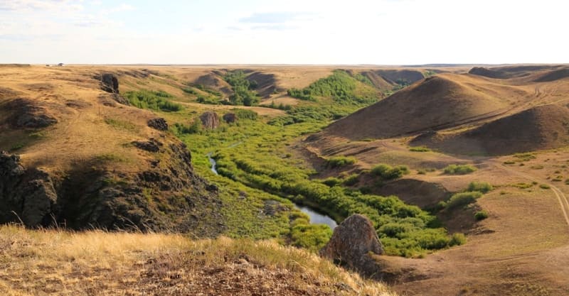
The canyon ends at an altitude of 191 m. a. s. l. at the beginning of the Siletinsky reservoir. 30 kilometers southwest from the beginning of the canyon there is the 35-kilometer-long Siletinsky reservoir, a dam and the village of Seletinsky (formerly the village of Sladkovodsky 1910-2007).
The length of the Silety River is 416 kilometers and the river has cut 26 kilometers into the river valley, a unique natural object that complements the variety of tourist attractions of the Akmola region. The sources of the Seleta River are located at an altitude of 426 m. a. s. l., east of the Popovsky Liman valley, 7 kilometers northeast of the village of Bozaigyr, (former village of Elizavetinka) located in the Shortandinsky district of the Akmola region, southeast of the Seletinsky reservoir in the Kazakh small hills.
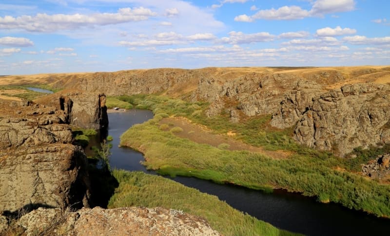
In the eastern part of the Kazakh small hills, in the southeast of the Siletinsky canyon, the Koitas and Karatumsyk mountains are located. Their northwestern slopes served to form the grandest part of the canyon. Among the semi-desert, endless steppe, a rare geological phenomenon suddenly appears - a section of the earth's surface.
It should be noted that on this terrain with gentle slopes, the analogue of a gorge is a valley between hills or mountains; accordingly, the concept of a canyon in this case is not entirely suitable for defining the topography of a river valley.
Geographical coordinates of Bestobe Canyon (Silety): N52°23'05 E73°03'01
Geographical coordinates of beginning of Bestobe canyon (Silety): N52°26'40 E73°13'44
Geographical coordinates of end of Bestobe canyon (Silety): N52°08'57 E72°44'19
Authority and photos by:
Alexander Petrov.