You are here
Glaciers of Darvaz.

Popular destinations Pamir mountains.
“Separating the two valleys,
Plunging in height
He lies at the feet of the summit,
Perched on the ridge
I would never know peace
He walked around half the country,
o touch your hand
To his blueness"
Yuri Vizbor. December 1954.
Backpacker in Tajikistan.
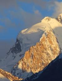
Upper limit of Darvaz glacier is located at an altitude of 5209 meters above sea level, end of glacier is located at an altitude of 3851 meters above sea level. Upper reaches of glacier are located on northern slope of Darvaz ridge, southwestern part of glacier lies on southeastern slope of Dar-Kharvak ridge, 23 kilometers long, in Sangvor region of Republic of Tajikistan.
The Darvaz glacier, the largest in the middle part of the Darvaz ridge, lies in a deep narrow valley between the Dar Kharvak ridge and the spur of the Arnawad massif. Several small tributaries form at the crests of the surrounding ridges. The significant right branch of the glacier is fed by runoff from the Arnavad plateau.
A small river, 3.3 kilometers long, flows from the glacier, which is the first, left tributary of the Obi-Mazor River. In the upper reaches of the eastern part of the glacier lies the Arnavad pass, 4556 meters above sea level. The length of the Darvaz glacier is 16.2 kilometers, the glacier area is 27.8 square kilometers - a complex valley glacier, the main trunk of which is formed from 5 small streams starting on steep slopes in the upper reaches of the valleys.
The feeding area of its large right tributary connects with the firn region of the Sed glacier on the southern slope of the ridge, and the tongue flows along a narrow steep valley and is broken by cracks almost to the confluence with the main glacier.
The tongue is sheathed, hilly and broken by thermokarst sinkholes.
Geographic coordinates of Darvaz glacier: N38°31'48 E71°30'11
Authority:
"Glaciers." L.D. Dolgushin, G.B. Osipova. Series "Nature of the world." Moscow, the publishing house "Thought". 1989.
Photos by
Alexander Petrov.


