


![]()
You are here
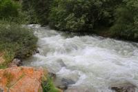
Juku River.
Description of rivers in Juku Gorge.
"Some of the Karakirghiz guides called the river, which we decided to ascend and which, according to their stories, flowed higher through two lakes, Kashka-su, and others - Zauka. Which of the two names was more correct - remained unknown to me."
P. P. Semenov-Tyan-Shansky. "Journey to Tien-Shan". 1856 - 1857.
"Soon the river widens into a second smaller lake with almost transparent water. Soon juniper appears, and then a spruce forest along the right northern slope. From here the Juuku Valley, stretching to the northeast, is very picturesque. Its right slope, partly wooded, is covered with dense turf of a low meadow, and the left is dry - with lonely bushes of dry grasses."
V.V. Sapozhnikov. "Research in Naryn River Valley." 1913.
Interesting places in Juku Gorge.
Juku River is located in eponymous gorge on northern slope of Terskey Ala-Too ridge, between valleys of the Kichi-Kyzyl-Suu River in east and Barskoon River in west in Jety-Oguz district of Issyk-Kul region.
Juku River, 64 kilometers long, is one of the significant waterways of the southern slope of the Terskey Ala-Too ridge in Kyrgyzstan. It originates at an altitude of about 3800 meters above sea level, in the zone of glacier melting, and flows through picturesque mountain valleys, forming unique natural landscapes.
Juku River is fed by glacial and snow waters, which makes it full-flowing and turbulent, especially in the summer. It flows through a deep gorge of the same name and alpine meadows, forming cascades and small waterfalls, and then flows into Lake Issyk-Kul.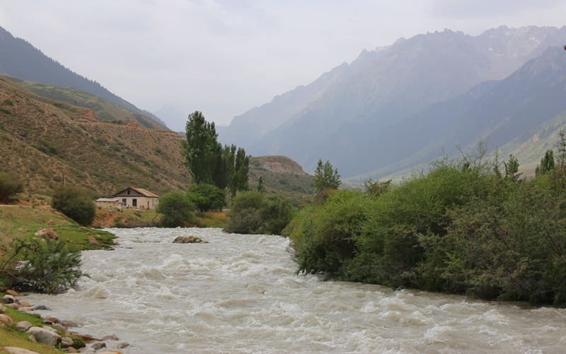
Juku River plays an important role in maintaining the region's ecosystem. Its waters are used to irrigate pastures, and also provide life for many species of flora and fauna. Along the river you can find coniferous forests, alpine meadows and rare endemic plants. Mountain fish live in its waters, and in the surrounding area you can meet snow leopards, argali and other wild animals.
Tourism and active recreation on Juku River.
The Juku River attracts tourists and lovers of active recreation. Along it there are routes for trekking, mountaineering and horse riding. Especially popular are hikes to glaciers, lakes and passes, from where stunning views of the Terskey Ala-Too ridge and Lake Issyk-Kul open up.
Juku River is not only an important waterway of the region, but also a unique natural site that attracts travelers and researchers. Its tributaries, glacial feeding and picturesque surroundings make it one of the most interesting places for study and tourism in Kyrgyzstan.
In western spur, in upper reaches of Dzhuku River, there is a fresh, moraine lake Dzhuku West, located at an altitude of 3820 meters above sea level,
At 4.5 kilometers from the beginning of the sources, the Juku River flows into Lake Juku Upper Dugloromo.
After the lake, for 1.5 kilometers, the river flows under the rubble of the moraine and only at 6 kilometers appears on the surface of the gorge.
After 5.5 kilometers from the beginning of the sources, the Juku River flows into Lake Juku North.
Left tributaries of Juku River.
Dungurome River.
After 10 kilometers from the beginning of the sources, the full-flowing tributary of the Dungurome, 9.8 kilometers long, flows into the Juku River from the left. The river originates from the eastern side of the pass of the same name at an altitude of 3773 meters above sea level. In the riverbed there are three powerful moraines that block the path of its waters.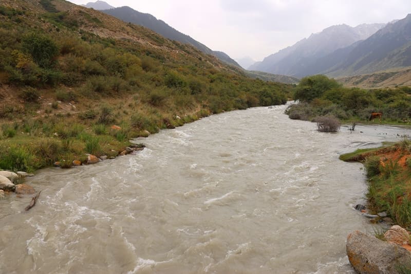
The river goes under the rubble and there it makes passages. From the northern slope of the gorge, Dungurome receives 6 powerful tributaries that flow down from the glaciers. The mouth of the river is located at an altitude of 2925 meters above sea level.
Geographical coordinates of Dungurome River: N41 ° 59'38 E77 ° 48'16
Tomon-Kashkasu River.
After 38.6 kilometers from the beginning of the sources, the low-flow tributary of Tomon-Kashkasu flows into the Dzhuku River from the left, 5.6 kilometers long. The source of the river is on the eastern slope of the Dzhuku gorge at an altitude of 3497 meters above sea level, the mouth of the river is located at an altitude of 2115 meters above sea level.
Geographic coordinates of Tomon-Kashkasu River: N42°10'58 E77°55'59
Right tributaries of Dzhuku River.
Ashu-Kashka-Su River.
27.4 kilometers from the beginning of its sources, the Ashu-Kashka-Su tributary, 10.8 kilometers long, flows into the Dzhuku River from the right. The river begins its sources from the northern slope of the Kashkasu Pass, 3891 meters above sea level, which is located in the main ridge of the Terskey Ala-Too Range. The mouth of the river is located at an altitude of 2502 meters above sea level.
Geographical coordinates of Ashu-Kashka-Su River: N42°04'57 E78°01'40
Ittysh River.
23.5 kilometers from the beginning of its sources, the Ittysh tributary, 5.2 kilometers long, flows into the Dzhuka River from the right. The river's sources begin in the eastern part of the Ittysh glacier, 3.7 kilometers long, the greatest width in the central part reaches 1.6 kilometers.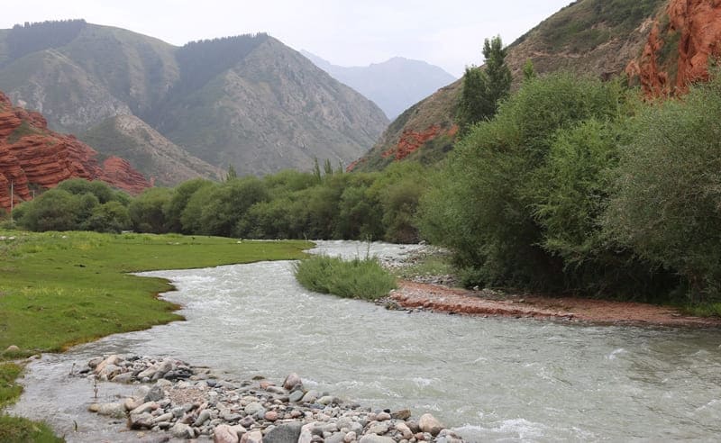
The area of the glacier is 5.76 square kilometers, the perimeter is 14 kilometers. The upper boundary of the glacier is located at an altitude of 4808.1 (Ittish summit) meters above sea level. To the north of the Ittish glacier, a serpentine glacier 1.5 kilometers long separates along a deep and narrow gorge.
From the glacier to the east and further north there is a moraine 1.5 kilometers long and up to 800 meters wide, at the end of the moraine there is a small glacial lake. In the southwest, behind the main ridge on the southern side of the Terskey Ala-Too ridge, there is the Popov glacier 5.3 kilometers long.
Geographical coordinates of Ittish glacier: N42 ° 00'50 E77 ° 57'14
Geographical coordinates of Ittish River: N42 ° 03'20 E77 ° 57'05
Dzhukuchak River.
"By the evening of August 6, we reached the customs picket near the mouth of the Djuukuchak River, marked by powerful walls of red Khangai deposits. Even near Dakuukuchak, grain fields appeared at an altitude of more than 2,100 meters above sea level."
V.V. Sapozhnikov. "Explorations in Naryn River Valley." 1913.
"It must be said that the route along the Djuukuchak River is generally quite difficult. Frequent steep climbs and descents, long detours to cross transverse sais, frequent crossings over the sometimes extremely turbulent river present significant difficulties for movement. In places, the trail disappears completely, and you have to move along the rocky bed of a fast stream, sometimes repacking, since pack animals are not able to move with normal packs."
L.K. Davydov "Petrov Glacier", 1925.
"The Zaukshak Pass from the south is easy to climb. The road goes along the glacier on moraines. The descent is very unpleasant; first along the moraine, then on cracked ice, then on a giant terminal moraine, between huge boulders, on slippery, narrow paths. This is the most unpleasant of all the passes I have visited. Kuilyu is passable only for horsemen; Bedel and for camels (although for the latter it is difficult); Zaukshak is difficult for horses too."
A.N. Krasnov. "Experience of history of development of flora of southern part of eastern Tien-Shan" 1886.
After 42.7 kilometers from the beginning of the sources, the Dzhukuchak tributary flows into the Dzhuku River from the right, 23.5 kilometers long. The river originates from the south-eastern side of the Dzhukuchak Pass, 4,042 meters above sea level, from the southern part of the glacier of the same name, 2.2 kilometers long.
The Dzhukuchak Glacier has two parts of isolated glaciers. The main part descends from the pass saddle down the gorge. In the right, side gorge of the western part there is another small glacier 2 kilometers long. The total area of glaciers is 2.37 square kilometers, the perimeter reaches 11.47 kilometers.
The upper boundary of the glaciers is located at an altitude of 4,042 and 4,452 meters above sea level. The moraine of the glacier with small lakes stretches almost 2 kilometers down the gorge. The tongues of the glaciers are located at an altitude of 3,840 meters above sea level.
Natural and tourist attractions in the Dzhukuchak Gorge. At 5.3 kilometers from the mouth of the Dzhukuchak River up the gorge of the same name at an altitude of 2198 meters above sea level there are hot radon springs in the open air and indoors, with the presence of hydrogen sulfide, the water temperature reaches + 34 degrees.
At 1.8 kilometers from the hot springs, up the Dzhukuchak gorge in the left side gorge at an altitude of 2339 meters above sea level there is a waterfall, which is especially attractive looks like in winter.
Geographic coordinates of Dzhukuchak source: N42°10'53 E78°00'23.
Geographic coordinates of Dzhukuchak glacier: N42°01'48 E78°06'30
Geographical coordinates of Dzhukuchak river: N42°06'55 E78°02'46
Natural and tourist attractions in Dzhuku gorge.
In the Tomon-Kashkasu gorge, approximately 2 kilometers from the mouth of the river, in a large clearing surrounded by Tien-Shan firs, there is a falconry center with hunting birds, where you can conduct a demonstration hunt.
After 26.5 kilometers from the beginning of the sources, on the left bank of the river, there are 8 small lakes.
After 34.3 kilometers from the beginning of the sources, on the left bank of the Dzhuku River, there are stones with Tibetan inscriptions.
After 56.8 kilometers from the beginning of the sources, the Juku River reaches the bridge on the Karakol-Tamga road and the villages of Darkhan and Saruu.
At 61 kilometers from the beginning of the sources of the Juku River, the floodplain part of the river begins.
At 64 kilometers, the Juku River flows into the Pokrovsky Bay of Lake Issyk-Kul.
Geographic coordinates of Juku River: N42°09'10 E77°57'11
Authority and photos by:
Alexander Petrov.