


![]()
You are here
Summit of SNK of Kyrgyzstan (Sary-Tor).
.")

Peaks in Ak-Shyirak Range.
“- In the middle of Ak-Shyirak, a snowy gilded pyramid rises in the setting sun, the harmony of its proportions reminds me of Mont Blanc. “No one has ever climbed this summit,” says August.
Meditatively, his health has miraculously recovered, and his blue eyes sparkle in his crimson face. But they are happy, for the summit has been reached. August says:
- “We conquered it from the left. We slept very well, but did not eat anything. The crampons were useless, the snow was crumbly all the way to the top.”
Ella Maillart. “Turkestan Solo.” 1932.
Ascents in Ak-Shyirak Range.
Summit of SNK Kyrgyzstan is 4946.9 meters above sea level and is located in northwestern part of Ak-Shyirak ridge, in Jety-Oguz district of Issyk-Kul region.
Summit of SNK Kyrgyzstan is one of the significant mountain peaks of Kyrgyzstan. The Ak-Shyirak ridge, of which the summit of SNK Kyrgyzstan is a part, is one of the most remote and inaccessible mountain regions of the Tien-Shan. This massif is known for its glaciers, harsh climate and difficult climbing routes.
The summit of SNK Kyrgyzstan is located in close proximity to large glaciers that feed the rivers of the Naryn basin. The name of the summit is associated with the Council of People's Commissars (SNK) of the Kirghiz SSR. The Council of People's Commissars of the Kirghiz SSR was created on October 12, 1920, as the executive and administrative body of the KirCEC, on June 15, 1925 it was renamed the Council of People's Commissars of the Kazakh ASSR (Sovnarkom KASSR), on December 5, 1936 - the Council of People's Commissars of the Kazakh SSR. It was abolished on March 15, 1946 in connection with the formation of the Council of Ministers of the Kazakh SSR.
The first ascent to the top of Sary-Tor (subsequently the Council of People's Commissars of Kirghizia was made) at the end of July 1932 by Avgust and Kapitolina Letavet over the course of two days. Even when leaving the village of Karakol, Avgust Letavet fell seriously ill, the expedition was forced to wait out the course of Letavet's illness in the upper reaches of the Djuku gorge through which they intended to reach the Arabel valley. After the illness had passed, the expedition (Swiss traveler, journalist, skier Ella Maillart, Vladimir and Milissa Engelhardt, Augusta and Kapitolina Letavet).
The base for the ascent was the "Tien-Shan Observatory", which was located 10 kilometers northwest of the summit. Early in the morning one day, August and Kapitolina left the observatory, rode horses to the tongue of the Sary-Tor glacier, climbed, spent the night in a tent and returned to the observatory in the afternoon the next day.
This is a brief history of the ascent. The day after Letavet's ascent, Ella Maillart skied down from the top of Sary-Tor, which took her 17 hours.
Is how Ella Maillart describes her ascent and descent on skis from top of Sary-Tor in late July 1932:
"The mountains around me gradually diminish, transforming into hills. The last effort: a few more steps ... I am on the summit, on the leeward side of an inaccessible cornice. The overhanging peak is less than twenty feet above me: a huge frozen wave, on the crest of which the clouds curl.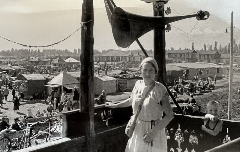
Sitting on a block of ice, I look at what I can see, having risen so high: a sea of motionless peaks covered with ice. To the east, a dense pile of black clouds surrounds the twenty-three thousand foot high Khan Tengri, this gigantic mountain.
Whose entire southeastern slope is still "unexplored territory."
What magic in these words! To the north, through a break in the clouds, I can see the Terskey range not far away, and behind me the vast luminous void of an invisible lake and the pale line of Kungey beyond it. A ledge obscures part of the panorama. Sary-Tor, hitherto measured only in "fathoms," rises to nearly sixteen thousand feet, and I think of it fondly as "my sixteen-thousander."
Now I must descend as fast as I can, fighting the cold. Sheltered under a pass, I stop in the sun to munch a little mutton fat and chocolate, bread and meat being too dry for me. The upper glacier provides excellent and smooth skiing, and I rest. But the compact and melting snow of the lower section makes for a hard ride.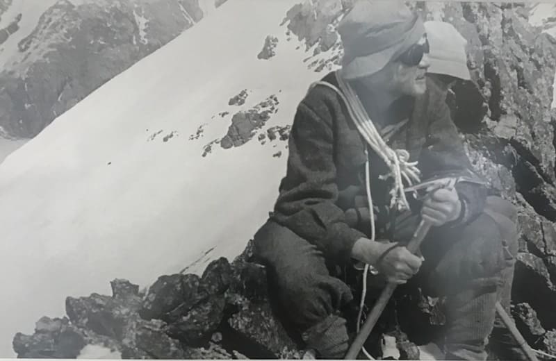
Three-quarters of an hour after the descent began, I am back in the saddle. The remaining fourteen hours were spent climbing, if my memory serves me right, I had intended to do it in only seven hours. Crossing the Naryn in the evening is a completely different matter than in the morning: now it is a powerful river, swollen with muddy waters of glaciers melting from the heat.
A slow return as the evening light fades! We join our comrades who have also returned. I am proud of myself, I want to shout and tell where I have been, but... I have to wait for the questions of the extremely interested August.
- "It is impossible in such a short time," says Capa.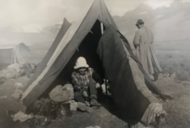
Mila laughs, looking at me, and winks in Capa's direction. You can read on her face, like in an open book - Capa was disappointed that she was not the only woman who climbed to the top of Sary-Tor. "
The summit is covered with an ice shell, the western slope and the main ridge of the ridge are under ice, only on the eastern slope in several places there are rock outcrops. The 10.9-kilometer-long Karsai (Edelstein) glacier descends along the eastern slopes of the peak, while the Sary-Tor (Davydov) North and South Sary-Tor glaciers flow down the western slopes of the peak.
The tongue of the Sary-Tor North glacier and its middle part have been destroyed by the work carried out by the Kyrgyz "Kumtor mine". The peak is located in a high-mountain climate zone characterized by low temperatures, strong winds, and significant precipitation in the form of snow. 
The summer months are short here, and most of the year is shrouded in frost. The average annual temperature at such altitudes often drops below -10°C, and in winter it can reach -30°C and below. The summit of the SNK of Kyrgyzstan attracts experienced climbers, since climbing it requires good physical fitness and technical skills.
The main difficulties of the route are glacial crevasses, rockfalls, and sudden weather changes. Due to the remoteness of the area, climbers must carefully plan their expedition and take into account all possible risks. The summit of SNK Kyrgyzstan is not only a geographical but also a historical landmark of Kyrgyzstan.
It is of interest to researchers, climbers and extreme tourism enthusiasts. Its inaccessibility and harsh natural conditions make it a real challenge for those who want to conquer the highest peaks of Central Asia.
Geographical coordinates of summit of SNK Kyrgyzstan: N41°49'11 E78°12'26
Authority:
Alexander Petrov.