


![]()
You are here
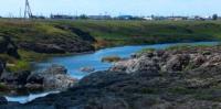
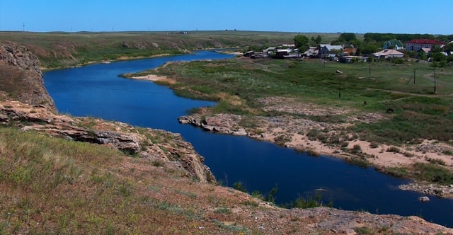
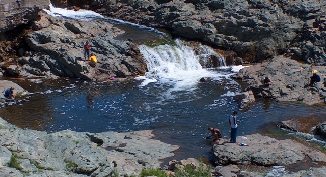
Tobol river in Kazakhstan.
Wildlife Tours in Kostanay region.
“Of the other rivers flowing into the Irtysh from the left side, the most remarkable is the Tobol, which flows from the Karaadyr ridge and flows until the Uya River flows into it, that is, to the Russian border to the northeast. At its peaks it either disappears underground, then appears again, but, strengthened by the rivers flowing into it, it flows without interruption. As is known, it flows into the Irtysh near Tobolsk. The Tobol often changes its course and therefore leaves its original channel, parts of which are usually called oxbow lakes. The sand taken out of it contains iron in places. Its name, as Rychkov writes in his “Orenburg Topography,” comes from the shabul tree, or meadowsweet, which grows in abundance along its banks. The water in it near the peaks is very bad and astringent, but as the flow continues it loses this property. There is very good fish in Tobol."
Levshin A.I. “Description of the Kyrgyz-Cossack or Kyrgyz-Kaisak mountains and steppes.” 1833.
Flower Tours in Kostanay region.
The Tobol River in Kazakhstan flows through the territory of the Kostanay region. The length of the Tobol River is 1591 kilometers, Tobol flows into the Irtysh, then the waters of these rivers flow into the Ob, then all together flow into the icy Kara Sea.
The water circulation basin of Tobol and its tributaries belongs to the Kostanay region and several regions of the Russian Federation at once. The source of Tobol is in the Orenburg region. From the west, the influx of Dzhelkuar flows into it, formed by the confluence of two rivers - Santashta and Bersuat, which originate in the Chelyabinsk region.
Then the rivers Ayat and Uy flow into Tobol. Their upper reaches are in the Chelyabinsk region of Russia, and the lower reaches belong to Kazakhstan. A part of the border between the two states passes along the rivers Uy, Toguzak and Tobol.
After 450 kilometers, Tobol again becomes a Russian river and flows through the territory of the Kurgan and Tyumen regions. The middle and lower reaches of the river are within the West Siberian Plain in a wide valley with a winding channel.
In the Tobol basin - about 20 thousand lakes with a total area of 9 thousand km2 In the upper reaches the river freezes in November, in the lower reaches - at the end of October - beginning of November. It is opened from ice usually in the second half of April - early May.
The food is mostly snowy. The flood is stretched (in the lower reaches - until the beginning of August). In rare warm winters there are winter floods. Average water consumption is 805 meters cubic per second. Tobol is navigable 437 km from the mouth.
The river flow is regulated by a number of reservoirs. The rafting of the forest is carried out. Cities on Tobol Lisakovsk, Ore, Kostanay, Yalutorovsk, Kurgan, Tobolsk.
Authority:
The book "Altyn Dala". Kostanay region. Kazinpress. 2008.
Photo
Alexander Petrov.